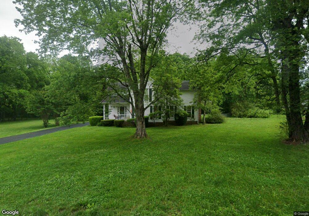
215 Stardust Dr Shelbyville, TN 37160
Estimated Value: $291,507 - $355,000
--
Bed
3
Baths
1,674
Sq Ft
$198/Sq Ft
Est. Value
About This Home
This home is located at 215 Stardust Dr, Shelbyville, TN 37160 and is currently estimated at $331,377, approximately $197 per square foot. 215 Stardust Dr is a home located in Bedford County with nearby schools including East Side Elementary School, Harris Middle School, and Christian Chapel Academy.
Ownership History
Date
Name
Owned For
Owner Type
Purchase Details
Closed on
Sep 18, 2000
Sold by
Lokey Neil C
Bought by
Shapard Scott S
Current Estimated Value
Purchase Details
Closed on
Nov 3, 1992
Bought by
Lokey Neil C and Lokey Connie K
Purchase Details
Closed on
Oct 3, 1990
Bought by
Moses Leslie U and Moses Margie L
Purchase Details
Closed on
Jul 14, 1978
Bought by
Dampier Ronald Wayne and Dampier Linda W
Create a Home Valuation Report for This Property
The Home Valuation Report is an in-depth analysis detailing your home's value as well as a comparison with similar homes in the area
Home Values in the Area
Average Home Value in this Area
Purchase History
| Date | Buyer | Sale Price | Title Company |
|---|---|---|---|
| Shapard Scott S | $16,000 | -- | |
| Lokey Neil C | $85,000 | -- | |
| Moses Leslie U | $81,000 | -- | |
| Dampier Ronald Wayne | -- | -- |
Source: Public Records
Tax History Compared to Growth
Tax History
| Year | Tax Paid | Tax Assessment Tax Assessment Total Assessment is a certain percentage of the fair market value that is determined by local assessors to be the total taxable value of land and additions on the property. | Land | Improvement |
|---|---|---|---|---|
| 2025 | -- | $47,550 | $0 | $0 |
| 2024 | -- | $47,550 | $8,050 | $39,500 |
| 2023 | $704 | $47,550 | $8,050 | $39,500 |
| 2022 | $1,862 | $47,550 | $8,050 | $39,500 |
| 2021 | $1,690 | $47,550 | $8,050 | $39,500 |
| 2020 | $1,476 | $47,550 | $8,050 | $39,500 |
| 2019 | $1,476 | $33,325 | $5,750 | $27,575 |
| 2018 | $1,443 | $33,325 | $5,750 | $27,575 |
| 2017 | $1,443 | $33,325 | $5,750 | $27,575 |
| 2016 | $1,430 | $33,325 | $5,750 | $27,575 |
| 2015 | $1,430 | $33,325 | $5,750 | $27,575 |
| 2014 | $1,161 | $29,627 | $0 | $0 |
Source: Public Records
Map
Nearby Homes
- 309 Honeysuckle Ln
- 223 Megan Cir
- 407 Dow Dr
- 1030 Union St
- 402 Rose Ln
- 1615 Elevation ABC Plan at Wheatfield
- 1567 Elevation ABC Plan at Wheatfield
- 102 Greystone Way
- 122 Laurelwood Dr
- 130 Horseshoe Dr
- 312 Cottonwood Dr
- 225 Republic St
- 227 Republic St
- 119 Millet St
- 232 Republic St
- 410 Dover St
- 226 Republic St
- 228 Republic St
- 0 Archery Ln
- 118 Millet St
- 401 Fairlane Dr
- 403 Fairlane Dr
- 211 Stardust Dr
- 307 Fairlane Dr
- 1004 Dow Dr
- 405 Fairlane Dr
- 607 Apple Blossom Trail
- 703 Apple Blossom Trail
- 301 Stardust Dr
- 209 Stardust Dr
- 305 Fairlane Dr
- 605 Apple Blossom Trail
- 308 Fairlane Dr
- 1100 Dow Dr
- 1002 Dow Dr
- 801 Apple Blossom Trail
- 303 Fairlane Dr
- 207 Stardust Dr
- 302 Fairlane Dr
- 501 Fairlane Dr