Estimated Value: $312,891 - $335,000
4
Beds
3
Baths
2,406
Sq Ft
$135/Sq Ft
Est. Value
About This Home
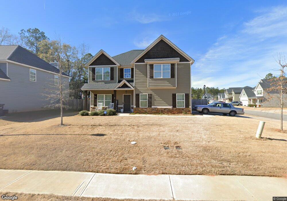
This home is located at 215 Wild Azalea Dr Unit 282, Perry, GA 31069 and is currently estimated at $324,223, approximately $134 per square foot. 215 Wild Azalea Dr Unit 282 is a home located in Houston County with nearby schools including Langston Road Elementary School, Mossy Creek Middle School, and Perry High School.
Ownership History
Date
Name
Owned For
Owner Type
Purchase Details
Closed on
Nov 4, 2019
Sold by
Edgar Hughston Builder Inc
Bought by
Cooper Rashaun D and Cooper Aleshia A
Current Estimated Value
Home Financials for this Owner
Home Financials are based on the most recent Mortgage that was taken out on this home.
Original Mortgage
$229,958
Outstanding Balance
$200,542
Interest Rate
3.6%
Mortgage Type
FHA
Estimated Equity
$123,681
Purchase Details
Closed on
Nov 27, 2017
Sold by
Regions Bank
Bought by
Edgar Hughston Builder Inc
Create a Home Valuation Report for This Property
The Home Valuation Report is an in-depth analysis detailing your home's value as well as a comparison with similar homes in the area
Home Values in the Area
Average Home Value in this Area
Purchase History
| Date | Buyer | Sale Price | Title Company |
|---|---|---|---|
| Cooper Rashaun D | $234,200 | None Available | |
| Edgar Hughston Builder Inc | -- | None Available |
Source: Public Records
Mortgage History
| Date | Status | Borrower | Loan Amount |
|---|---|---|---|
| Open | Cooper Rashaun D | $229,958 |
Source: Public Records
Tax History
| Year | Tax Paid | Tax Assessment Tax Assessment Total Assessment is a certain percentage of the fair market value that is determined by local assessors to be the total taxable value of land and additions on the property. | Land | Improvement |
|---|---|---|---|---|
| 2025 | $3,807 | $115,840 | $10,000 | $105,840 |
| 2024 | $4,430 | $120,560 | $10,000 | $110,560 |
| 2023 | $4,398 | $118,880 | $10,000 | $108,880 |
| 2022 | $2,451 | $106,600 | $10,000 | $96,600 |
| 2021 | $2,148 | $92,920 | $10,000 | $82,920 |
| 2020 | $2,038 | $87,720 | $11,600 | $76,120 |
| 2019 | $1,895 | $81,560 | $11,600 | $69,960 |
| 2018 | $359 | $15,440 | $11,600 | $3,840 |
| 2017 | $223 | $10,000 | $10,000 | $0 |
Source: Public Records
Map
Nearby Homes
- 215 Goldenrod Trail
- 207 Golden Rod Trail
- 207 Goldenrod Trail
- 104 Goldenrod Trail
- 108 Dog Fennel Ln
- 122 Blue Dunn Cir
- 104 Black Birch Rd Unit 84G
- 104 Black Birch Rd
- 243 Mossland Dr
- 207 Bald Cypress Dr Unit 37G
- 207 Bald Cypress Dr
- 209 Bald Cypress Dr Unit 38G
- 209 Bald Cypress Dr
- 211 Bald Cypress Dr Unit 39G
- 211 Bald Cypress Dr
- 102 Gallberry Ln Unit 53G
- 104 Gallberry Ln Unit 52G
- 213 Bald Cypress Dr
- 213 Bald Cypress Dr Unit 40G
- 133 W River Cane Run
- 213 Wild Azalea Dr
- 211 Wild Azalea Dr
- 203 Wildfire Way Unit 283
- 214 Wild Azalea Dr
- 209 Wild Azalea Dr
- 216 Wild Azalea Dr Unit 271
- 202 Wildfire Way Unit 225
- 202 Wildfire Way
- 200 Wild Fire Way Unit 226
- 212 Wild Azalea Dr
- 100 Bluestem Ct Unit 284
- 100 Bluestem Ct
- 204 Wildfire Way Unit 224
- 204 Wildfire Way
- 106 Wildfire Way Unit 227
- 102 Bluestem Ct Unit 285
- 104 Wildfire Way Unit 228
- 206 Wildfire Way Unit 223
- 206 Wild Fire Way Unit 223
- 103 Wildfire Way
Your Personal Tour Guide
Ask me questions while you tour the home.