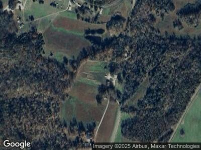
2150 Bolestown Loop Alpine, TN 38543
Estimated Value: $262,000 - $580,000
--
Bed
--
Bath
1,728
Sq Ft
$225/Sq Ft
Est. Value
About This Home
This home is located at 2150 Bolestown Loop, Alpine, TN 38543 and is currently estimated at $388,373, approximately $224 per square foot. 2150 Bolestown Loop is a home with nearby schools including Pickett County Elementary School and Pickett County High School.
Ownership History
Date
Name
Owned For
Owner Type
Purchase Details
Closed on
Sep 3, 2013
Sold by
King Christopher
Bought by
King Christopher and King Amber L
Current Estimated Value
Home Financials for this Owner
Home Financials are based on the most recent Mortgage that was taken out on this home.
Original Mortgage
$140,000
Interest Rate
4.37%
Mortgage Type
Cash
Purchase Details
Closed on
Feb 3, 2006
Bought by
King Christopher
Home Financials for this Owner
Home Financials are based on the most recent Mortgage that was taken out on this home.
Original Mortgage
$53,000
Interest Rate
6.14%
Mortgage Type
New Conventional
Purchase Details
Closed on
Apr 26, 2001
Bought by
Mark Linder and Pendergrass Julie
Create a Home Valuation Report for This Property
The Home Valuation Report is an in-depth analysis detailing your home's value as well as a comparison with similar homes in the area
Home Values in the Area
Average Home Value in this Area
Purchase History
| Date | Buyer | Sale Price | Title Company |
|---|---|---|---|
| King Christopher | -- | -- | |
| King Christopher | $62,000 | -- | |
| Mark Linder | $28,500 | -- |
Source: Public Records
Mortgage History
| Date | Status | Borrower | Loan Amount |
|---|---|---|---|
| Closed | King Christopher | $180,000 | |
| Closed | King Christopher | $175,824 | |
| Closed | King Christopher | $152,500 | |
| Closed | King Christopher | $140,000 | |
| Previous Owner | King Christopher | $53,000 |
Source: Public Records
Tax History Compared to Growth
Tax History
| Year | Tax Paid | Tax Assessment Tax Assessment Total Assessment is a certain percentage of the fair market value that is determined by local assessors to be the total taxable value of land and additions on the property. | Land | Improvement |
|---|---|---|---|---|
| 2024 | $1,132 | $66,225 | $9,150 | $57,075 |
| 2023 | $1,130 | $66,225 | $9,150 | $57,075 |
| 2022 | $1,135 | $47,100 | $7,100 | $40,000 |
| 2021 | $1,135 | $47,100 | $7,100 | $40,000 |
| 2020 | $1,135 | $47,100 | $7,100 | $40,000 |
| 2019 | $1,159 | $47,100 | $7,100 | $40,000 |
| 2018 | $810 | $47,100 | $7,100 | $40,000 |
| 2017 | $906 | $48,425 | $7,100 | $41,325 |
| 2016 | $370 | $19,775 | $7,100 | $12,675 |
| 2015 | $370 | $19,783 | $0 | $0 |
| 2014 | $370 | $19,783 | $0 | $0 |
Source: Public Records
Map
Nearby Homes
- 0 Bolestown Loop
- 0 Bolestown Loop
- 00 Bolestown Loop
- 2061 Bolestown Loop
- 2059 Bolestown Loop
- 7125 Bolestown Rd
- 1103 Boles Beaty Rd
- 400 Sabre Park Rd
- 5735 E East Port Rd
- 1100 Eastport Dock Rd
- 0 Milky Way Rd Unit RTC2806137
- 171 Deer Cliff Ln
- 0 N Star Rd
- Lot 27 N Star Rd
- 2021 Milky Way
- LOT 32 Old Stephens Rd
- 2150 Bolestown Loop
- 2138 Bolestown Loop
- 1.77 AC Bolestown Loop
- 2126 Bolestown Loop
- 2158 Bolestown Loop
- 1021 Boles Beaty Rd
- 1023 Boles Beaty Rd
- 1029 Boles Beaty Rd
- 1029 Boles Beaty Rd
- 1025 Boles Beaty Rd
- 1.77 AC Bolestown Rd
- 1045 Boles Beaty Rd
- 1046 Boles Beaty Rd
- 00 Boles Beaty Rd
- 1.67 AC Boles Beaty Rd
- 1.06 Ac. Boles Beaty Rd
- 0 Boles Beaty Rd Unit 134599
- 0 Boles Beaty Rd Unit 134600
- 0 Boles Beaty Rd Unit 602103
- 0 Boles Beaty Rd Unit 602095
