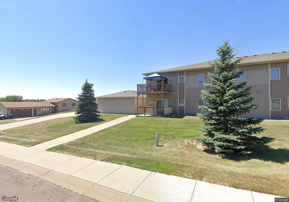
2155 10th Ave W Unit 1 Dickinson, ND 58601
Estimated Value: $215,000 - $356,000
2
Beds
2
Baths
1,325
Sq Ft
$199/Sq Ft
Est. Value
About This Home
This home is located at 2155 10th Ave W Unit 1, Dickinson, ND 58601 and is currently estimated at $264,136, approximately $199 per square foot. 2155 10th Ave W Unit 1 is a home located in Stark County with nearby schools including Hope Christian Academy.
Ownership History
Date
Name
Owned For
Owner Type
Purchase Details
Closed on
Mar 31, 2023
Sold by
Presler Linda
Bought by
Hughes Neil
Current Estimated Value
Purchase Details
Closed on
Oct 14, 2015
Sold by
Torgerson Miles L and Torgerson Ann E
Bought by
Presler Linda
Home Financials for this Owner
Home Financials are based on the most recent Mortgage that was taken out on this home.
Original Mortgage
$140,000
Interest Rate
3.88%
Mortgage Type
New Conventional
Create a Home Valuation Report for This Property
The Home Valuation Report is an in-depth analysis detailing your home's value as well as a comparison with similar homes in the area
Home Values in the Area
Average Home Value in this Area
Purchase History
| Date | Buyer | Sale Price | Title Company |
|---|---|---|---|
| Hughes Neil | $204,000 | The Title Team | |
| Presler Linda | -- | None Available |
Source: Public Records
Mortgage History
| Date | Status | Borrower | Loan Amount |
|---|---|---|---|
| Previous Owner | Presler Linda | $140,000 |
Source: Public Records
Tax History Compared to Growth
Tax History
| Year | Tax Paid | Tax Assessment Tax Assessment Total Assessment is a certain percentage of the fair market value that is determined by local assessors to be the total taxable value of land and additions on the property. | Land | Improvement |
|---|---|---|---|---|
| 2024 | $104 | $179,100 | $15,200 | $163,900 |
| 2023 | $1,757 | $179,100 | $15,200 | $163,900 |
| 2022 | $1,669 | $83,900 | $0 | $0 |
| 2021 | $1,640 | $159,400 | $15,200 | $144,200 |
| 2020 | $1,660 | $159,200 | $15,200 | $144,000 |
| 2019 | $1,665 | $159,200 | $15,200 | $144,000 |
| 2017 | $1,544 | $167,200 | $15,200 | $152,000 |
| 2015 | $1,544 | $176,400 | $14,500 | $161,900 |
| 2014 | $1,605 | $169,700 | $14,500 | $155,200 |
| 2013 | -- | $65,200 | $14,500 | $50,700 |
Source: Public Records
Map
Nearby Homes
- 2178 10th Ave W
- 2321 10th Ave W
- 1971 10th Ave W
- 978 24th St W
- 1213 24th St W
- 928 24th St W
- 1180 24th St W
- 836 24th St W
- 710 23rd St W
- 1814 #1 Prairie Ave
- 2418 Prairie Oak Dr
- 671 24th St W
- 679 19th St W
- 1814 Prairie Ave
- 0 6th Ave W Unit 25-375
- 0 6th Ave W Unit 25-344
- 0 Blk 8 Lot 4 Prairie Creek Rd NW
- Blk8lot4 Prairie Creek Rd
- Blk6lot26 Prairie Creek Rd
- Blk5lot6 Prairie Creek Rd
- 2155 10th Ave W Unit 1
- 2119 10th Ave W
- 2107 10th Ave W
- 2136 10th Ave W
- 979 22nd St W
- 988 22nd St W
- 968 21st St W
- 2275 10th Ave W #9 Ave W
- 955 22nd St W
- 2278 10th Ave W
- 958 22nd St W
- 933 22nd St W
- 1046 20th St W
- 2023 10th Ave W
- 2020 10th Ave W
- 1106 20th St W
- 930 21st St W
- 2317 10th Ave W
- 930 22nd St W
- 2325 10th Ave W