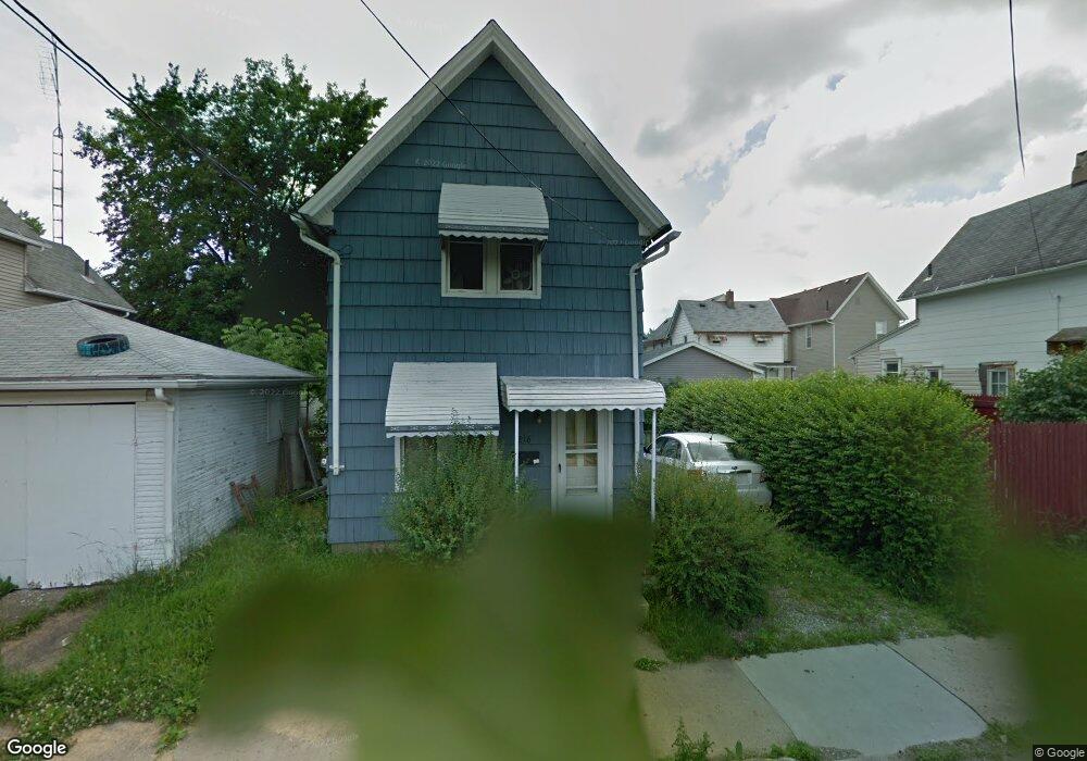
216 Collins Ct NW Canton, OH 44703
Summit NeighborhoodEstimated Value: $38,000
2
Beds
1
Bath
832
Sq Ft
$46/Sq Ft
Est. Value
About This Home
This home is located at 216 Collins Ct NW, Canton, OH 44703 and is currently priced at $38,000, approximately $45 per square foot. 216 Collins Ct NW is a home located in Stark County with nearby schools including Early Learning Center @ Schreiber, Clarendon Intermediate School, and Gibbs Elementary School.
Ownership History
Date
Name
Owned For
Owner Type
Purchase Details
Closed on
Aug 20, 2024
Sold by
Stark County Port Authority
Bought by
Canton For All People Acquisition & Holding C
Current Estimated Value
Purchase Details
Closed on
Jul 8, 2024
Sold by
City Of Canton
Bought by
Stark County Port Authority
Purchase Details
Closed on
Feb 28, 2022
Sold by
Stark County Land Reutilization Corporat
Bought by
City Of Canton
Purchase Details
Closed on
May 2, 2018
Sold by
Stark County Land Reutilization Corporat
Bought by
Stark County Regional Planning Commissio
Purchase Details
Closed on
Jun 13, 2017
Sold by
Longenecker Donald
Bought by
Stark County Land Reutilization Corporat
Purchase Details
Closed on
Apr 6, 2001
Sold by
Swinderman Cleta I and Alexander Leroy
Bought by
Longenecker Donald and Longenecker Candy
Create a Home Valuation Report for This Property
The Home Valuation Report is an in-depth analysis detailing your home's value as well as a comparison with similar homes in the area
Home Values in the Area
Average Home Value in this Area
Purchase History
| Date | Buyer | Sale Price | Title Company |
|---|---|---|---|
| Canton For All People Acquisition & Holding C | -- | None Listed On Document | |
| Stark County Port Authority | -- | None Listed On Document | |
| City Of Canton | -- | Anthony John F | |
| Stark County Regional Planning Commissio | -- | None Available | |
| Stark County Land Reutilization Corporat | -- | None Available | |
| Longenecker Donald | $15,000 | -- |
Source: Public Records
Tax History
| Year | Tax Paid | Tax Assessment Tax Assessment Total Assessment is a certain percentage of the fair market value that is determined by local assessors to be the total taxable value of land and additions on the property. | Land | Improvement |
|---|---|---|---|---|
| 2025 | -- | -- | -- | -- |
| 2024 | -- | $390 | $390 | -- |
| 2023 | $2 | $980 | $980 | $0 |
| 2022 | $717 | $420 | $420 | $0 |
| 2021 | $717 | $420 | $420 | $0 |
| 2019 | $211 | $3,470 | $880 | $2,590 |
Source: Public Records
Map
Nearby Homes
- 1124 Monnot Place NW
- 1407 7th St NW
- 1401 8th St NW
- 1405 8th St NW
- 1409 8th St NW
- 1428 9th St NW
- 1221 9th St NW
- 706 Harriet Ave NW
- 1018 9th St NW
- 900 4th St SW
- 935 Ridge Rd NW
- 609 Lincoln Ave NW
- 814 Plymouth Ct NW
- 1322 12th St NW
- 719 Prospect Ave SW
- 304 Harrison Ave NW
- 912 Essig Ct NW
- 917 Camden Ave SW
- 921 Camden Ave SW
- 817 Halter Ct NW
- 212 Collins Ct NW
- 207 Brown Ave NW
- 301 Brown Ave NW
- 219 Collins Ct NW
- 223 Collins Ct NW
- 223 Collins Ct NW
- 205 Brown Ave NW
- 305 Brown Ave NW
- 309 Brown Ave NW
- 201 Brown Ave NW
- 999999 2nd St NW
- 123 Brown Ave NW
- 123 Brown Ave NW Unit 1
- 200 Collins Ct NW
- 1317 2nd St NW
- 1315 4th St NW
- 1321 4th St NW
- 1313 4th St NW
- 119 Brown Ave NW
- 1309 4th St NW
Your Personal Tour Guide
Ask me questions while you tour the home.