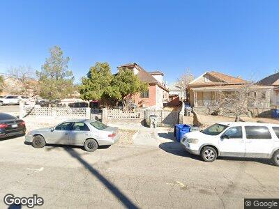
216 Los Angeles Dr Unit 2 El Paso, TX 79902
Sunset Heights NeighborhoodEstimated Value: $195,706 - $308,000
3
Beds
2
Baths
1,498
Sq Ft
$171/Sq Ft
Est. Value
About This Home
This home is located at 216 Los Angeles Dr Unit 2, El Paso, TX 79902 and is currently estimated at $255,677, approximately $170 per square foot. 216 Los Angeles Dr Unit 2 is a home located in El Paso County with nearby schools including Mesita Elementary School, Wiggs Middle School, and El Paso High School.
Ownership History
Date
Name
Owned For
Owner Type
Purchase Details
Closed on
Oct 12, 2023
Sold by
El Paso County Hsng Authority
Bought by
Park Place Boardwalk Llc
Current Estimated Value
Purchase Details
Closed on
Aug 24, 2011
Sold by
Jenkins Michael D and Jenkins Zovieda Serrano
Bought by
Huelga Carlos Manuel
Purchase Details
Closed on
Apr 2, 2007
Sold by
Luna Luis Javier
Bought by
Jenkins Michael D and Jenkins Zovieda Serrano
Home Financials for this Owner
Home Financials are based on the most recent Mortgage that was taken out on this home.
Original Mortgage
$76,000
Interest Rate
6.24%
Mortgage Type
Purchase Money Mortgage
Purchase Details
Closed on
Mar 24, 2005
Sold by
Luna Victor Manuel
Bought by
Luna Luis Javier
Purchase Details
Closed on
Jul 21, 1995
Sold by
Luna Maria
Bought by
Luna Victor Manuel
Create a Home Valuation Report for This Property
The Home Valuation Report is an in-depth analysis detailing your home's value as well as a comparison with similar homes in the area
Home Values in the Area
Average Home Value in this Area
Purchase History
| Date | Buyer | Sale Price | Title Company |
|---|---|---|---|
| Park Place Boardwalk Llc | $103,000 | None Listed On Document | |
| Huelga Carlos Manuel | -- | None Available | |
| Jenkins Michael D | -- | None Available | |
| Luna Luis Javier | -- | -- | |
| Luna Victor Manuel | -- | -- |
Source: Public Records
Mortgage History
| Date | Status | Borrower | Loan Amount |
|---|---|---|---|
| Previous Owner | Jenkins Michael D | $76,000 |
Source: Public Records
Tax History Compared to Growth
Tax History
| Year | Tax Paid | Tax Assessment Tax Assessment Total Assessment is a certain percentage of the fair market value that is determined by local assessors to be the total taxable value of land and additions on the property. | Land | Improvement |
|---|---|---|---|---|
| 2023 | $4,892 | $176,844 | $16,856 | $159,988 |
| 2022 | $5,404 | $182,565 | $16,856 | $165,709 |
| 2021 | $4,896 | $156,801 | $16,856 | $139,945 |
| 2020 | $4,053 | $131,856 | $12,473 | $119,383 |
| 2018 | $3,870 | $130,754 | $12,473 | $118,281 |
| 2017 | $3,356 | $119,147 | $12,473 | $106,674 |
| 2016 | $3,356 | $119,147 | $12,473 | $106,674 |
| 2015 | $3,307 | $119,147 | $12,473 | $106,674 |
| 2014 | $3,307 | $120,864 | $12,473 | $108,391 |
Source: Public Records
Map
Nearby Homes
- 641 Upson Dr
- 910 W Missouri Ave
- 500 Fewel St Unit A & B
- 521 Randolph Dr
- 1020 Upson Dr Unit A
- 1111 Terrace Ct
- 215 W Rio Grande Ave
- 1508 Hawthorne St Unit A & B
- 1401 N Mesa St
- 1009 N Florence St
- 612 E Nevada Ave
- 501 E Cliff Dr
- 1800 N Stanton St Unit 502
- 1800 N Stanton St Unit 305
- 619 N Virginia St
- 1611 N Florence St
- 608 E Crosby Ave
- 1119 N Saint Vrain St
- 501 E Hague Rd
- 1003 Wyoming Ave
- 216 Los Angeles Dr
- 216 Los Angeles Dr Unit 2
- 216 Los Angeles Dr Unit A
- 216 Los Angeles Dr Unit B
- 214 Los Angeles Dr
- 640 Stewart Ct
- 212 Los Angeles Dr
- 638 Stewart Ct
- 701 Mundy Dr
- 636 1/2 Stewart Ct
- 705 Mundy Dr
- 628 Stewart Ct
- 707 Mundy Dr
- 626 Stewart Ct
- 301 Los Angeles Dr
- 709 Mundy Dr
- 624 Stewart Ct
- 119 Los Angeles Dr
- 711 Mundy Dr
- 702 W Missouri Ave