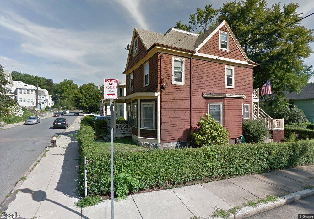
216 Poplar St Unit 1 Roslindale, MA 02131
Roslindale NeighborhoodEstimated Value: $715,461 - $928,000
2
Beds
2
Baths
1,400
Sq Ft
$622/Sq Ft
Est. Value
About This Home
This home is located at 216 Poplar St Unit 1, Roslindale, MA 02131 and is currently estimated at $870,615, approximately $621 per square foot. 216 Poplar St Unit 1 is a home located in Suffolk County with nearby schools including Brooke Charter School Roslindale, Sacred Heart STEM School, and St. Clare High School.
Ownership History
Date
Name
Owned For
Owner Type
Purchase Details
Closed on
Aug 31, 2007
Sold by
Cotter Johh W
Bought by
Sepulveda Angel L and Sepulveda Sandra J
Current Estimated Value
Home Financials for this Owner
Home Financials are based on the most recent Mortgage that was taken out on this home.
Original Mortgage
$307,923
Outstanding Balance
$196,350
Interest Rate
6.71%
Mortgage Type
Purchase Money Mortgage
Estimated Equity
$674,265
Create a Home Valuation Report for This Property
The Home Valuation Report is an in-depth analysis detailing your home's value as well as a comparison with similar homes in the area
Home Values in the Area
Average Home Value in this Area
Purchase History
| Date | Buyer | Sale Price | Title Company |
|---|---|---|---|
| Sepulveda Angel L | $399,900 | -- |
Source: Public Records
Mortgage History
| Date | Status | Borrower | Loan Amount |
|---|---|---|---|
| Open | Sepulveda Angel L | $307,923 |
Source: Public Records
Tax History Compared to Growth
Tax History
| Year | Tax Paid | Tax Assessment Tax Assessment Total Assessment is a certain percentage of the fair market value that is determined by local assessors to be the total taxable value of land and additions on the property. | Land | Improvement |
|---|---|---|---|---|
| 2025 | $6,143 | $530,500 | $262,600 | $267,900 |
| 2024 | $5,040 | $462,400 | $249,400 | $213,000 |
| 2023 | $4,775 | $444,600 | $239,800 | $204,800 |
| 2022 | $4,398 | $404,200 | $218,000 | $186,200 |
| 2021 | $4,227 | $396,200 | $213,700 | $182,500 |
| 2020 | $4,190 | $396,800 | $192,400 | $204,400 |
| 2019 | $3,946 | $374,400 | $155,400 | $219,000 |
| 2018 | $3,702 | $353,200 | $155,400 | $197,800 |
| 2017 | $3,666 | $346,200 | $155,400 | $190,800 |
| 2016 | $3,527 | $320,600 | $155,400 | $165,200 |
| 2015 | $3,945 | $325,800 | $149,100 | $176,700 |
| 2014 | $3,660 | $290,900 | $149,100 | $141,800 |
Source: Public Records
Map
Nearby Homes
- 25 Crandall St
- 250 Poplar St Unit 1
- 67 Cummins Hwy Unit 101
- 16 Hilburn Place
- 142 Metropolitan Ave Unit A
- 69 Metropolitan Ave
- 108 Florence St Unit 3
- 108 Florence St Unit 4
- 27 Rowe St
- 55 Metropolitan Ave
- 65 Birch St Unit 3
- 142 Birch St
- 142 Birch St Unit 1
- 142 Birch St Unit 2
- 543 Hyde Park Ave Unit 1
- 80 Roslindale Ave Unit 3
- 415 Poplar St
- 417 Poplar St
- 5 7 Hemman St
- 112 Roslindale Ave Unit 2
- 216 Poplar St
- 220 Poplar St
- 8 Heathcote St Unit 2
- 214 Poplar St
- 6-8 Heathcote St
- 68 Heathcote St
- 6-8 Heathcote St Unit 2
- 208 Poplar St
- 213 Poplar St
- 221 Poplar St
- 228 Poplar St
- 10 Heathcote St Unit ONE
- 10 Heathcote St Unit 1
- 209 Poplar St
- 204 Poplar St
- 16 Heathcote St
- 16 Heathcote St Unit 1
- 24 Crandall St
- 195 Poplar St
- 9 Heathcote St