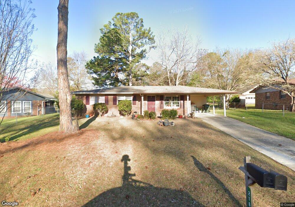
216 Randy Cir Warner Robins, GA 31088
Estimated Value: $145,000 - $154,383
3
Beds
2
Baths
1,143
Sq Ft
$131/Sq Ft
Est. Value
About This Home
This home is located at 216 Randy Cir, Warner Robins, GA 31088 and is currently estimated at $149,846, approximately $131 per square foot. 216 Randy Cir is a home located in Houston County with nearby schools including Russell Elementary School, Warner Robins Middle School, and Warner Robins High School.
Ownership History
Date
Name
Owned For
Owner Type
Purchase Details
Closed on
Aug 12, 2016
Sold by
West Of The Fields Llc
Bought by
Gunningham Brian A and Gunningham Terri L
Current Estimated Value
Home Financials for this Owner
Home Financials are based on the most recent Mortgage that was taken out on this home.
Original Mortgage
$50,500
Interest Rate
3.42%
Mortgage Type
New Conventional
Purchase Details
Closed on
Sep 29, 1982
Sold by
Livingston Ernest W and Livingston Janet M
Bought by
Livingston Ernest W and Livingston Janet M
Purchase Details
Closed on
Oct 3, 1975
Sold by
Clark Walter E and Clark Sharon E
Bought by
Livingston Ernest W and Livingston Janet M
Purchase Details
Closed on
Mar 6, 1974
Sold by
Burkhalter Dana L and Burkhalter Doris F
Bought by
Clark Walter E and Clark Sharon E
Purchase Details
Closed on
Sep 12, 1973
Sold by
Secretary Of Housing & Urban Dev
Bought by
Burkhalter Dana L and Burkhalter Doris F
Purchase Details
Closed on
Sep 11, 1972
Sold by
Citizens & Southern National Bank
Bought by
Secretary Of Housing & Urban Dev
Purchase Details
Closed on
Jun 9, 1970
Sold by
Tyree Realty Co Inc
Bought by
Lane Alan K and Lane Carol J
Purchase Details
Closed on
Mar 12, 1970
Sold by
Williams Eugene
Bought by
Tyree Realty Co Inc
Create a Home Valuation Report for This Property
The Home Valuation Report is an in-depth analysis detailing your home's value as well as a comparison with similar homes in the area
Home Values in the Area
Average Home Value in this Area
Purchase History
| Date | Buyer | Sale Price | Title Company |
|---|---|---|---|
| Gunningham Brian A | $63,000 | -- | |
| Livingston Ernest W | -- | -- | |
| Livingston Ernest W | -- | -- | |
| Clark Walter E | -- | -- | |
| Burkhalter Dana L | -- | -- | |
| Secretary Of Housing & Urban Dev | -- | -- | |
| Citizens & Southern National Bank | -- | -- | |
| Lane Alan K | -- | -- | |
| Tyree Realty Co Inc | -- | -- |
Source: Public Records
Mortgage History
| Date | Status | Borrower | Loan Amount |
|---|---|---|---|
| Closed | Gunningham Brian A | $50,500 |
Source: Public Records
Tax History
| Year | Tax Paid | Tax Assessment Tax Assessment Total Assessment is a certain percentage of the fair market value that is determined by local assessors to be the total taxable value of land and additions on the property. | Land | Improvement |
|---|---|---|---|---|
| 2025 | $1,472 | $50,560 | $8,000 | $42,560 |
| 2024 | $1,509 | $46,120 | $8,000 | $38,120 |
| 2023 | $1,174 | $35,600 | $8,000 | $27,600 |
| 2022 | $694 | $30,200 | $5,400 | $24,800 |
| 2021 | $565 | $24,440 | $5,400 | $19,040 |
| 2020 | $565 | $24,320 | $5,400 | $18,920 |
| 2019 | $565 | $24,320 | $5,400 | $18,920 |
| 2018 | $565 | $24,320 | $5,400 | $18,920 |
| 2017 | $566 | $24,320 | $5,400 | $18,920 |
| 2016 | $566 | $24,320 | $5,400 | $18,920 |
| 2015 | -- | $26,200 | $5,400 | $20,800 |
| 2014 | $262 | $26,200 | $5,400 | $20,800 |
| 2013 | $262 | $26,200 | $5,400 | $20,800 |
Source: Public Records
Map
Nearby Homes
- 114 Tommy Terrace
- 223 Randy Cir
- 213 Self St
- 1850 Russell Pkwy
- 0 Russell Pkwy Unit 10656199
- 114 Windsor Dr
- 205 Sonja Dr
- 118 Fox Glove Ct
- 25 & 26 Lot
- 209 Tracy Terrace
- 305 Bonnie Dr
- 223 Highland Dr
- 108 Woodsdale Dr
- 302 Creek Ridge Dr
- 104 Ridgedale Dr
- 119 Colonial Rd
- 101 Sunnybrook Ct
- 107 Woodfield Dr
- 103 Oakdale Dr
- 337 Mary Ln
Your Personal Tour Guide
Ask me questions while you tour the home.