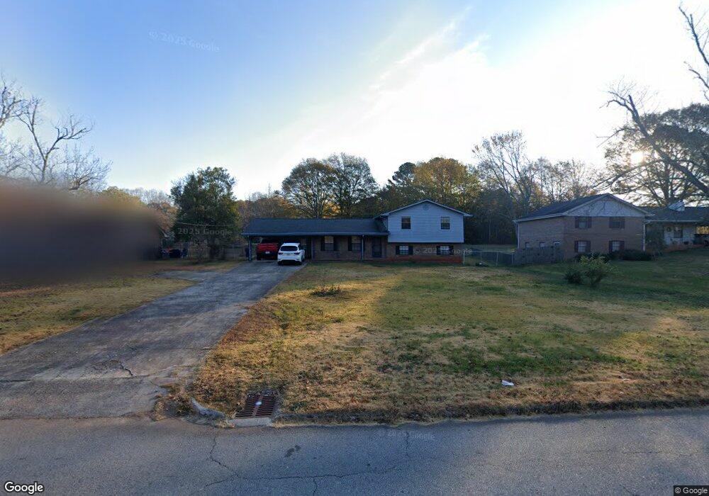
216 Shields Rd Stockbridge, GA 30281
Estimated Value: $228,000 - $262,000
3
Beds
2
Baths
2,032
Sq Ft
$121/Sq Ft
Est. Value
About This Home
This home is located at 216 Shields Rd, Stockbridge, GA 30281 and is currently estimated at $246,820, approximately $121 per square foot. 216 Shields Rd is a home located in Henry County with nearby schools including Stockbridge Elementary School, Smith-Barnes Elementary School, and Stockbridge Middle School.
Ownership History
Date
Name
Owned For
Owner Type
Purchase Details
Closed on
Sep 11, 2017
Sold by
Ong Ranny
Bought by
Ong Ranny and Ong Jennifer Phanit
Current Estimated Value
Home Financials for this Owner
Home Financials are based on the most recent Mortgage that was taken out on this home.
Original Mortgage
$124,699
Outstanding Balance
$105,500
Interest Rate
4.4%
Mortgage Type
FHA
Estimated Equity
$141,320
Purchase Details
Closed on
Apr 22, 2008
Sold by
Bank Of New York Trust
Bought by
Mcmeans David S
Purchase Details
Closed on
Dec 4, 2007
Sold by
Jenkins Anthony and Jenkins Linda L
Bought by
Bank Of New York
Create a Home Valuation Report for This Property
The Home Valuation Report is an in-depth analysis detailing your home's value as well as a comparison with similar homes in the area
Home Values in the Area
Average Home Value in this Area
Purchase History
| Date | Buyer | Sale Price | Title Company |
|---|---|---|---|
| Ong Ranny | -- | -- | |
| Ong Ranny | $127,000 | -- | |
| Mcmeans David S | $79,900 | -- | |
| Bank Of New York Trust Co Na | -- | -- | |
| Bank Of New York | $140,000 | -- |
Source: Public Records
Mortgage History
| Date | Status | Borrower | Loan Amount |
|---|---|---|---|
| Open | Ong Ranny | $124,699 | |
| Closed | Ong Ranny | $124,699 |
Source: Public Records
Tax History
| Year | Tax Paid | Tax Assessment Tax Assessment Total Assessment is a certain percentage of the fair market value that is determined by local assessors to be the total taxable value of land and additions on the property. | Land | Improvement |
|---|---|---|---|---|
| 2025 | $2,989 | $101,280 | $14,000 | $87,280 |
| 2024 | $2,989 | $93,080 | $14,000 | $79,080 |
| 2023 | $2,671 | $92,280 | $10,000 | $82,280 |
| 2022 | $2,446 | $72,600 | $10,000 | $62,600 |
| 2021 | $2,124 | $59,000 | $10,000 | $49,000 |
| 2020 | $1,995 | $53,520 | $8,000 | $45,520 |
| 2019 | $1,839 | $50,520 | $8,000 | $42,520 |
| 2018 | $2,099 | $50,040 | $8,000 | $42,040 |
| 2016 | $537 | $39,320 | $6,000 | $33,320 |
| 2015 | $505 | $35,520 | $6,000 | $29,520 |
| 2014 | $409 | $29,120 | $4,800 | $24,320 |
Source: Public Records
Map
Nearby Homes
- 129 Landover Dr
- 201 Brush Creek Ct
- 197 Brush Creek Ct
- 193 Brush Creek Ct
- 189 Brush Creek Ct
- 185 Brush Creek Ct
- 173 Brush Creek Ct
- 152 Club Cir
- 73 Lillian Cir
- 101 Bridge Park Ct
- 130 Club Dr
- 103 Oak Cir S
- 120 Mossy Brook Dr
- 235 Oak Cir N
- 105 Woodhaven Dr
- 125 Valley Hill Rd
- 106 Flippen Rd
- 145 Turning Point
- 107 Turning Point
- 306 Iron Horse Way
- 220 Shields Rd
- 212 Shields Rd
- 310 Rebecca Ct
- 208 Shields Rd
- 224 Shields Rd
- 310 Rebecca Ct
- 146 Meadow Ridge Dr
- 146 Meadow Ridge Dr Unit 3A
- 308 Rebecca Ct
- 230 Shields Rd
- 202 Shields Rd
- 101 Meadow Ridge Way
- 148 Meadow Ridge Dr
- 144 Meadow Ridge Dr
- 234 Shields Rd Unit 1
- 103 Meadow Ridge Way
- 227 Shields Rd
- 306 Rebecca Ct Unit 3
- 302 Rebecca Ct Unit 3
- 105 Meadow Ridge Way
Your Personal Tour Guide
Ask me questions while you tour the home.