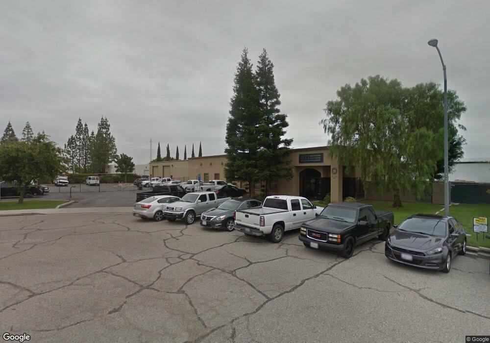
2161 Saturn Ct Bakersfield, CA 93308
Estimated Value: $2,153,778
--
Bed
--
Bath
10,380
Sq Ft
$207/Sq Ft
Est. Value
About This Home
This home is located at 2161 Saturn Ct, Bakersfield, CA 93308 and is currently estimated at $2,153,778, approximately $207 per square foot. 2161 Saturn Ct is a home located in Kern County with nearby schools including North Beardsley Elementary School, Beardsley Junior High School, and North High School.
Ownership History
Date
Name
Owned For
Owner Type
Purchase Details
Closed on
Jun 19, 2023
Sold by
Harold And Diana Robertson Family Trust
Bought by
Ag West Distributing Co Inc
Current Estimated Value
Purchase Details
Closed on
May 24, 2023
Sold by
Northeast Partners Iv Llc
Bought by
Fred And Saundra Porter Family Trust
Purchase Details
Closed on
Jun 13, 2022
Sold by
Love And Joy Trust and Tackitt Jason A
Bought by
Northeast Partners Iv Llc
Purchase Details
Closed on
May 13, 2022
Sold by
Jti Electrical & Instrumentation Llc
Bought by
Tackitt Jason and Tackitt Megan
Purchase Details
Closed on
May 20, 2014
Sold by
Tackitt Jason and Tackitt Megan
Bought by
The Love & Joy Trust
Purchase Details
Closed on
Dec 3, 2009
Sold by
Pinnacle Civil Engineering Inc
Bought by
Tackitt Jason and Tackitt Megan
Home Financials for this Owner
Home Financials are based on the most recent Mortgage that was taken out on this home.
Original Mortgage
$367,500
Interest Rate
4.93%
Mortgage Type
Commercial
Purchase Details
Closed on
May 9, 2006
Sold by
Accelerated Technologies Inc
Bought by
Pelupessy Richard A and Pelupessy Mary C
Home Financials for this Owner
Home Financials are based on the most recent Mortgage that was taken out on this home.
Original Mortgage
$460,000
Interest Rate
6.46%
Mortgage Type
Commercial
Purchase Details
Closed on
Mar 16, 2006
Sold by
Pelupessy Richard A and Pelupessy Mary C
Bought by
Pinnacle Civil Engineering Inc
Home Financials for this Owner
Home Financials are based on the most recent Mortgage that was taken out on this home.
Original Mortgage
$460,000
Interest Rate
6.46%
Mortgage Type
Commercial
Purchase Details
Closed on
Sep 15, 1999
Sold by
Ms Vickers Ii Llc
Bought by
Pelupessy Richard A and Pelupessy Mary C
Purchase Details
Closed on
Mar 1, 1996
Sold by
Chevron Land & Development Company
Bought by
Ms Vickers Ii Llc
Create a Home Valuation Report for This Property
The Home Valuation Report is an in-depth analysis detailing your home's value as well as a comparison with similar homes in the area
Home Values in the Area
Average Home Value in this Area
Purchase History
| Date | Buyer | Sale Price | Title Company |
|---|---|---|---|
| Ag West Distributing Co Inc | $2,000,000 | First American Title | |
| Fred And Saundra Porter Family Trust | -- | Accommodation/Courtesy Recordi | |
| Northeast Partners Iv Llc | $1,500,000 | First American Title | |
| Tackitt Jason | -- | First American Title | |
| The Love & Joy Trust | -- | None Available | |
| Tackitt Jason | $738,500 | Ticor Title Company Of Ca | |
| Pelupessy Richard A | -- | First American Title Company | |
| Pinnacle Civil Engineering Inc | $1,200,000 | First American Title Company | |
| Pelupessy Richard A | -- | American Title Co | |
| Ms Vickers Ii Llc | -- | Chicago Title Insurance |
Source: Public Records
Mortgage History
| Date | Status | Borrower | Loan Amount |
|---|---|---|---|
| Previous Owner | Tackitt Jason | $367,500 | |
| Previous Owner | Pelupessy Richard A | $460,000 | |
| Previous Owner | Pinnacle Civil Engineering Inc | $586,000 |
Source: Public Records
Tax History Compared to Growth
Tax History
| Year | Tax Paid | Tax Assessment Tax Assessment Total Assessment is a certain percentage of the fair market value that is determined by local assessors to be the total taxable value of land and additions on the property. | Land | Improvement |
|---|---|---|---|---|
| 2025 | $24,076 | $2,040,000 | $382,500 | $1,657,500 |
| 2024 | $24,076 | $2,000,000 | $375,000 | $1,625,000 |
| 2023 | $18,632 | $1,530,000 | $346,800 | $1,183,200 |
| 2022 | $11,218 | $900,105 | $206,779 | $693,326 |
| 2021 | $11,201 | $882,457 | $202,725 | $679,732 |
| 2020 | $11,201 | $873,410 | $200,647 | $672,763 |
| 2019 | $10,943 | $873,410 | $200,647 | $672,763 |
| 2018 | $10,637 | $839,496 | $192,856 | $646,640 |
| 2017 | $10,500 | $823,036 | $189,075 | $633,961 |
| 2016 | $9,785 | $806,899 | $185,368 | $621,531 |
| 2015 | $9,461 | $794,780 | $182,584 | $612,196 |
| 2014 | $9,213 | $779,212 | $179,008 | $600,204 |
Source: Public Records
Map
Nearby Homes
- 393 Famoso Hills Dr
- 6600 Audene Way
- 7207 Briar Ridge Ct
- 6918 Crestwood St
- 6918 Normandy Rose Ave
- 6504 Cherrywood Ave
- 6200 Wright Ave
- 6418 Abby Rose Ave
- 7108 Luke Ave
- 6708 Cranbrook Ave
- 6338 Bama Rose Ct
- 6600 Cedarcrest Ave
- 7116 Jolynn St
- 6709 Cedarcrest Ave
- 7400 Petris Ave
- 6317 Tallman Ave
- 1729 Melody Ln
- 6304 Stanley St
- 6201 Victor St Unit C
- 2221 Orpheus Ct
- 2131 Saturn Ct
- 2231 Orpheus Ct
- 3331 Pegasus Dr
- 2241 Orpheus Ct
- 3359 Pegasus Dr
- 2131 Mars Ct
- 2236 Orpheus Ct
- 3335 Pegasus Dr
- 3363 Pegasus Dr
- 2246 Orpheus Ct
- 2219 Zeus Ct
- 2254 Orpheus Ct
- 2301 Perseus Ct
- 2314 Perseus Ct
- 3206 Pegasus Dr Unit B
- 3023 Unicorn Rd
- 2353 Cepheus Ct
- 3600 Pegasus Dr Unit 15
- 3600 Pegasus Dr Unit 16