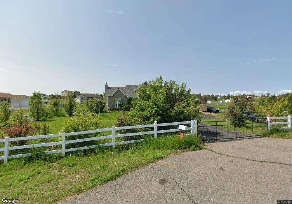
2162 Red Maple Cir Parker, CO 80138
Estimated Value: $779,411 - $930,000
3
Beds
3
Baths
2,418
Sq Ft
$358/Sq Ft
Est. Value
About This Home
This home is located at 2162 Red Maple Cir, Parker, CO 80138 and is currently estimated at $865,603, approximately $357 per square foot. 2162 Red Maple Cir is a home located in Elbert County with nearby schools including Elizabeth High School.
Ownership History
Date
Name
Owned For
Owner Type
Purchase Details
Closed on
Jun 21, 2007
Sold by
Ocwen Loan Servicing Llc
Bought by
Hinkle Phillip B and Hinkle Brooke D
Current Estimated Value
Home Financials for this Owner
Home Financials are based on the most recent Mortgage that was taken out on this home.
Original Mortgage
$297,600
Outstanding Balance
$185,525
Interest Rate
6.54%
Mortgage Type
Unknown
Estimated Equity
$680,078
Purchase Details
Closed on
Jan 12, 2007
Sold by
Camasso Derrick and Yankovich Qilly
Bought by
Ocwen Loan Servicing Llc
Purchase Details
Closed on
Aug 31, 2005
Sold by
Camasso Derrick and Yankovich Qilly
Bought by
Camasso Derrick
Purchase Details
Closed on
May 20, 2005
Sold by
Fireside Fine Homes Llc
Bought by
Camasso Derrick and Yankovich Qilly
Purchase Details
Closed on
Jan 9, 2004
Sold by
3 & D Ranch Inc
Bought by
Fireside Fine Homes Llc
Create a Home Valuation Report for This Property
The Home Valuation Report is an in-depth analysis detailing your home's value as well as a comparison with similar homes in the area
Home Values in the Area
Average Home Value in this Area
Purchase History
| Date | Buyer | Sale Price | Title Company |
|---|---|---|---|
| Hinkle Phillip B | $372,000 | Chicago Title Co | |
| Ocwen Loan Servicing Llc | -- | None Available | |
| Camasso Derrick | -- | -- | |
| Camasso Derrick | $370,000 | -- | |
| Fireside Fine Homes Llc | $88,000 | -- |
Source: Public Records
Mortgage History
| Date | Status | Borrower | Loan Amount |
|---|---|---|---|
| Open | Hinkle Phillip B | $297,600 |
Source: Public Records
Tax History Compared to Growth
Tax History
| Year | Tax Paid | Tax Assessment Tax Assessment Total Assessment is a certain percentage of the fair market value that is determined by local assessors to be the total taxable value of land and additions on the property. | Land | Improvement |
|---|---|---|---|---|
| 2024 | $3,579 | $42,310 | $9,240 | $33,070 |
| 2023 | $3,579 | $42,310 | $9,240 | $33,070 |
| 2022 | $3,202 | $36,060 | $9,380 | $26,680 |
| 2021 | $3,283 | $37,100 | $9,650 | $27,450 |
| 2020 | $3,145 | $35,360 | $6,790 | $28,570 |
| 2019 | $3,152 | $35,360 | $6,790 | $28,570 |
| 2018 | $2,855 | $32,080 | $6,480 | $25,600 |
| 2017 | $2,856 | $32,080 | $6,480 | $25,600 |
| 2016 | $2,547 | $28,110 | $7,400 | $20,710 |
| 2015 | $2,341 | $28,110 | $7,400 | $20,710 |
| 2014 | $2,341 | $25,050 | $7,160 | $17,890 |
Source: Public Records
Map
Nearby Homes
- 41504 Vista Ridge
- 2104 Helen Ct
- 3074 County Road 166
- 42146 Vista Ridge
- 1789 Joseph Cir
- 3672 Deer Creek Dr
- 3560 Zane Gray Loop
- 42313 Vista Ridge
- 41479 Countryside Cir
- 42274 Thunder Hill Rd
- 41419 Deer Creek Cir
- 1740 Joseph Cir
- 40305 Margaret Dr
- 1250 County Road 166
- 40216 Margaret Dr
- 2470 Driftwood
- 39833 Transition Terrace
- 42919 Vista Ridge
- 1280 Stockholm Way
- 39681 Swift Creek Cir
- 2129 Red Maple Cir
- 2184 Red Maple Cir
- 2173 Red Maple Cir
- 2151 Red Maple Cir
- 41175 Round Hill Cir
- 2195 Red Maple Cir
- 41169 Round Hill Cir
- 41266 Ann Ct
- 2228 Red Maple Cir
- 41183 Round Hill Cir
- 41165 Round Hill Cir
- 2785 Deer Creek Dr
- 2217 Red Maple Cir
- 2162 Pleasant Hill Cir
- 2184 Pleasant Hill Cir
- 41296 Ann Ct
- 41170 Round Hill Cir
- 41155 Round Hill Cir
- 2140 Pleasant Hill Cir
- 41195 Round Hill Cir