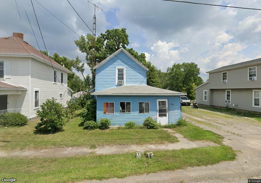
21622 State Route 347 Raymond, OH 43067
Estimated Value: $123,000 - $228,000
3
Beds
1
Bath
1,194
Sq Ft
$146/Sq Ft
Est. Value
About This Home
This home is located at 21622 State Route 347, Raymond, OH 43067 and is currently estimated at $174,312, approximately $145 per square foot. 21622 State Route 347 is a home with nearby schools including Raymond Elementary School, Creekview Intermediate Elementary School, and Bunsold Middle School.
Create a Home Valuation Report for This Property
The Home Valuation Report is an in-depth analysis detailing your home's value as well as a comparison with similar homes in the area
Tax History
| Year | Tax Paid | Tax Assessment Tax Assessment Total Assessment is a certain percentage of the fair market value that is determined by local assessors to be the total taxable value of land and additions on the property. | Land | Improvement |
|---|---|---|---|---|
| 2024 | $1,136 | $25,640 | $3,590 | $22,050 |
| 2023 | $1,174 | $25,640 | $3,590 | $22,050 |
| 2022 | $1,177 | $25,640 | $3,590 | $22,050 |
| 2021 | $1,088 | $20,280 | $2,760 | $17,520 |
| 2020 | $1,041 | $20,280 | $2,760 | $17,520 |
| 2019 | $1,070 | $20,280 | $2,760 | $17,520 |
| 2018 | $826 | $15,090 | $2,250 | $12,840 |
| 2017 | $779 | $15,090 | $2,250 | $12,840 |
| 2016 | $777 | $15,090 | $2,250 | $12,840 |
| 2015 | $1,046 | $18,900 | $2,250 | $16,650 |
| 2014 | $1,027 | $18,900 | $2,250 | $16,650 |
| 2013 | $975 | $19,030 | $2,250 | $16,780 |
Source: Public Records
Map
Nearby Homes
- 23564 Shirk Ave
- 0 Main St
- 23051 Bear Swamp Rd
- 22015 Liberty West Rd
- 22437 State Route 739
- 18902 State Route 347
- 0 Johnson Rd Unit 226000479
- 0 Johnson Rd Unit 225027964
- 0 Benton Rd Unit 226004840
- 1322 Forest Edge Dr
- 830 Lorenzo Ct
- 19400 Bear Swamp Rd
- 20689 State Route 47
- 28370 Ohio 739
- 18140 Bear Swamp Rd
- 0 Smokey Rd
- 28384 Bitler Rd
- 262 S Main St
- 955 Kentucky Cir
- 560 Harness Place
- 21630 Ohio 347
- 21679 Ohio 739
- 28050 Ohio 739
- 22098 Ohio 739
- 21614 Main St
- 21614 Ohio 347
- 21608 State Route 347
- 21588 State Route 347
- 21588 Ohio 347
- 23484 State Route 739 Ave
- 21630 Raymond St
- 21652 Main St
- 21584 Ohio 347
- 21584 Main St
- 21612 Raymond St
- 21644 Delaware St
- 21597 Raymond St
- 23509 Shirk Ave
- 21588 Delaware Ave
- 21581 Main St
Your Personal Tour Guide
Ask me questions while you tour the home.