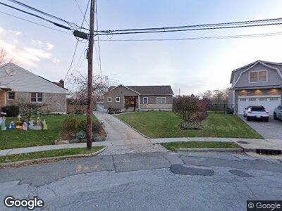
2164 Merokee Dr Merrick, NY 11566
Merrick NeighborhoodEstimated Value: $778,000 - $1,139,903
3
Beds
2
Baths
1,575
Sq Ft
$609/Sq Ft
Est. Value
About This Home
This home is located at 2164 Merokee Dr, Merrick, NY 11566 and is currently estimated at $958,952, approximately $608 per square foot. 2164 Merokee Dr is a home located in Nassau County with nearby schools including Winthrop Avenue School, Shore Road School, and Grand Avenue Middle School.
Ownership History
Date
Name
Owned For
Owner Type
Purchase Details
Closed on
Oct 26, 2015
Sold by
Rippa Vincent R and Last Will And Testament Of Eugne Rippa
Bought by
Leventeris Michael and Leventeris Christina
Current Estimated Value
Home Financials for this Owner
Home Financials are based on the most recent Mortgage that was taken out on this home.
Original Mortgage
$280,000
Outstanding Balance
$227,413
Interest Rate
3.88%
Mortgage Type
New Conventional
Estimated Equity
$850,787
Purchase Details
Closed on
Sep 11, 1996
Create a Home Valuation Report for This Property
The Home Valuation Report is an in-depth analysis detailing your home's value as well as a comparison with similar homes in the area
Home Values in the Area
Average Home Value in this Area
Purchase History
| Date | Buyer | Sale Price | Title Company |
|---|---|---|---|
| Leventeris Michael | $380,000 | First American Title Ins | |
| -- | $200,000 | -- |
Source: Public Records
Mortgage History
| Date | Status | Borrower | Loan Amount |
|---|---|---|---|
| Open | Leventeris Michael | $280,000 |
Source: Public Records
Tax History Compared to Growth
Tax History
| Year | Tax Paid | Tax Assessment Tax Assessment Total Assessment is a certain percentage of the fair market value that is determined by local assessors to be the total taxable value of land and additions on the property. | Land | Improvement |
|---|---|---|---|---|
| 2024 | $3,038 | $709 | $339 | $370 |
| 2023 | $12,077 | $667 | $359 | $308 |
| 2022 | $12,077 | $358 | $355 | $3 |
| 2021 | $18,222 | $343 | $340 | $3 |
| 2020 | $14,503 | $984 | $897 | $87 |
| 2019 | $17,999 | $1,036 | $897 | $139 |
| 2018 | $17,840 | $977 | $0 | $0 |
| 2017 | $10,610 | $977 | $897 | $80 |
| 2016 | $14,889 | $977 | $661 | $316 |
| 2015 | $4,205 | $1,031 | $697 | $334 |
| 2014 | $4,205 | $1,031 | $697 | $334 |
| 2013 | $5,077 | $1,326 | $897 | $429 |
Source: Public Records
Map
Nearby Homes
- 2176 Cayuga Dr
- 17 Oak Brook Ln
- 2325 Grand Ave
- 2126 Cayuga Dr
- 5 Oak Brook Ln
- 15 Range Dr
- 2175 Helene Ave
- 12 Ranch Place
- 205 Howell St
- 138 Hewlett Ave
- 103 Frankel Blvd
- 12 Whitman Ave
- 114 Frankel Blvd
- 711 Oak St
- 2007 Brook Place
- 14 Marlboro Place
- 70 Nancy Blvd
- 2364 Newbridge Rd
- 58 Croydon Dr
- 16 Ocean Ave
- 2164 Merokee Dr
- 2168 Merokee Dr
- 2160 Merokee Dr
- 2172 Merokee Dr
- 2156 Merokee Dr
- 2152 Merokee Dr
- 2177 Merokee Dr
- 2178 Merokee Dr
- 2146 Merokee Dr
- 2146 Merokee Dr
- 2184 Merokee Dr
- 2141 Merokee Dr
- 2185 Merokee Dr
- 2140 Merokee Dr
- 2190 Merokee Dr
- 2135 Merokee Dr
- 2134 Merokee Dr
- 2196 Merokee Dr
- 2242 Smith St
- 2236 Smith St