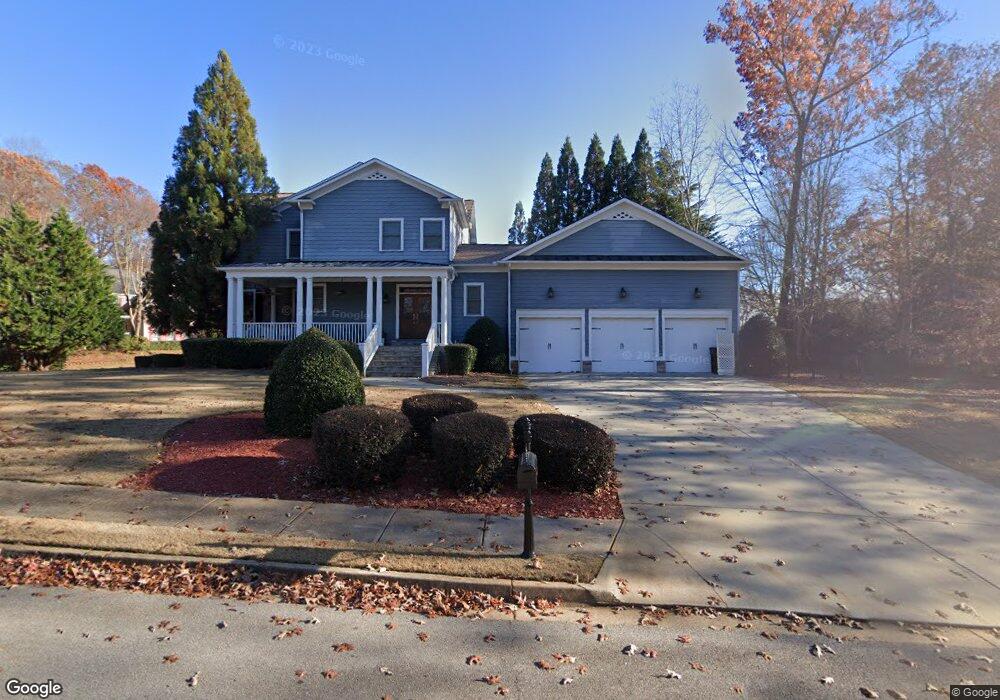
2165 Misty Oaks Dr Buford, GA 30519
Estimated Value: $638,000 - $742,000
5
Beds
5
Baths
3,103
Sq Ft
$217/Sq Ft
Est. Value
About This Home
This home is located at 2165 Misty Oaks Dr, Buford, GA 30519 and is currently estimated at $673,865, approximately $217 per square foot. 2165 Misty Oaks Dr is a home located in Gwinnett County with nearby schools including Harmony Elementary School and Glenn C. Jones Middle School.
Ownership History
Date
Name
Owned For
Owner Type
Purchase Details
Closed on
Jul 20, 2007
Sold by
Huff Glendon C and Huff Jamie H
Bought by
Marze Orville T and Marze Patricia
Current Estimated Value
Home Financials for this Owner
Home Financials are based on the most recent Mortgage that was taken out on this home.
Original Mortgage
$285,530
Outstanding Balance
$178,652
Interest Rate
6.52%
Mortgage Type
New Conventional
Estimated Equity
$495,213
Purchase Details
Closed on
Dec 2, 2004
Sold by
Homestead Dev Corp
Bought by
Huff Glendon C and Huff Jamie
Home Financials for this Owner
Home Financials are based on the most recent Mortgage that was taken out on this home.
Original Mortgage
$275,000
Interest Rate
5.67%
Create a Home Valuation Report for This Property
The Home Valuation Report is an in-depth analysis detailing your home's value as well as a comparison with similar homes in the area
Home Values in the Area
Average Home Value in this Area
Purchase History
| Date | Buyer | Sale Price | Title Company |
|---|---|---|---|
| Marze Orville T | $407,900 | -- | |
| Huff Glendon C | $50,600 | -- |
Source: Public Records
Mortgage History
| Date | Status | Borrower | Loan Amount |
|---|---|---|---|
| Open | Marze Orville T | $285,530 | |
| Previous Owner | Huff Glendon C | $275,000 |
Source: Public Records
Tax History Compared to Growth
Tax History
| Year | Tax Paid | Tax Assessment Tax Assessment Total Assessment is a certain percentage of the fair market value that is determined by local assessors to be the total taxable value of land and additions on the property. | Land | Improvement |
|---|---|---|---|---|
| 2024 | $2,373 | $258,240 | $39,600 | $218,640 |
| 2023 | $2,373 | $228,520 | $39,600 | $188,920 |
| 2022 | $2,332 | $228,520 | $39,600 | $188,920 |
| 2021 | $2,314 | $184,320 | $30,720 | $153,600 |
| 2020 | $2,312 | $184,320 | $30,720 | $153,600 |
| 2019 | $2,118 | $184,320 | $30,720 | $153,600 |
| 2018 | $2,100 | $162,240 | $28,000 | $134,240 |
| 2016 | $2,128 | $146,880 | $25,600 | $121,280 |
| 2015 | $2,004 | $129,120 | $18,400 | $110,720 |
| 2014 | $1,903 | $120,280 | $18,400 | $101,880 |
Source: Public Records
Map
Nearby Homes
- 3600 Devenwood Way
- 3684 Heritage Crest Pkwy
- 190 Maddox Rd
- 2040 Harvest Ridge Cir
- 2040 Harvest Ridge Cir NE
- 2398 E Maddox Rd
- 2140 Harvest Ridge Cir
- 2361 Black Bear Ct Unit 2
- 2183 Ivy Crest Dr
- 2101 E Maddox Rd
- 3476 Harvest Ridge Ln
- 2692 Bogan Creek Dr
- 4041 Lost Mill Ln
- 4316 Woodland Bank Blvd
- 2551 E Maddox Rd
- 2446 Thrasher Rd
- 4017 S South Bogan Rd
- 4245 Woodland Bank Blvd
- 1970 Sturbridge Ln Unit 1
- 3878 Morning Meadow Ln
- 2170 Misty Oaks Dr
- 2155 Misty Oaks Dr
- 2195 Misty Oaks Dr Unit 2
- 3868 Morning Meadow Ln Unit 41
- 3868 Morning Meadow Ln
- 3883 Morning Meadow Ln Unit 51
- 3883 Morning Meadow Ln
- 2140 Misty Oaks Dr Unit 3
- 2180 Misty Oaks Dr
- 0 Morning Meadow Ln NE Unit 7489862
- 0 Morning Meadow Ln NE Unit 7467516
- 0 Morning Meadow Ln NE Unit 8513383
- 0 Morning Meadow Ln NE Unit 8471130
- 0 Morning Meadow Ln NE Unit 8151951
- 0 Morning Meadow Ln NE Unit 8441331
- 0 Morning Meadow Ln NE Unit 8126752
- 0 Morning Meadow Ln NE Unit 8390845
- 0 Morning Meadow Ln NE Unit 8376178
- 0 Morning Meadow Ln NE Unit 8331024