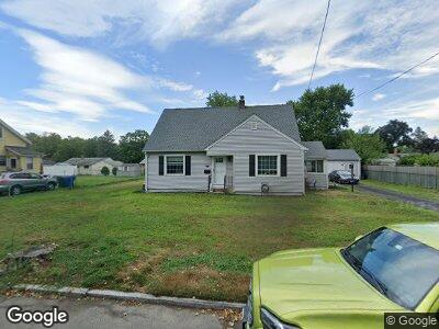
217 Arthur St Springfield, MA 01104
East Springfield NeighborhoodEstimated Value: $281,000 - $312,000
2
Beds
2
Baths
1,542
Sq Ft
$191/Sq Ft
Est. Value
About This Home
This home is located at 217 Arthur St, Springfield, MA 01104 and is currently estimated at $294,610, approximately $191 per square foot. 217 Arthur St is a home located in Hampden County with nearby schools including Van Sickle Academy, Springfield Central High School, and Roger L. Putnam Vocational Technical Academy.
Ownership History
Date
Name
Owned For
Owner Type
Purchase Details
Closed on
Nov 19, 2020
Sold by
Hunt Jonathan B and Hunt Jonathon B
Bought by
Hunt Kenneth R and Hunt Laura E
Current Estimated Value
Purchase Details
Closed on
Nov 5, 2020
Sold by
Tymeson Lillian H Est
Bought by
Hunt Kenneth R and Hunt Laura E
Purchase Details
Closed on
Sep 26, 2018
Sold by
Tymeson John E
Bought by
Tymeson Lillian H
Home Financials for this Owner
Home Financials are based on the most recent Mortgage that was taken out on this home.
Original Mortgage
$40,000
Interest Rate
4.6%
Mortgage Type
Unknown
Purchase Details
Closed on
Jul 6, 2018
Sold by
Tymeson Lillian H
Bought by
Tymeson John E
Purchase Details
Closed on
Apr 20, 2005
Sold by
Hunt Jean E and Tymeson John E
Bought by
Tymeson John E and Tymeson Lillian H
Purchase Details
Closed on
Jun 2, 2004
Sold by
Tymeson John E
Bought by
Hunt Jean E and Tymeson John E
Create a Home Valuation Report for This Property
The Home Valuation Report is an in-depth analysis detailing your home's value as well as a comparison with similar homes in the area
Home Values in the Area
Average Home Value in this Area
Purchase History
| Date | Buyer | Sale Price | Title Company |
|---|---|---|---|
| Hunt Kenneth R | -- | None Available | |
| Hunt Kenneth R | -- | None Available | |
| Tymeson Lillian H | -- | -- | |
| Tymeson John E | -- | -- | |
| Tymeson John E | -- | -- | |
| Hunt Jean E | -- | -- |
Source: Public Records
Mortgage History
| Date | Status | Borrower | Loan Amount |
|---|---|---|---|
| Open | Grant Michael J | $218,500 | |
| Previous Owner | Tymeson John | $40,000 | |
| Previous Owner | Tymeson Lillian H | $30,000 |
Source: Public Records
Tax History Compared to Growth
Tax History
| Year | Tax Paid | Tax Assessment Tax Assessment Total Assessment is a certain percentage of the fair market value that is determined by local assessors to be the total taxable value of land and additions on the property. | Land | Improvement |
|---|---|---|---|---|
| 2025 | $4,403 | $280,800 | $39,600 | $241,200 |
| 2024 | $4,299 | $267,700 | $39,600 | $228,100 |
| 2023 | $3,415 | $200,300 | $36,900 | $163,400 |
| 2022 | $3,224 | $171,300 | $34,600 | $136,700 |
| 2021 | $3,119 | $165,000 | $31,400 | $133,600 |
| 2020 | $2,994 | $153,300 | $31,400 | $121,900 |
| 2019 | $2,962 | $150,500 | $32,400 | $118,100 |
| 2018 | $2,655 | $134,900 | $32,400 | $102,500 |
| 2017 | $2,648 | $134,700 | $29,300 | $105,400 |
| 2016 | $2,497 | $127,000 | $29,300 | $97,700 |
| 2015 | $2,549 | $129,600 | $29,300 | $100,300 |
Source: Public Records
Map
Nearby Homes
- 31 Thornton St
- 1774 Carew St
- 32 Chateaugay St
- 7 East St
- 259 Beauchamp Terrace
- 133-135 Edendale St
- 98 Osborne Terrace
- NS Notre Dame St
- 203 Crestwood St
- 69 Notre Dame St
- 75 Osborne Terrace
- 123 Watson St
- 1206-1208 Saint James Ave
- 85 Edendale St
- 160 Crestwood St
- 232 East St
- 229 Saint James Blvd
- 456-458 Page Blvd
- 59 Kulig St
- 0 Oliver St