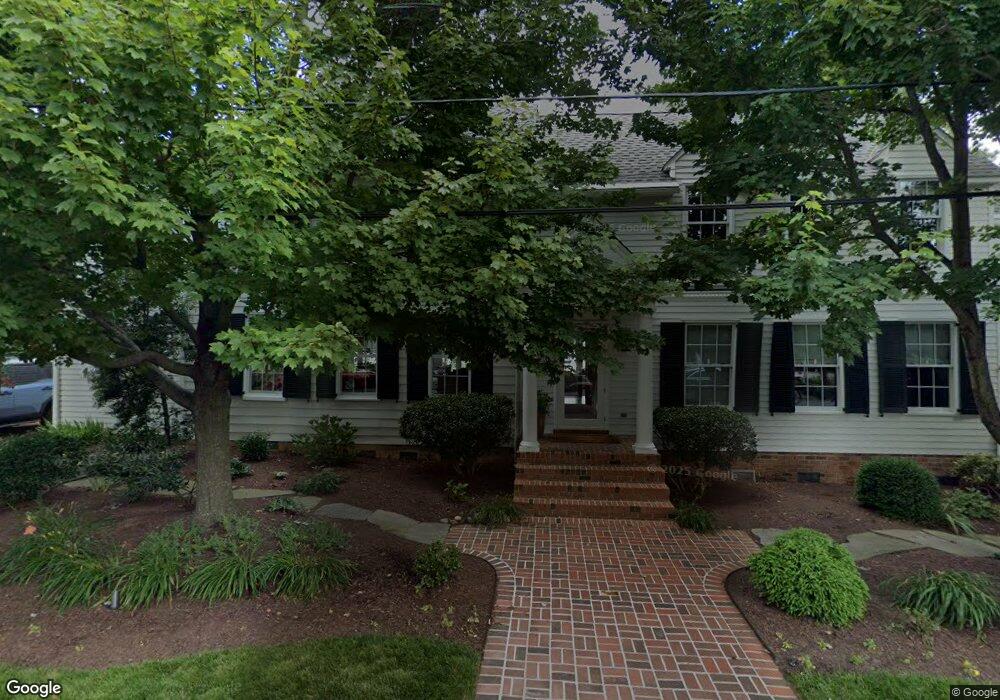
217 E Chestnut St St. Michaels, MD 21663
Estimated Value: $1,982,000 - $4,166,614
5
Beds
4
Baths
3,953
Sq Ft
$663/Sq Ft
Est. Value
About This Home
This home is located at 217 E Chestnut St, St. Michaels, MD 21663 and is currently estimated at $2,620,904, approximately $663 per square foot. 217 E Chestnut St is a home located in Talbot County with nearby schools including St. Michaels Elementary School, St. Michaels Middle/High School, and Easton High School.
Ownership History
Date
Name
Owned For
Owner Type
Purchase Details
Closed on
Jan 12, 2007
Sold by
Campi Thomas R
Bought by
Woodroof Albert C and Woodroof Michelle C
Current Estimated Value
Purchase Details
Closed on
Jan 10, 2007
Sold by
Campi Thomas R
Bought by
Woodroof Albert C and Woodroof Michelle C
Purchase Details
Closed on
Feb 4, 2004
Sold by
Campi Thomas R
Bought by
Campi Thomas R and Campi Abigail B
Purchase Details
Closed on
Dec 1, 1997
Sold by
Campi Thomas R
Bought by
Campi Thomas R and Campi Abigail B
Purchase Details
Closed on
Nov 7, 1997
Sold by
Trovato Vincent P and Trovato Patsy
Bought by
Campi Thomas R and Campi Abigail B
Create a Home Valuation Report for This Property
The Home Valuation Report is an in-depth analysis detailing your home's value as well as a comparison with similar homes in the area
Home Values in the Area
Average Home Value in this Area
Purchase History
| Date | Buyer | Sale Price | Title Company |
|---|---|---|---|
| Woodroof Albert C | $2,600,000 | -- | |
| Woodroof Albert C | $2,600,000 | -- | |
| Campi Thomas R | -- | -- | |
| Campi Thomas R | -- | -- | |
| Campi Thomas R | $475,000 | -- |
Source: Public Records
Tax History
| Year | Tax Paid | Tax Assessment Tax Assessment Total Assessment is a certain percentage of the fair market value that is determined by local assessors to be the total taxable value of land and additions on the property. | Land | Improvement |
|---|---|---|---|---|
| 2025 | $31,658 | $2,539,300 | $1,382,500 | $1,156,800 |
| 2024 | $30,388 | $2,461,233 | $0 | $0 |
| 2023 | $28,303 | $2,383,167 | $0 | $0 |
| 2022 | $26,429 | $2,305,100 | $1,382,500 | $922,600 |
| 2021 | $25,758 | $2,297,167 | $0 | $0 |
| 2020 | $26,002 | $2,289,233 | $0 | $0 |
| 2019 | $25,912 | $2,281,300 | $1,415,400 | $865,900 |
| 2018 | $25,030 | $2,244,633 | $0 | $0 |
| 2017 | $23,842 | $2,207,967 | $0 | $0 |
| 2016 | $20,897 | $2,171,300 | $0 | $0 |
| 2015 | $14,796 | $2,171,300 | $0 | $0 |
| 2014 | $14,796 | $2,171,300 | $0 | $0 |
Source: Public Records
Map
Nearby Homes
- 216 E Chew Ave
- 114 E Chew Ave
- 106 E Chestnut St
- Lot 16A Meadow St
- 101 Mulberry St
- 105 Seymour Ave
- 107 W Chestnut St
- 205 Cherry St
- 114 W Chestnut St
- 111 Gloria Ave
- 117 Chesapeake Ave
- 408 Spinnaker Ln
- 912 Calvert Ave
- 938 Marea Terrace
- 926 Calvert Ave
- 101 Brooks Ln
- 209 Webb Ln
- 228 Perry Cabin Dr Unit 228 / 226
- 216 Brooks Ln
- 228 Tyler Ave
- 215 E Chestnut St
- 217 Chestnut St E
- 220 E Chestnut St
- 216 E Chestnut St
- 218 E Chestnut St
- 218 Chestnut St E
- 214 E Chestnut St
- 212 E Chestnut St
- 411 Water St
- 210 E Chestnut St
- 415 Water St
- 417 Water St
- 208 E Chestnut St
- 409 Water St
- 407 Water St
- 206 E Chestnut St
- 405 Water St
- 412 Water St
- 204 E Chestnut St
- 209 E Chestnut St
Your Personal Tour Guide
Ask me questions while you tour the home.