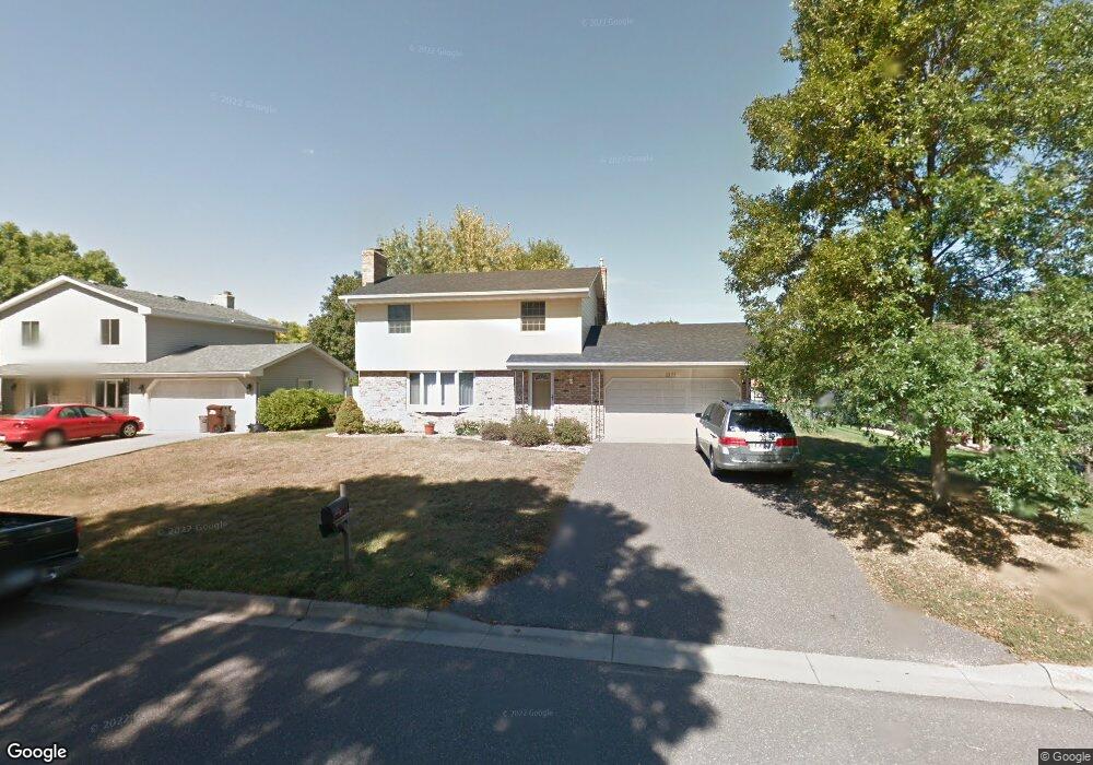
2171 Maple Ln E Saint Paul, MN 55109
Maplewood Heights NeighborhoodEstimated Value: $343,227 - $428,000
3
Beds
2
Baths
1,470
Sq Ft
$258/Sq Ft
Est. Value
About This Home
This home is located at 2171 Maple Ln E, Saint Paul, MN 55109 and is currently estimated at $378,807, approximately $257 per square foot. 2171 Maple Ln E is a home located in Ramsey County with nearby schools including Richardson Elementary School, John Glenn Middle School, and Christ Lutheran School.
Ownership History
Date
Name
Owned For
Owner Type
Purchase Details
Closed on
Jan 17, 2003
Sold by
Schmidt Scott A and Schmidt Tammy R
Bought by
American Escrow & Closing Co
Current Estimated Value
Purchase Details
Closed on
Jan 28, 1999
Sold by
Debner Gerald W and Debner Lois D
Bought by
Schmidt Scott A and Schmidt Tammy
Purchase Details
Closed on
Apr 24, 1996
Sold by
Stickney Andrew
Bought by
Debner Gerald W and Debner Lois D
Create a Home Valuation Report for This Property
The Home Valuation Report is an in-depth analysis detailing your home's value as well as a comparison with similar homes in the area
Home Values in the Area
Average Home Value in this Area
Purchase History
| Date | Buyer | Sale Price | Title Company |
|---|---|---|---|
| American Escrow & Closing Co | $214,900 | -- | |
| Bernal Henry J | $214,900 | -- | |
| Schmidt Scott A | $132,000 | -- | |
| Debner Gerald W | $116,250 | -- |
Source: Public Records
Tax History
| Year | Tax Paid | Tax Assessment Tax Assessment Total Assessment is a certain percentage of the fair market value that is determined by local assessors to be the total taxable value of land and additions on the property. | Land | Improvement |
|---|---|---|---|---|
| 2025 | $2,232 | $335,100 | $69,500 | $265,600 |
| 2023 | $2,232 | $306,300 | $69,500 | $236,800 |
| 2022 | $1,626 | $325,000 | $69,500 | $255,500 |
| 2021 | $1,664 | $258,000 | $69,500 | $188,500 |
| 2020 | $1,548 | $263,000 | $69,500 | $193,500 |
| 2019 | $950 | $247,900 | $69,500 | $178,400 |
| 2018 | $752 | $211,000 | $69,500 | $141,500 |
| 2017 | $872 | $196,900 | $69,500 | $127,400 |
| 2016 | $690 | $0 | $0 | $0 |
| 2015 | $636 | $190,900 | $61,900 | $129,000 |
| 2014 | $8 | $0 | $0 | $0 |
Source: Public Records
Map
Nearby Homes
- 2245 Maple Ln E
- 2974 Howard St N
- 2946 Mcknight Rd N
- 2067 Mesabi Ave
- 2065 Woodlynn Ave
- 2724 Mcknight Rd N
- 2701 Gerald Ave
- 3084 Chisholm Ct N
- 2662 Delaware Ave
- 2654 Delaware Ave
- 2327 17th Ave E
- 2333 17th Ave E
- 2339 17th Ave E
- 2345 17th Ave E
- 2308 16th Ave E
- 2416 14th Ave E
- 1995 11th Ave E Unit 2
- 1995 11th Ave E Unit 1
- 2522 15th Ave E
- 2521 Sumac Ridge
- 2177 Maple Ln E
- 2163 Maple Ln E
- 2936 Winthrop Dr
- 2930 Winthrop Dr
- 2183 Maple Ln E
- 2170 Maple Ln E
- 31XX Furness Place
- 2942 Winthrop Dr
- 2176 Maple Ln E
- 2162 Maple Ln E
- 2182 Maple Ln E
- 2189 Maple Ln E
- 2925 Furness St
- 2917 Furness St
- 2188 Maple Ln E
- 2933 Furness St
- 2948 Winthrop Dr
- 2909 Furness St
- 2933 Howard St N
- 2939 Furness St
Your Personal Tour Guide
Ask me questions while you tour the home.