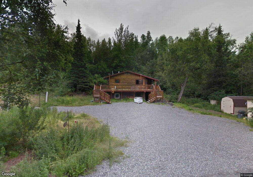
21808 Robin Dr Unit 1 MIL APT Chugiak, AK 99567
Chugiak NeighborhoodEstimated Value: $376,000 - $420,250
3
Beds
2
Baths
962
Sq Ft
$413/Sq Ft
Est. Value
About This Home
This home is located at 21808 Robin Dr Unit 1 MIL APT, Chugiak, AK 99567 and is currently estimated at $397,750, approximately $413 per square foot. 21808 Robin Dr Unit 1 MIL APT is a home located in Anchorage Municipality with nearby schools including Fire Lake Elementary School, Mirror Lake Middle School, and Chugiak High School.
Ownership History
Date
Name
Owned For
Owner Type
Purchase Details
Closed on
Apr 7, 2020
Sold by
Craig Thomas M and Craig Haley
Bought by
Langer Kimberly
Current Estimated Value
Home Financials for this Owner
Home Financials are based on the most recent Mortgage that was taken out on this home.
Original Mortgage
$298,716
Outstanding Balance
$277,838
Interest Rate
3.4%
Mortgage Type
VA
Estimated Equity
$119,912
Purchase Details
Closed on
May 24, 2011
Sold by
Mount Richard C and Mount Ruth L
Bought by
Craig Thomas M
Home Financials for this Owner
Home Financials are based on the most recent Mortgage that was taken out on this home.
Original Mortgage
$231,600
Interest Rate
4.37%
Mortgage Type
FHA
Purchase Details
Closed on
Aug 13, 2010
Sold by
Mount Richard C and Richard C Mount Revocable Trus
Bought by
Mount Richard C and Mount Ruth L
Create a Home Valuation Report for This Property
The Home Valuation Report is an in-depth analysis detailing your home's value as well as a comparison with similar homes in the area
Home Values in the Area
Average Home Value in this Area
Purchase History
| Date | Buyer | Sale Price | Title Company |
|---|---|---|---|
| Langer Kimberly | -- | None Available | |
| Craig Thomas M | -- | United Title | |
| Mount Richard C | -- | None Available |
Source: Public Records
Mortgage History
| Date | Status | Borrower | Loan Amount |
|---|---|---|---|
| Open | Langer Kimberly | $298,716 | |
| Previous Owner | Craig Thomas M | $231,600 |
Source: Public Records
Tax History Compared to Growth
Tax History
| Year | Tax Paid | Tax Assessment Tax Assessment Total Assessment is a certain percentage of the fair market value that is determined by local assessors to be the total taxable value of land and additions on the property. | Land | Improvement |
|---|---|---|---|---|
| 2025 | $4,387 | $317,100 | $85,300 | $231,800 |
| 2024 | $4,387 | $298,200 | $76,300 | $221,900 |
| 2023 | $4,154 | $277,300 | $76,300 | $201,000 |
| 2022 | $4,263 | $282,300 | $79,500 | $202,800 |
| 2021 | $4,172 | $259,800 | $79,500 | $180,300 |
| 2020 | $3,917 | $261,100 | $79,500 | $181,600 |
| 2019 | $3,813 | $258,700 | $79,500 | $179,200 |
| 2018 | $3,651 | $248,700 | $79,500 | $169,200 |
| 2017 | $3,752 | $259,800 | $79,500 | $180,300 |
| 2016 | $3,115 | $253,100 | $77,300 | $175,800 |
| 2015 | $3,115 | $237,400 | $73,300 | $164,100 |
| 2014 | $3,115 | $231,800 | $65,800 | $166,000 |
Source: Public Records
Map
Nearby Homes
- 000 Midway Industrial Park
- L1 Midway Industrial Park
- L2 Midway Industrial Park
- L6 Midway Industrial Park
- L5 Parks Creek Cir
- L6 Parks Creek Cir
- L10 Parks Crk Cir
- L4 Parks Creek Cir
- 23082 Parks Crk Cir
- L3 Parks Creek Cir
- 000 Jasmine Rd
- L11 Jasmine Rd
- L12 Jasmine Rd
- 19400 Wildwood Dr
- 18610 Sue Tawn Dr
- 19333 Wildwood Dr
- 22710 Hunters Dr
- 19939 Adrian Ave
- 22307 Aurora Borealis Rd
- 19411 Klondike St
- 21808 Robin Dr
- 21808 Robin Dr Unit B
- 18330 Amonson Rd
- 18206 Amonson Rd
- 2920 Birch Ln
- 21725 Robin Dr
- 18308 Amonson Rd
- 000 Robin Dr
- L7 B2 Amonson Rd
- L2 Amonson Rd
- 18317 Amonson Rd
- 21708 Robin Dr
- 18358 Amonson Rd
- 18368 Amonson Rd
- 18414 Amonson Rd
- 18309 Amonson Rd
- 18221 Amonson Rd
- 21919 Birch Ln
- 21907 Spring Creek Ln
- 18235 Bending Birch Dr