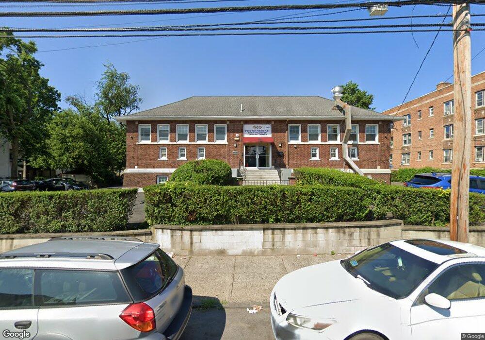
2181 Main St Bridge Port, CT 06606
Brooklawn-Saint Vincent NeighborhoodEstimated Value: $633,752
--
Bed
--
Bath
6,606
Sq Ft
$96/Sq Ft
Est. Value
About This Home
This home is located at 2181 Main St, Bridge Port, CT 06606 and is currently estimated at $633,752, approximately $95 per square foot. 2181 Main St is a home located in Fairfield County with nearby schools including Read School, Central High School, and Catholic Academy of Bridgeport-St. Raphael Academy.
Ownership History
Date
Name
Owned For
Owner Type
Purchase Details
Closed on
Nov 2, 2009
Sold by
745 Special Assets Llc
Bought by
Coraland Llc
Current Estimated Value
Purchase Details
Closed on
May 15, 2009
Sold by
Tores Oswaldo
Bought by
745 Special Assts Llc
Purchase Details
Closed on
Apr 10, 2001
Sold by
2181 Main St Llc
Bought by
Torres Oswaldo
Home Financials for this Owner
Home Financials are based on the most recent Mortgage that was taken out on this home.
Original Mortgage
$200,000
Interest Rate
7.05%
Mortgage Type
Commercial
Purchase Details
Closed on
Aug 2, 1996
Sold by
Bridgeport City Of
Bought by
2181 Main St Llc
Create a Home Valuation Report for This Property
The Home Valuation Report is an in-depth analysis detailing your home's value as well as a comparison with similar homes in the area
Home Values in the Area
Average Home Value in this Area
Purchase History
| Date | Buyer | Sale Price | Title Company |
|---|---|---|---|
| Coraland Llc | $350,000 | -- | |
| Coraland Llc | $350,000 | -- | |
| 745 Special Assts Llc | -- | -- | |
| 745 Special Assts Llc | -- | -- | |
| Torres Oswaldo | $350,000 | -- | |
| Torres Oswaldo | $350,000 | -- | |
| 2181 Main St Llc | $95,250 | -- | |
| 2181 Main St Llc | $95,250 | -- |
Source: Public Records
Mortgage History
| Date | Status | Borrower | Loan Amount |
|---|---|---|---|
| Previous Owner | 2181 Main St Llc | $200,000 |
Source: Public Records
Tax History Compared to Growth
Tax History
| Year | Tax Paid | Tax Assessment Tax Assessment Total Assessment is a certain percentage of the fair market value that is determined by local assessors to be the total taxable value of land and additions on the property. | Land | Improvement |
|---|---|---|---|---|
| 2025 | $19,755 | $454,670 | $174,640 | $280,030 |
| 2024 | $19,755 | $454,670 | $174,640 | $280,030 |
| 2023 | $19,755 | $454,670 | $174,640 | $280,030 |
| 2022 | $19,755 | $454,670 | $174,640 | $280,030 |
| 2021 | $19,755 | $454,670 | $174,640 | $280,030 |
| 2020 | $22,429 | $415,430 | $142,980 | $272,450 |
| 2019 | $22,429 | $415,430 | $142,980 | $272,450 |
| 2018 | $22,587 | $415,430 | $142,980 | $272,450 |
| 2017 | $22,587 | $415,430 | $142,980 | $272,450 |
| 2016 | $22,587 | $415,430 | $142,980 | $272,450 |
| 2015 | $20,502 | $485,840 | $171,580 | $314,260 |
| 2014 | $20,502 | $485,840 | $171,580 | $314,260 |
Source: Public Records
Map
Nearby Homes
- 76 Porter St
- 90 Tom Thumb St
- 78 Fairmount Ave
- 2395 Main St Unit 2397
- 390 Charles St Unit 106
- 724 Capitol Ave Unit 726
- 31 Taft Ave
- 330 French St
- 318 Center St
- 119 Madison Terrace
- 191 Oak St
- 152 River St
- 508 Hawley Ave
- 183 Calhoun Ave
- 356 Taft Ave
- 178 Island Brook Ave
- 100 Lorraine St
- 139 Highland Ave Unit 143
- 604 William St
- 936 Lindley St
- 26 Tom Thumb St
- 2209 Main St Unit A-19
- 2209 Main St Unit c39
- 2209 Main St Unit A16
- 2209 Main St Unit A15
- 2209 Main St Unit A14
- 2209 Main St Unit A12
- 2209-2225 Main St
- 28 Tom Thumb St
- 2225 Main St Unit C-04
- 2225 Main St Unit B-33
- 2225 Main St Unit B-32
- 2225 Main St Unit C-58
- 2225 Main St Unit C-31
- 2225 Main St Unit C-27
- 2225 Main St Unit A-16
- 2225 Main St Unit A-44
- 2225 Main St Unit C-47
- 2225 Main St Unit A-17
- 2225 Main St Unit C-09