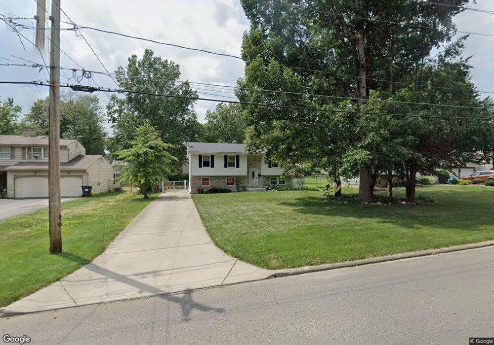
2182 Woodland Trace St Youngstown, OH 44515
Austintown NeighborhoodEstimated Value: $206,000 - $220,573
3
Beds
2
Baths
1,438
Sq Ft
$148/Sq Ft
Est. Value
About This Home
This home is located at 2182 Woodland Trace St, Youngstown, OH 44515 and is currently estimated at $213,393, approximately $148 per square foot. 2182 Woodland Trace St is a home located in Mahoning County with nearby schools including Austintown Elementary School, Austintown Intermediate School, and Austintown Middle School.
Ownership History
Date
Name
Owned For
Owner Type
Purchase Details
Closed on
Sep 6, 2018
Sold by
Woolley Dennis J and Woolley Rae Lynne
Bought by
Thompson Heidi
Current Estimated Value
Home Financials for this Owner
Home Financials are based on the most recent Mortgage that was taken out on this home.
Original Mortgage
$107,025
Outstanding Balance
$93,872
Interest Rate
4.87%
Mortgage Type
FHA
Estimated Equity
$119,521
Purchase Details
Closed on
Sep 26, 2001
Sold by
Liposchak Lisa
Bought by
Woolley Dennis J and Woolley Rae Lynne
Home Financials for this Owner
Home Financials are based on the most recent Mortgage that was taken out on this home.
Original Mortgage
$95,702
Interest Rate
6.97%
Mortgage Type
FHA
Purchase Details
Closed on
May 23, 1991
Bought by
Wallick Lois E
Create a Home Valuation Report for This Property
The Home Valuation Report is an in-depth analysis detailing your home's value as well as a comparison with similar homes in the area
Home Values in the Area
Average Home Value in this Area
Purchase History
| Date | Buyer | Sale Price | Title Company |
|---|---|---|---|
| Thompson Heidi | $109,000 | None Available | |
| Woolley Dennis J | $96,600 | -- | |
| Wallick Lois E | -- | -- |
Source: Public Records
Mortgage History
| Date | Status | Borrower | Loan Amount |
|---|---|---|---|
| Open | Thompson Heidi | $107,025 | |
| Previous Owner | Woolley Dennis J | $95,702 |
Source: Public Records
Tax History Compared to Growth
Tax History
| Year | Tax Paid | Tax Assessment Tax Assessment Total Assessment is a certain percentage of the fair market value that is determined by local assessors to be the total taxable value of land and additions on the property. | Land | Improvement |
|---|---|---|---|---|
| 2024 | $2,508 | $54,290 | $8,160 | $46,130 |
| 2023 | $2,464 | $54,290 | $8,160 | $46,130 |
| 2022 | $2,025 | $35,780 | $7,440 | $28,340 |
| 2021 | $2,027 | $35,780 | $7,440 | $28,340 |
| 2020 | $2,034 | $35,780 | $7,440 | $28,340 |
| 2019 | $2,023 | $32,230 | $6,700 | $25,530 |
| 2018 | $1,947 | $32,230 | $6,700 | $25,530 |
| 2017 | $1,933 | $32,230 | $6,700 | $25,530 |
| 2016 | $1,856 | $30,630 | $6,700 | $23,930 |
| 2015 | $1,799 | $30,630 | $6,700 | $23,930 |
| 2014 | $1,807 | $30,630 | $6,700 | $23,930 |
| 2013 | $1,787 | $30,630 | $6,700 | $23,930 |
Source: Public Records
Map
Nearby Homes
- 2211 Penny Ln
- 4689 Crabwood Dr
- 4815 New Rd
- 4674 Barrington Dr
- 1707 Westhampton Dr
- 2493 Frostwood Dr
- 1339 Cavalcade Dr
- 5256 S Saratoga Ave
- 1228 Cavalcade Dr
- 5179 Willow Crest Ave
- 2792 S Canfield Niles Rd
- 316 S Inglewood Ave
- 5285 Kirk Rd
- 5192 Pinecrest Ave
- 40 Woodleigh Ct
- 4314 Kerrybrook Dr
- 5318 Pinecrest Ave
- 3270 S Canfield Niles Rd
- 4289 Wedgewood Dr
- 3475 42nd St
- 2182 Woodland Trace
- 2158 Woodland Trace
- 2206 Woodland Trace
- 2183 Birch Trace Dr
- 2134 Woodland Trace
- 2220 Woodland Trace
- 2159 Birch Trace Dr
- 2207 Birch Trace Dr
- 2183 Woodland Trace
- 2135 Birch Trace Dr
- 2219 Birch Trace Dr
- 2159 Woodland Trace
- 2207 Woodland Trace
- 2230 Woodland Trace
- 2110 Woodland Trace
- 2135 Woodland Trace
- 2219 Woodland Trace
- 2131 Birch Trace Dr
- 2229 Birch Trace Dr
- 2229 Woodland Trace