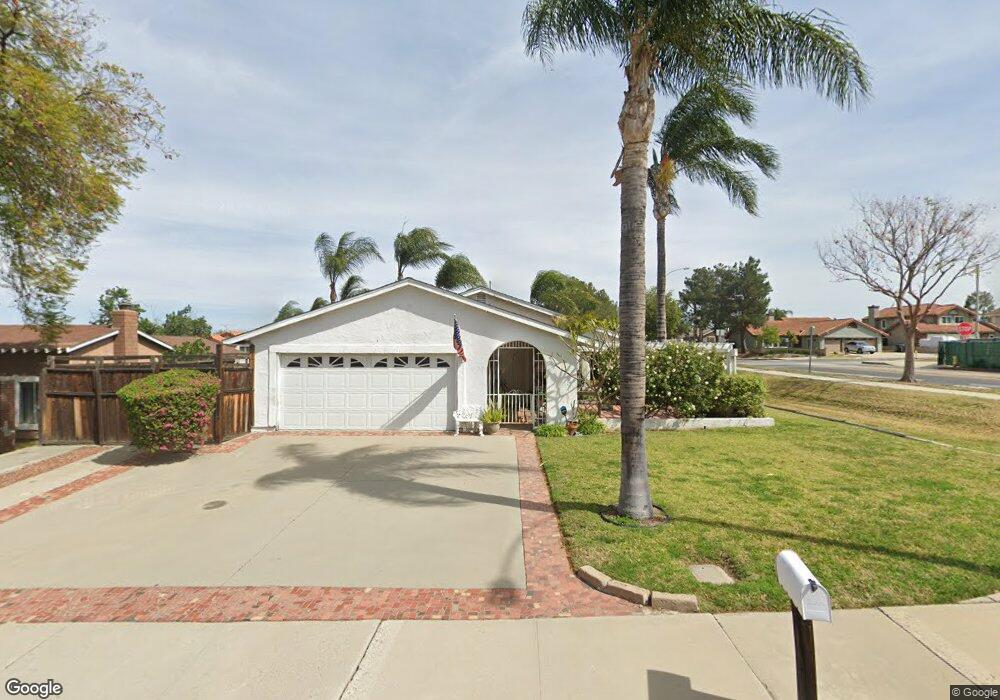
2183 Newton Dr Corona, CA 92882
Central Corona NeighborhoodEstimated Value: $658,722 - $782,000
4
Beds
2
Baths
1,326
Sq Ft
$546/Sq Ft
Est. Value
About This Home
This home is located at 2183 Newton Dr, Corona, CA 92882 and is currently estimated at $724,181, approximately $546 per square foot. 2183 Newton Dr is a home located in Riverside County with nearby schools including John Adams Elementary School, Letha Raney Intermediate School, and Corona High School.
Ownership History
Date
Name
Owned For
Owner Type
Purchase Details
Closed on
Aug 8, 2018
Sold by
Wade Kathleen Anne
Bought by
Wade Kathleen Anne
Current Estimated Value
Purchase Details
Closed on
Jan 22, 2008
Sold by
Nemeth Kathleen Ann and Nemeth Kathleen
Bought by
Nemeth Kathleen Ann
Purchase Details
Closed on
Aug 28, 2006
Sold by
Nemeth Kathleen
Bought by
Nemeth Kathleen
Home Financials for this Owner
Home Financials are based on the most recent Mortgage that was taken out on this home.
Original Mortgage
$150,001
Outstanding Balance
$103,564
Interest Rate
9.62%
Mortgage Type
Purchase Money Mortgage
Estimated Equity
$620,617
Purchase Details
Closed on
Jan 26, 2006
Sold by
Nemeth Larry
Bought by
Nemeth Kathleen
Create a Home Valuation Report for This Property
The Home Valuation Report is an in-depth analysis detailing your home's value as well as a comparison with similar homes in the area
Home Values in the Area
Average Home Value in this Area
Purchase History
| Date | Buyer | Sale Price | Title Company |
|---|---|---|---|
| Wade Kathleen Anne | -- | None Available | |
| Nemeth Kathleen Ann | -- | None Available | |
| Nemeth Kathleen | -- | Orange Coast Title Company M | |
| Nemeth Kathleen | -- | None Available |
Source: Public Records
Mortgage History
| Date | Status | Borrower | Loan Amount |
|---|---|---|---|
| Open | Nemeth Kathleen | $150,001 |
Source: Public Records
Tax History Compared to Growth
Tax History
| Year | Tax Paid | Tax Assessment Tax Assessment Total Assessment is a certain percentage of the fair market value that is determined by local assessors to be the total taxable value of land and additions on the property. | Land | Improvement |
|---|---|---|---|---|
| 2025 | $2,081 | $191,653 | $59,719 | $131,934 |
| 2023 | $2,081 | $184,213 | $57,401 | $126,812 |
| 2022 | $2,014 | $180,602 | $56,276 | $124,326 |
| 2021 | $1,973 | $177,062 | $55,173 | $121,889 |
| 2020 | $1,951 | $175,248 | $54,608 | $120,640 |
| 2019 | $1,921 | $171,813 | $53,538 | $118,275 |
| 2018 | $1,940 | $168,445 | $52,489 | $115,956 |
| 2017 | $1,894 | $165,143 | $51,460 | $113,683 |
| 2016 | $1,875 | $161,905 | $50,451 | $111,454 |
| 2015 | $1,836 | $159,476 | $49,695 | $109,781 |
| 2014 | $1,771 | $156,354 | $48,722 | $107,632 |
Source: Public Records
Map
Nearby Homes
- 1427 Baird St
- 2350 Centennial Way
- 1486 Baird St
- 1317 Sonora Dr
- 1310 Brentwood Cir Unit B
- 1365 Kroonen Dr
- 1386 Fairmont Dr
- 1344 Brentwood Cir Unit C
- 2314 Mcneil Cir
- 2393 Mesquite Ln
- 2425 Centennial Way
- 1598 Border Ave Unit H
- 1535 Border Ave Unit C
- 1554 Border Ave Unit G
- 1757 Fraser Cir
- 2471 Via Pacifica
- 2531 Independence Way
- 1372 Old Trail Dr
- 1336 Old Trail Dr
- 1763 Gleason St
- 2161 Newton Dr
- 2137 Newton Dr
- 2190 Newton Dr
- 2154 Valor Cir
- 2164 Valor Cir
- 2168 Newton Dr
- 2144 Valor Cir
- 2085 Newton Dr
- 2134 Valor Cir
- 2144 Newton Dr
- 2124 Valor Cir
- 1403 W Ontario Ave
- 2201 Mangular Ave
- 2092 Newton Dr
- 2063 Newton Dr
- 2114 Valor Cir
- 2211 Mangular Ave
- 1415 W Ontario Ave
- 2070 Newton Dr
- 2092 Valor Dr