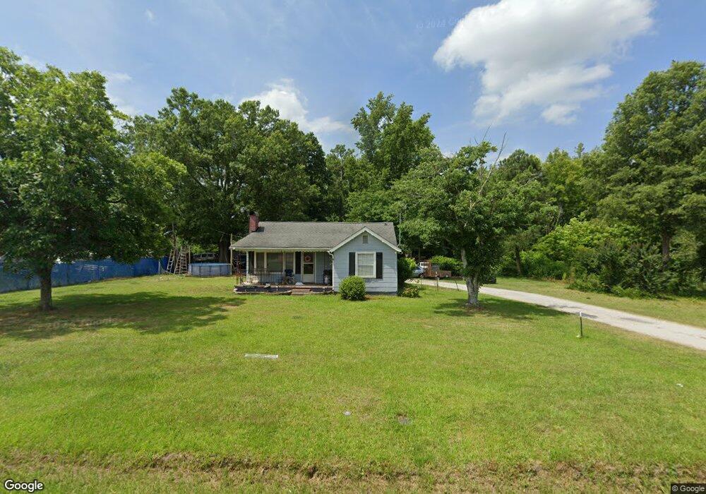
2188 McIlwain Rd Lancaster, SC 29720
Estimated Value: $83,000 - $222,000
2
Beds
1
Bath
958
Sq Ft
$168/Sq Ft
Est. Value
About This Home
This home is located at 2188 McIlwain Rd, Lancaster, SC 29720 and is currently estimated at $160,745, approximately $167 per square foot. 2188 McIlwain Rd is a home located in Lancaster County with nearby schools including McDonald Green Elementary School, South Middle School, and Lancaster High School.
Ownership History
Date
Name
Owned For
Owner Type
Purchase Details
Closed on
Feb 12, 2020
Sold by
Carter Sara L
Bought by
Alvarez Moree Properties Llc
Current Estimated Value
Purchase Details
Closed on
Nov 15, 2016
Sold by
Carter Sybil S
Bought by
Carter Scotty Eugene and Carter Sara L
Purchase Details
Closed on
Oct 5, 2016
Sold by
Deese Michael
Bought by
Carter Scotty and Carter Sara
Purchase Details
Closed on
Jan 17, 2007
Sold by
Carter Jonathan H and Carter Sybil S
Bought by
Carter Scotty Eugene and Carter Sara L
Create a Home Valuation Report for This Property
The Home Valuation Report is an in-depth analysis detailing your home's value as well as a comparison with similar homes in the area
Home Values in the Area
Average Home Value in this Area
Purchase History
| Date | Buyer | Sale Price | Title Company |
|---|---|---|---|
| Alvarez Moree Properties Llc | $18,000 | None Available | |
| Carter Sara L | -- | None Available | |
| Carter Scotty Eugene | -- | -- | |
| Carter Scotty | $30,000 | -- | |
| Carter Scotty Eugene | -- | None Available |
Source: Public Records
Tax History
| Year | Tax Paid | Tax Assessment Tax Assessment Total Assessment is a certain percentage of the fair market value that is determined by local assessors to be the total taxable value of land and additions on the property. | Land | Improvement |
|---|---|---|---|---|
| 2024 | $338 | $2,196 | $644 | $1,552 |
| 2023 | $336 | $2,196 | $644 | $1,552 |
| 2022 | $335 | $2,196 | $644 | $1,552 |
| 2021 | $328 | $2,196 | $644 | $1,552 |
| 2020 | $1,066 | $3,294 | $966 | $2,328 |
| 2019 | $744 | $2,196 | $644 | $1,552 |
| 2018 | $716 | $2,196 | $644 | $1,552 |
| 2017 | $330 | $0 | $0 | $0 |
| 2016 | $991 | $0 | $0 | $0 |
| 2015 | $31 | $0 | $0 | $0 |
| 2014 | $31 | $0 | $0 | $0 |
| 2013 | $31 | $0 | $0 | $0 |
Source: Public Records
Map
Nearby Homes
- 1976 McIlwain Rd
- 5142 Sedgefield Dr
- 1139 Merribrook Ln
- 5114 Sedgefield Dr
- 1182 Merribrook Ln
- 1186 Merribrook Ln
- 2599 State Road S-29-503
- 2908 Woodland Way
- 1.18 acres McIlwain Rd
- 2795 Cane Mill Rd
- 2826 Drew Dr
- 3489 Oakridge Rd
- 1411 Foxbrook Cir
- Lot 24 Avalon Ln Unit 24
- 00 Bath Ln
- 2644 Downey Dr
- 2697 State Road S-29-369
- 2694 Pineview Dr
- 2417 Lynwood Dr
- 0 Watson Dr Unit 39
- 939 Harkey Rd
- 2164 McIlwain Rd
- 2224 McIlwain Rd
- 2140 McIlwain Rd
- 2240 McIlwain Rd
- 954 Harkey Rd
- 962 Harkey Rd
- 936 Alamo Ln
- 2256 McIlwain Rd
- 2253 McIlwain Rd
- 2239 McIlwain Rd
- 2118 McIlwain Rd
- 2264 McIlwain Rd
- 2267 McIlwain Rd
- 864 W Doc Garris Rd
- 2278 McIlwain Rd
- 684 W Doc Garris Rd
- 2090 McIlwain Rd
- 845 W Doc Garris Rd
- 2286 McIlwain Rd
Your Personal Tour Guide
Ask me questions while you tour the home.