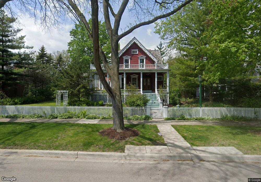
219 6th St Wilmette, IL 60091
Estimated Value: $2,058,000 - $2,327,000
5
Beds
4
Baths
4,353
Sq Ft
$502/Sq Ft
Est. Value
About This Home
This home is located at 219 6th St, Wilmette, IL 60091 and is currently estimated at $2,184,435, approximately $501 per square foot. 219 6th St is a home located in Cook County with nearby schools including Central Elementary School, Highcrest Middle School, and Wilmette Junior High School.
Ownership History
Date
Name
Owned For
Owner Type
Purchase Details
Closed on
Jun 1, 2017
Sold by
Sweitzwer Richard J and Sweitzer Helen
Bought by
Sweitzer Rick J and Sweitzer Helen
Current Estimated Value
Purchase Details
Closed on
Nov 15, 1995
Sold by
Young Gary S and Young Frank H
Bought by
Sweitzer Richard J and Sweitzer Helen M
Home Financials for this Owner
Home Financials are based on the most recent Mortgage that was taken out on this home.
Original Mortgage
$378,750
Interest Rate
5.87%
Create a Home Valuation Report for This Property
The Home Valuation Report is an in-depth analysis detailing your home's value as well as a comparison with similar homes in the area
Home Values in the Area
Average Home Value in this Area
Purchase History
| Date | Buyer | Sale Price | Title Company |
|---|---|---|---|
| Sweitzer Rick J | -- | None Available | |
| Sweitzer Richard J | $505,000 | -- |
Source: Public Records
Mortgage History
| Date | Status | Borrower | Loan Amount |
|---|---|---|---|
| Previous Owner | Sweitzer Richard J | $378,750 |
Source: Public Records
Tax History Compared to Growth
Tax History
| Year | Tax Paid | Tax Assessment Tax Assessment Total Assessment is a certain percentage of the fair market value that is determined by local assessors to be the total taxable value of land and additions on the property. | Land | Improvement |
|---|---|---|---|---|
| 2024 | $30,853 | $125,000 | $27,706 | $97,294 |
| 2023 | $29,161 | $141,933 | $27,706 | $114,227 |
| 2022 | $29,161 | $141,933 | $27,706 | $114,227 |
| 2021 | $25,948 | $105,873 | $22,165 | $83,708 |
| 2020 | $29,011 | $119,106 | $22,165 | $96,941 |
| 2019 | $29,476 | $135,387 | $22,165 | $113,222 |
| 2018 | $25,350 | $109,989 | $19,142 | $90,847 |
| 2017 | $25,801 | $114,908 | $19,142 | $95,766 |
| 2016 | $26,165 | $122,874 | $19,142 | $103,732 |
| 2015 | $22,507 | $93,284 | $5,571 | $87,713 |
| 2014 | $23,954 | $100,621 | $5,571 | $95,050 |
| 2013 | $24,050 | $105,714 | $15,868 | $89,846 |
Source: Public Records
Map
Nearby Homes
- 601 Linden Ave
- 2741 Eastwood Ave
- 526 Linden Ave
- 105 Dupee Place
- 2635 Poplar Ave
- 250 3rd St
- 521 10th St
- 706 Washington Ave
- 2539.5 Prairie Ave Unit 3W
- 315 Washington Ave
- 1107 Greenleaf Ave Unit 4G
- 1318 Central St Unit 1N
- 1025 Central Ave
- 1219 Central St Unit B
- 693 Sheridan Rd
- 2210 Hartzell St
- 2135 Central St Unit 3W
- 1531 Lincoln St
- 623 Forest Ave
- 2108 Harrison St