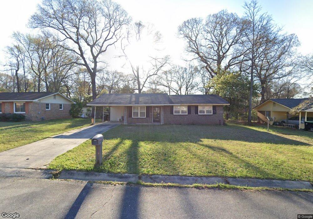
219 Randy Cir Warner Robins, GA 31088
Estimated Value: $152,000 - $180,038
Studio
2
Baths
1,739
Sq Ft
$94/Sq Ft
Est. Value
About This Home
This home is located at 219 Randy Cir, Warner Robins, GA 31088 and is currently estimated at $164,010, approximately $94 per square foot. 219 Randy Cir is a home located in Houston County with nearby schools including Russell Elementary School, Warner Robins Middle School, and Warner Robins High School.
Ownership History
Date
Name
Owned For
Owner Type
Purchase Details
Closed on
Feb 22, 2021
Sold by
Burnam Mary Lnger
Bought by
Burnam Mary Inger and Blevins Charles D
Current Estimated Value
Home Financials for this Owner
Home Financials are based on the most recent Mortgage that was taken out on this home.
Original Mortgage
$76,800
Outstanding Balance
$67,837
Interest Rate
2.65%
Mortgage Type
New Conventional
Estimated Equity
$96,173
Purchase Details
Closed on
Feb 19, 2021
Sold by
Burnam Mary I and Blevins Charles D
Bought by
Burnam Mary Inger
Home Financials for this Owner
Home Financials are based on the most recent Mortgage that was taken out on this home.
Original Mortgage
$76,800
Outstanding Balance
$67,837
Interest Rate
2.65%
Mortgage Type
New Conventional
Estimated Equity
$96,173
Purchase Details
Closed on
May 15, 2018
Sold by
Lee Adrian Ellis
Bought by
Blevins Charles D and Burnam Mary L
Home Financials for this Owner
Home Financials are based on the most recent Mortgage that was taken out on this home.
Original Mortgage
$78,551
Interest Rate
4.4%
Mortgage Type
FHA
Purchase Details
Closed on
May 30, 2006
Sold by
Snipes Shane A and Snipes Lorie L
Bought by
Lee Adrian Ellis
Home Financials for this Owner
Home Financials are based on the most recent Mortgage that was taken out on this home.
Original Mortgage
$91,000
Interest Rate
6.44%
Mortgage Type
New Conventional
Purchase Details
Closed on
Dec 30, 1999
Sold by
Avery William R and Avery Cheryll A
Bought by
Snipes Shane A and Snipes Lorie L
Purchase Details
Closed on
Sep 13, 1991
Sold by
Pratt David A and Pratt Brenda
Bought by
Avery William R and Avery Cheryll A
Purchase Details
Closed on
Mar 28, 1980
Sold by
Moorman John D and Moorman Patricia A
Bought by
Pratt David A and Pratt Brenda
Purchase Details
Closed on
Nov 17, 1976
Sold by
Welty Larry E and Welty Kathryn L
Bought by
Moorman John D and Moorman Patricia A
Purchase Details
Closed on
Jul 31, 1973
Sold by
Holcomb Frank Thomas and Holcomb Joan H
Bought by
Welty Larry E and Welty Kathryn L
Purchase Details
Closed on
Dec 29, 1970
Sold by
Tyree Realty Co Inc
Bought by
Holcomb Frank Thomas and Holcomb Joan H
Purchase Details
Closed on
Oct 8, 1970
Sold by
Williams Eugene
Bought by
Tyree Realty Co Inc
Create a Home Valuation Report for This Property
The Home Valuation Report is an in-depth analysis detailing your home's value as well as a comparison with similar homes in the area
Home Values in the Area
Average Home Value in this Area
Purchase History
| Date | Buyer | Sale Price | Title Company |
|---|---|---|---|
| Burnam Mary Inger | -- | None Available | |
| Burnam Mary Inger | -- | None Available | |
| Blevins Charles D | $80,000 | None Available | |
| Lee Adrian Ellis | $91,000 | None Available | |
| Snipes Shane A | $74,000 | -- | |
| Avery William R | $66,500 | -- | |
| Pratt David A | $17,100 | -- | |
| Moorman John D | $8,000 | -- | |
| Welty Larry E | $3,000 | -- | |
| Holcomb Frank Thomas | $17,900 | -- | |
| Tyree Realty Co Inc | $7,500 | -- |
Source: Public Records
Mortgage History
| Date | Status | Borrower | Loan Amount |
|---|---|---|---|
| Open | Burnam Mary Inger | $76,800 | |
| Closed | Blevins Charles D | $78,551 | |
| Previous Owner | Lee Adrian Ellis | $91,000 |
Source: Public Records
Tax History
| Year | Tax Paid | Tax Assessment Tax Assessment Total Assessment is a certain percentage of the fair market value that is determined by local assessors to be the total taxable value of land and additions on the property. | Land | Improvement |
|---|---|---|---|---|
| 2025 | $1,966 | $67,520 | $8,000 | $59,520 |
| 2024 | $2,068 | $63,200 | $8,000 | $55,200 |
| 2023 | $1,435 | $43,520 | $8,000 | $35,520 |
| 2022 | $842 | $36,640 | $5,400 | $31,240 |
| 2021 | $707 | $30,600 | $5,400 | $25,200 |
| 2020 | $709 | $30,520 | $5,400 | $25,120 |
| 2019 | $709 | $30,520 | $5,400 | $25,120 |
| 2018 | $709 | $30,520 | $5,400 | $25,120 |
| 2017 | $710 | $30,520 | $5,400 | $25,120 |
| 2016 | $711 | $30,520 | $5,400 | $25,120 |
| 2015 | -- | $31,960 | $5,400 | $26,560 |
| 2014 | -- | $31,960 | $5,400 | $26,560 |
| 2013 | -- | $32,360 | $5,400 | $26,960 |
Source: Public Records
Map
Nearby Homes
- 223 Randy Cir
- 114 Tommy Terrace
- 77 Oliver Dr
- 213 Self St
- 114 Windsor Dr
- 1850 Russell Pkwy
- 0 Russell Pkwy Unit 10656199
- 205 Sonja Dr
- 118 Fox Glove Ct
- 25 & 26 Lot
- 305 Bonnie Dr
- 209 Tracy Terrace
- 223 Highland Dr
- 302 Creek Ridge Dr
- 101 Sunnybrook Ct
- 119 Colonial Rd
- 108 Woodsdale Dr
- 107 Woodfield Dr
- 104 Ridgedale Dr
- 103 Oakdale Dr
Your Personal Tour Guide
Ask me questions while you tour the home.