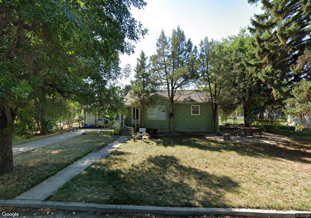
219 W 2nd Ave N Columbus, MT 59019
Estimated Value: $281,207 - $330,000
4
Beds
2
Baths
1,326
Sq Ft
$229/Sq Ft
Est. Value
About This Home
This home is located at 219 W 2nd Ave N, Columbus, MT 59019 and is currently estimated at $303,052, approximately $228 per square foot. 219 W 2nd Ave N is a home located in Stillwater County with nearby schools including Columbus Elementary School and Columbus Middle School.
Ownership History
Date
Name
Owned For
Owner Type
Purchase Details
Closed on
Jan 6, 2017
Bought by
Hampton Brooke Lanette
Current Estimated Value
Purchase Details
Closed on
Apr 2, 2008
Sold by
Dittmer Leanna Jo and Hahn Leanna
Bought by
Hampton Samuel R and Hampton Brooke
Home Financials for this Owner
Home Financials are based on the most recent Mortgage that was taken out on this home.
Original Mortgage
$101,500
Interest Rate
6.04%
Create a Home Valuation Report for This Property
The Home Valuation Report is an in-depth analysis detailing your home's value as well as a comparison with similar homes in the area
Home Values in the Area
Average Home Value in this Area
Purchase History
| Date | Buyer | Sale Price | Title Company |
|---|---|---|---|
| Hampton Brooke Lanette | -- | -- | |
| Hampton Samuel R | -- | -- |
Source: Public Records
Mortgage History
| Date | Status | Borrower | Loan Amount |
|---|---|---|---|
| Previous Owner | Hampton Samuel R | $101,500 |
Source: Public Records
Tax History Compared to Growth
Tax History
| Year | Tax Paid | Tax Assessment Tax Assessment Total Assessment is a certain percentage of the fair market value that is determined by local assessors to be the total taxable value of land and additions on the property. | Land | Improvement |
|---|---|---|---|---|
| 2025 | $1,631 | $312,700 | $0 | $0 |
| 2024 | $2,156 | $272,100 | $0 | $0 |
| 2023 | $2,092 | $272,100 | $0 | $0 |
| 2022 | $1,789 | $217,900 | $0 | $0 |
| 2021 | $1,800 | $217,900 | $0 | $0 |
| 2020 | $1,590 | $187,600 | $0 | $0 |
| 2019 | $1,680 | $187,600 | $0 | $0 |
| 2018 | $1,322 | $158,400 | $0 | $0 |
| 2017 | $1,378 | $158,400 | $0 | $0 |
| 2016 | $1,295 | $153,000 | $0 | $0 |
| 2015 | $1,251 | $153,000 | $0 | $0 |
| 2014 | $1,000 | $67,204 | $0 | $0 |
Source: Public Records
Map
Nearby Homes