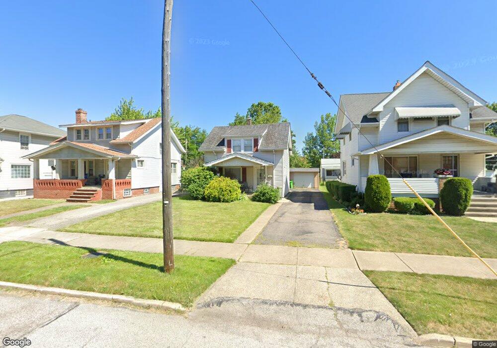
21901 Westport Ave Euclid, OH 44123
Estimated Value: $86,957 - $114,000
2
Beds
1
Bath
900
Sq Ft
$107/Sq Ft
Est. Value
About This Home
This home is located at 21901 Westport Ave, Euclid, OH 44123 and is currently estimated at $95,989, approximately $106 per square foot. 21901 Westport Ave is a home located in Cuyahoga County with nearby schools including Arbor Elementary School, Euclid Middle School, and Euclid High School.
Ownership History
Date
Name
Owned For
Owner Type
Purchase Details
Closed on
Apr 24, 2024
Sold by
Taylor Katrina A and Worewell Alfred
Bought by
Koa Capital Llc
Current Estimated Value
Purchase Details
Closed on
Nov 5, 2010
Sold by
Evans Richard M
Bought by
Taylor Katrina A
Purchase Details
Closed on
Jun 16, 1998
Sold by
Evans Joan D
Bought by
Evans Richard M
Home Financials for this Owner
Home Financials are based on the most recent Mortgage that was taken out on this home.
Original Mortgage
$70,800
Interest Rate
10.25%
Purchase Details
Closed on
Jun 21, 1985
Sold by
Miklavic Nancy
Bought by
Lukas Nancy L
Purchase Details
Closed on
Oct 25, 1975
Sold by
Kirk Kenneth L and Kirk Colleen O
Bought by
Miklavic Nancy
Purchase Details
Closed on
Jan 1, 1975
Bought by
Kirk Kenneth L and Kirk Colleen O
Create a Home Valuation Report for This Property
The Home Valuation Report is an in-depth analysis detailing your home's value as well as a comparison with similar homes in the area
Home Values in the Area
Average Home Value in this Area
Purchase History
| Date | Buyer | Sale Price | Title Company |
|---|---|---|---|
| Koa Capital Llc | $57,000 | None Listed On Document | |
| Taylor Katrina A | $30,000 | Patriot Land | |
| Evans Richard M | -- | -- | |
| Lukas Nancy L | -- | -- | |
| Evans Richard M | $37,400 | -- | |
| Miklavic Nancy | $22,500 | -- | |
| Kirk Kenneth L | -- | -- |
Source: Public Records
Mortgage History
| Date | Status | Borrower | Loan Amount |
|---|---|---|---|
| Previous Owner | Evans Richard M | $70,800 |
Source: Public Records
Tax History Compared to Growth
Tax History
| Year | Tax Paid | Tax Assessment Tax Assessment Total Assessment is a certain percentage of the fair market value that is determined by local assessors to be the total taxable value of land and additions on the property. | Land | Improvement |
|---|---|---|---|---|
| 2024 | $2,148 | $30,590 | $7,420 | $23,170 |
| 2023 | $1,756 | $19,670 | $5,810 | $13,860 |
| 2022 | $1,718 | $19,670 | $5,810 | $13,860 |
| 2021 | $1,904 | $19,670 | $5,810 | $13,860 |
| 2020 | $1,609 | $14,910 | $4,410 | $10,500 |
| 2019 | $1,441 | $42,600 | $12,600 | $30,000 |
| 2018 | $829 | $14,910 | $4,410 | $10,500 |
| 2017 | $1,470 | $12,570 | $2,940 | $9,630 |
| 2016 | $1,473 | $12,570 | $2,940 | $9,630 |
| 2015 | $2,908 | $12,570 | $2,940 | $9,630 |
| 2014 | $2,908 | $12,570 | $2,940 | $9,630 |
Source: Public Records
Map
Nearby Homes
- 21481 Ball Ave
- 21670 Wilmore Ave
- 21440 Fuller Ave
- 21181 Ball Ave
- 21170 Wilmore Ave
- 21051 Westport Ave
- 21030 Priday Ave
- 21251 S Lake Shore Blvd
- 21051 S Lake Shore Blvd
- 20760 Westport Ave
- 20801 Morris Ave
- 22301 Milton Dr
- 362 E 214th St
- 20671 Wilmore Ave
- 21561 Maydale Ave
- 20830 Tracy Ave
- 22601 Ivan Ave
- 21130 Arbor Ave
- 20450 Wilmore Ave
- 273 E 208th St
- 21931 Westport Ave
- 21871 Westport Ave
- 21951 Westport Ave
- 21851 Westport Ave
- 21841 Westport Ave
- 21900 Ball Ave
- 21930 Ball Ave
- 21870 Ball Ave
- 21971 Westport Ave
- 21801 Westport Ave
- 21950 Ball Ave
- 21830 Ball Ave
- 21771 Westport Ave
- 22001 Westport Ave
- 21800 Ball Ave
- 21970 Ball Ave
- 21900 Westport Ave
- 21930 Westport Ave
- 21950 Westport Ave
- 21850 Westport Ave