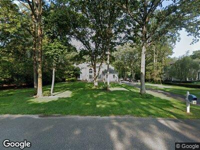
2192 S Tiiu Ct Toms River, NJ 08755
Estimated Value: $1,069,238 - $1,408,000
3
Beds
3
Baths
4,729
Sq Ft
$255/Sq Ft
Est. Value
About This Home
This home is located at 2192 S Tiiu Ct, Toms River, NJ 08755 and is currently estimated at $1,206,560, approximately $255 per square foot. 2192 S Tiiu Ct is a home located in Ocean County with nearby schools including Ocean Academy Charter School, Talmud Torah Bais Avrohom, and Bais Tova School.
Ownership History
Date
Name
Owned For
Owner Type
Purchase Details
Closed on
May 24, 2001
Sold by
Capuano Daniel
Bought by
Roncin Raymond and Roncin Linda
Current Estimated Value
Home Financials for this Owner
Home Financials are based on the most recent Mortgage that was taken out on this home.
Original Mortgage
$394,800
Outstanding Balance
$166,930
Interest Rate
7.09%
Estimated Equity
$971,358
Purchase Details
Closed on
Aug 1, 1996
Sold by
Weinstein Builders
Bought by
Capuano Daniel and Capuano Lynne
Home Financials for this Owner
Home Financials are based on the most recent Mortgage that was taken out on this home.
Original Mortgage
$247,000
Interest Rate
8.27%
Create a Home Valuation Report for This Property
The Home Valuation Report is an in-depth analysis detailing your home's value as well as a comparison with similar homes in the area
Home Values in the Area
Average Home Value in this Area
Purchase History
| Date | Buyer | Sale Price | Title Company |
|---|---|---|---|
| Roncin Raymond | $493,500 | -- | |
| Roncin Raymond | $493,500 | -- | |
| Capuano Daniel | $308,500 | -- |
Source: Public Records
Mortgage History
| Date | Status | Borrower | Loan Amount |
|---|---|---|---|
| Open | Roncin Raymond F | $200,000 | |
| Closed | Roncin Raymond F | $200,000 | |
| Open | Roncin Raymond | $394,800 | |
| Closed | Roncin Raymond | $394,800 | |
| Previous Owner | Capuano Daniel | $20,156 | |
| Previous Owner | Capuano Daniel | $240,000 | |
| Previous Owner | Capuano Daniel | $247,000 |
Source: Public Records
Tax History Compared to Growth
Tax History
| Year | Tax Paid | Tax Assessment Tax Assessment Total Assessment is a certain percentage of the fair market value that is determined by local assessors to be the total taxable value of land and additions on the property. | Land | Improvement |
|---|---|---|---|---|
| 2024 | $13,765 | $795,200 | $304,400 | $490,800 |
| 2023 | $13,264 | $795,200 | $304,400 | $490,800 |
| 2022 | $13,264 | $795,200 | $304,400 | $490,800 |
| 2021 | $12,275 | $491,400 | $126,100 | $365,300 |
| 2020 | $12,221 | $491,400 | $126,100 | $365,300 |
| 2019 | $11,690 | $491,400 | $126,100 | $365,300 |
| 2018 | $11,572 | $491,400 | $126,100 | $365,300 |
| 2017 | $11,494 | $491,400 | $126,100 | $365,300 |
| 2016 | $11,224 | $491,400 | $126,100 | $365,300 |
| 2015 | $10,821 | $491,400 | $126,100 | $365,300 |
| 2014 | $10,285 | $491,400 | $126,100 | $365,300 |
Source: Public Records
Map
Nearby Homes
- 1278 Precious Ct
- 2218 Longest Dr
- 1196 Arcadia Dr
- 1183 Cynthia Ln
- 1480 Essex Ct
- 1903 New Hampshire Ave
- 1488 Serrata Way
- 1499 Serrata Way
- 1141 Hickory St
- 1504 Serrata Way
- 1311 White Oak Bottom Rd
- 2020 Coconut Grove Ct
- 1905 Cherryvale Ct
- 2016 Coconut Grove Ct
- 1524 Quince Place
- 2001 Coconut Grove Ct
- 2013 Coconut Grove Ct
- 1020 Bal Harbor Dr
- 1478 Gleniffer Hill Rd
- 1013 Bal Harbor Dr
