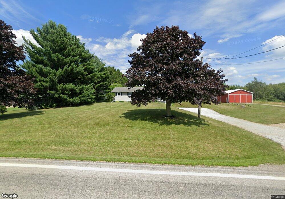
2193 Ohio 511 Perrysville, OH 44864
Estimated Value: $287,000 - $367,000
4
Beds
2
Baths
1,310
Sq Ft
$246/Sq Ft
Est. Value
About This Home
This home is located at 2193 Ohio 511, Perrysville, OH 44864 and is currently estimated at $322,640, approximately $246 per square foot. 2193 Ohio 511 is a home located in Ashland County with nearby schools including Hillsdale Elementary School, Hillsdale Middle School, and Hillsdale High School.
Ownership History
Date
Name
Owned For
Owner Type
Purchase Details
Closed on
Apr 7, 2016
Sold by
Killey Robert E and Killey Joanne
Bought by
Holmes James L and Holmes Wendy
Current Estimated Value
Purchase Details
Closed on
Apr 14, 2006
Sold by
Smeltzer Jason S
Bought by
Killey Robert E
Purchase Details
Closed on
Aug 1, 2002
Sold by
Watson Alfred M
Bought by
Smeltzer Jason S
Purchase Details
Closed on
Dec 6, 1994
Sold by
Stake James L
Bought by
Watson Alfred M
Create a Home Valuation Report for This Property
The Home Valuation Report is an in-depth analysis detailing your home's value as well as a comparison with similar homes in the area
Home Values in the Area
Average Home Value in this Area
Purchase History
| Date | Buyer | Sale Price | Title Company |
|---|---|---|---|
| Holmes James L | -- | Attorney Only | |
| Killey Robert E | $150,000 | -- | |
| Smeltzer Jason S | $125,000 | -- | |
| Watson Alfred M | $86,500 | -- |
Source: Public Records
Tax History Compared to Growth
Tax History
| Year | Tax Paid | Tax Assessment Tax Assessment Total Assessment is a certain percentage of the fair market value that is determined by local assessors to be the total taxable value of land and additions on the property. | Land | Improvement |
|---|---|---|---|---|
| 2024 | $2,512 | $77,140 | $14,990 | $62,150 |
| 2023 | $2,512 | $77,140 | $14,990 | $62,150 |
| 2022 | $2,187 | $53,200 | $10,340 | $42,860 |
| 2021 | $2,190 | $53,200 | $10,340 | $42,860 |
| 2020 | $2,050 | $53,200 | $10,340 | $42,860 |
| 2019 | $1,962 | $49,900 | $9,830 | $40,070 |
| 2018 | $1,950 | $49,900 | $9,830 | $40,070 |
| 2017 | $1,704 | $49,900 | $9,830 | $40,070 |
| 2016 | $1,704 | $43,390 | $8,550 | $34,840 |
| 2015 | $1,683 | $43,390 | $8,550 | $34,840 |
| 2013 | $1,919 | $48,510 | $8,920 | $39,590 |
Source: Public Records
Map
Nearby Homes
- 1048 Township Road 2156
- 0 Township Road 925
- 1106 County Road 30a
- 820 County Road 30a
- 968 Township Road 2506
- 1183 County Road 30a
- 19 Maine St
- 0 Applegate Rd
- 150 E Main St
- 0 Mount Zion Rd Unit 9069748
- 0 Twp Rd 1806 Unit 11591470
- 2428 Applegate Rd
- 0 Ashland County Road 2175
- 0 Ashland County Road 2175
- 945 Pike Dr
- 609 Ohio 95
- 560 Township Road 2402
- 1845 County Road 655
- 3290 Shad Dr W
- 2193 State Route 511
- 2189 Ohio 511
- 2189 State Route 511
- 2185 Ohio 511
- 994 Township Road 2206
- 2185 State Route 511
- 2204 State Route 511
- 986 Township Road 2206
- 2173 State Route 511
- 978 Township Road 2206
- 2163 State Route 511
- 2163A State Route 511
- 2220 State Route 511
- 2159 State Route 511
- 2159 Ohio 511
- 2156 State Route 511
- 962 Township Road 2206
- 2156 Ohio 511
- 2151 Ohio 511
- 2234 Ohio 511