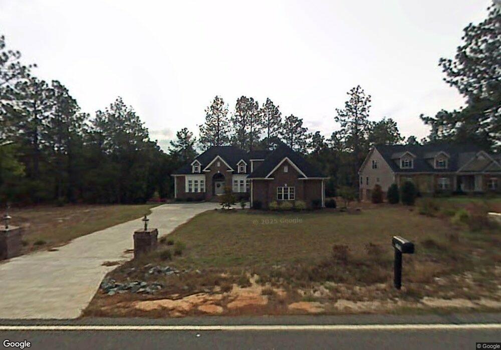
2195 Airport Rd Whispering Pines, NC 28327
Estimated Value: $527,000 - $618,000
3
Beds
3
Baths
2,572
Sq Ft
$224/Sq Ft
Est. Value
About This Home
This home is located at 2195 Airport Rd, Whispering Pines, NC 28327 and is currently estimated at $577,295, approximately $224 per square foot. 2195 Airport Rd is a home located in Moore County with nearby schools including Ida B. Wells Academy, McDeeds Creek Elementary School, and Crain's Creek Middle School.
Ownership History
Date
Name
Owned For
Owner Type
Purchase Details
Closed on
Mar 19, 2007
Sold by
Lairmore Michael G and Lairmore Helen M
Bought by
Mitton Terrylynn
Current Estimated Value
Home Financials for this Owner
Home Financials are based on the most recent Mortgage that was taken out on this home.
Original Mortgage
$200,000
Outstanding Balance
$120,327
Interest Rate
6.15%
Mortgage Type
Purchase Money Mortgage
Estimated Equity
$456,968
Purchase Details
Closed on
Mar 9, 2006
Sold by
Merchants Properties Inc
Bought by
Lairmore Michael G and Lairmore Helen M
Home Financials for this Owner
Home Financials are based on the most recent Mortgage that was taken out on this home.
Original Mortgage
$229,000
Interest Rate
6.23%
Mortgage Type
Fannie Mae Freddie Mac
Create a Home Valuation Report for This Property
The Home Valuation Report is an in-depth analysis detailing your home's value as well as a comparison with similar homes in the area
Home Values in the Area
Average Home Value in this Area
Purchase History
| Date | Buyer | Sale Price | Title Company |
|---|---|---|---|
| Mitton Terrylynn | $350,000 | None Available | |
| Lairmore Michael G | $329,000 | None Available |
Source: Public Records
Mortgage History
| Date | Status | Borrower | Loan Amount |
|---|---|---|---|
| Open | Mitton Terrylynn | $200,000 | |
| Previous Owner | Lairmore Michael G | $229,000 |
Source: Public Records
Tax History Compared to Growth
Tax History
| Year | Tax Paid | Tax Assessment Tax Assessment Total Assessment is a certain percentage of the fair market value that is determined by local assessors to be the total taxable value of land and additions on the property. | Land | Improvement |
|---|---|---|---|---|
| 2024 | $3,297 | $538,920 | $60,000 | $478,920 |
| 2023 | $3,396 | $538,920 | $60,000 | $478,920 |
| 2022 | $3,009 | $347,430 | $42,000 | $305,430 |
| 2021 | $3,085 | $347,430 | $42,000 | $305,430 |
| 2020 | $2,959 | $347,430 | $42,000 | $305,430 |
| 2019 | $2,805 | $347,430 | $42,000 | $305,430 |
| 2018 | $2,425 | $322,120 | $36,000 | $286,120 |
| 2017 | $2,786 | $322,120 | $36,000 | $286,120 |
| 2015 | $2,754 | $322,120 | $36,000 | $286,120 |
| 2014 | $3,216 | $376,100 | $36,000 | $340,100 |
| 2013 | -- | $376,100 | $36,000 | $340,100 |
Source: Public Records
Map
Nearby Homes
- 2177 Airport Rd
- 7 Martin Dr
- 32 Martin Dr Unit D
- 32A Martin Dr
- 2000 Airport Rd
- 36 Martin Dr Unit C
- 31 Cardinal Dr
- 48 Martin Dr
- 52 Cardinal Dr
- 4 Winding Trail
- 57 Cardinal Dr
- 830 Ave of the Carolinas
- 335 Ashurst Rd
- 810 Ave of the Carolinas
- 375 Ashurst Rd
- 510 Nicely
- 515 Nicely Way
- 525 Nicely
- 3928 Niagara Carthage Rd
- 1768 Airport Rd
- 2213 Airport Rd
- 2159 Airport Rd
- 2223 Airport Rd
- 2200 Airport Rd
- 2188 Airport Rd
- 2212 Airport Rd
- 2176 Airport Rd
- 2141 Airport Rd
- 2225 Airport Rd
- 2164 Airport Rd
- 2222 Airport Rd
- 2152 Airport Rd
- 139 Hardee Ln
- 2140 Airport Rd
- 137 Hardee Ln
- 2111 Airport Rd
- 2128 Airport Rd
- 4 Cardinal Dr
- 8 Martin Dr
- 2116 Airport Rd