Estimated Value: $414,000 - $473,000
3
Beds
2
Baths
1,929
Sq Ft
$225/Sq Ft
Est. Value
About This Home
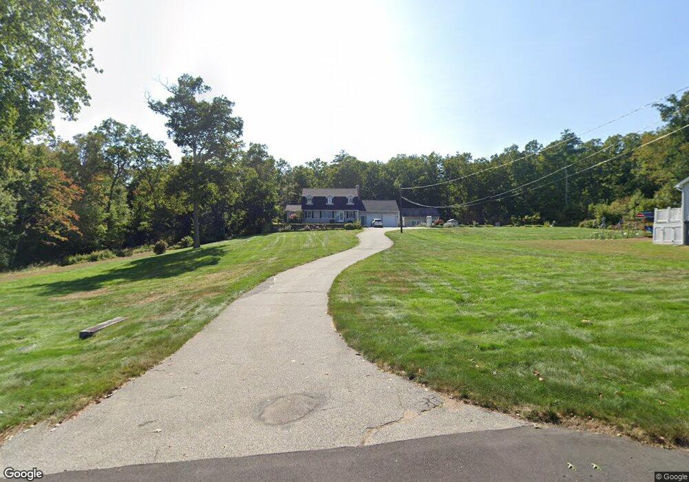
This home is located at 22 Anderson Rd, Ware, MA 01082 and is currently estimated at $434,000, approximately $224 per square foot. 22 Anderson Rd is a home located in Hampshire County with nearby schools including Stanley M. Koziol Elementary School, Ware Middle School, and Ware Junior/Senior High School.
Ownership History
Date
Name
Owned For
Owner Type
Purchase Details
Closed on
Mar 21, 2018
Sold by
Desjardins Donald E and Desjardins Jane M
Bought by
Desjardins Ft
Current Estimated Value
Purchase Details
Closed on
Sep 10, 1970
Bought by
Desjardins Donald E and Desjardins Jane M
Create a Home Valuation Report for This Property
The Home Valuation Report is an in-depth analysis detailing your home's value as well as a comparison with similar homes in the area
Home Values in the Area
Average Home Value in this Area
Purchase History
| Date | Buyer | Sale Price | Title Company |
|---|---|---|---|
| Desjardins Ft | -- | -- | |
| Desjardins Donald E | $6,000 | -- |
Source: Public Records
Mortgage History
| Date | Status | Borrower | Loan Amount |
|---|---|---|---|
| Previous Owner | Desjardins Donald E | $1,000,000 |
Source: Public Records
Tax History
| Year | Tax Paid | Tax Assessment Tax Assessment Total Assessment is a certain percentage of the fair market value that is determined by local assessors to be the total taxable value of land and additions on the property. | Land | Improvement |
|---|---|---|---|---|
| 2025 | $6,108 | $405,600 | $61,400 | $344,200 |
| 2024 | $5,866 | $359,200 | $57,900 | $301,300 |
| 2023 | $5,680 | $329,100 | $56,700 | $272,400 |
| 2022 | $5,611 | $290,100 | $52,500 | $237,600 |
| 2021 | $5,372 | $266,200 | $52,500 | $213,700 |
| 2020 | $5,221 | $253,100 | $52,500 | $200,600 |
| 2019 | $5,115 | $253,100 | $52,500 | $200,600 |
| 2018 | $4,995 | $241,200 | $51,300 | $189,900 |
| 2017 | $4,972 | $239,400 | $51,300 | $188,100 |
| 2016 | $4,838 | $239,400 | $51,300 | $188,100 |
| 2015 | $4,704 | $239,400 | $51,300 | $188,100 |
| 2014 | $4,612 | $251,900 | $56,200 | $195,700 |
Source: Public Records
Map
Nearby Homes
- 310 Palmer Rd
- 201 West St
- LOT 3 Monson Turnpike Rd
- 201 Belchertown Rd
- 24 Clinton St
- 30 Warebrook Village
- 87 W Main St
- 375 Belchertown Rd
- 67 Babcock Tavern Rd
- Lot 16 Coldbrook Dr
- Lot 20 Coldbrook Dr
- Lot 22 Coldbrook Dr
- Lot 13 Coldbrook Dr
- Lot 25 Coldbrook Dr
- 23 West St Unit 25
- 7 Webb Ct
- 60 Quaboag Valley Co Op St
- 44 South St
- 48 North St Unit 1
- 79 Pleasant St
Your Personal Tour Guide
Ask me questions while you tour the home.