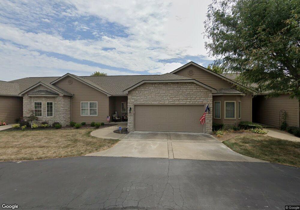
22 Claire Ct Unit 22 Circleville, OH 43113
Estimated Value: $300,905 - $314,000
2
Beds
2
Baths
1,492
Sq Ft
$207/Sq Ft
Est. Value
About This Home
This home is located at 22 Claire Ct Unit 22, Circleville, OH 43113 and is currently estimated at $308,726, approximately $206 per square foot. 22 Claire Ct Unit 22 is a home located in Pickaway County with nearby schools including Logan Elm High School.
Ownership History
Date
Name
Owned For
Owner Type
Purchase Details
Closed on
Dec 17, 2018
Sold by
Lutz Robert T and Lutz Shirley M
Bought by
Jacobs Marsha and The Lutz Preservation Trust
Current Estimated Value
Purchase Details
Closed on
Jul 31, 2006
Sold by
Thornton Roger W
Bought by
Lutz Robert T and Lutz Shirley M
Purchase Details
Closed on
Dec 4, 2003
Sold by
Community Investment Corp
Bought by
Thornton Roger W and Ronald P Thornton Revocable Inter Vivos
Home Financials for this Owner
Home Financials are based on the most recent Mortgage that was taken out on this home.
Original Mortgage
$98,166
Interest Rate
6.01%
Mortgage Type
Purchase Money Mortgage
Create a Home Valuation Report for This Property
The Home Valuation Report is an in-depth analysis detailing your home's value as well as a comparison with similar homes in the area
Home Values in the Area
Average Home Value in this Area
Purchase History
| Date | Buyer | Sale Price | Title Company |
|---|---|---|---|
| Jacobs Marsha | -- | None Available | |
| Lutz Robert T | -- | None Available | |
| Lutz Robert T | $176,900 | Clt | |
| Thornton Roger W | $122,800 | Clt |
Source: Public Records
Mortgage History
| Date | Status | Borrower | Loan Amount |
|---|---|---|---|
| Previous Owner | Thornton Roger W | $98,166 |
Source: Public Records
Tax History Compared to Growth
Tax History
| Year | Tax Paid | Tax Assessment Tax Assessment Total Assessment is a certain percentage of the fair market value that is determined by local assessors to be the total taxable value of land and additions on the property. | Land | Improvement |
|---|---|---|---|---|
| 2024 | -- | $83,730 | $8,750 | $74,980 |
| 2023 | $2,446 | $83,730 | $8,750 | $74,980 |
| 2022 | $2,063 | $67,660 | $8,750 | $58,910 |
| 2021 | $2,116 | $67,660 | $8,750 | $58,910 |
| 2020 | $2,144 | $67,660 | $8,750 | $58,910 |
| 2019 | $1,639 | $53,320 | $8,750 | $44,570 |
| 2018 | $1,732 | $53,320 | $8,750 | $44,570 |
| 2017 | $1,417 | $53,320 | $8,750 | $44,570 |
| 2016 | $1,256 | $48,620 | $8,750 | $39,870 |
| 2015 | $1,261 | $48,620 | $8,750 | $39,870 |
| 2014 | $1,263 | $48,620 | $8,750 | $39,870 |
| 2013 | $1,378 | $51,110 | $8,750 | $42,360 |
Source: Public Records
Map
Nearby Homes
- 31 Claire Ct Unit 31
- 22952 Bolender Pontius Rd
- 0 Old Tarlton Pike
- 334 Lancaster Pike
- 533 Douglas Dr
- 6983 Old Tarlton Pike
- 152 Griner Ave
- 208 Moats Dr
- 308 Wedgewood Ct
- 231 Westwood Dr
- 955 Mccormick Ave
- 551 E Main St
- 466 John St
- 461 Watt St
- 420 Faye Ave
- 595 Ridgewood Dr
- 449 Watt St
- 1616 Crossing Blvd Unit 1616
- 511 Mowrer Rd
- 1424 Anthem Way
- 20 Claire Ct Unit 20
- 24 Claire Ct
- 14 Claire Ct Unit 14
- 26 Claire Ct Unit 26
- 16 Claire Ct Unit 16
- 28 Claire Ct Unit 28
- 30 Claire Ct Unit 30
- 32 Claire Ct Unit 32
- 18 Claire Ct
- 38 Claire Ct Unit 38
- 40 Claire Ct Unit 40
- 36 Claire Ct Unit 36
- 34 Claire Ct Unit 34
- 41 Claire Ct Unit 41
- 39 Claire Ct Unit 39
- 12 Claire Ct Unit 12
- 10 Claire Ct
- 37 Claire Ct Unit 37
- 8 Claire Ct Unit 8
- 21 Claire Ct Unit 21