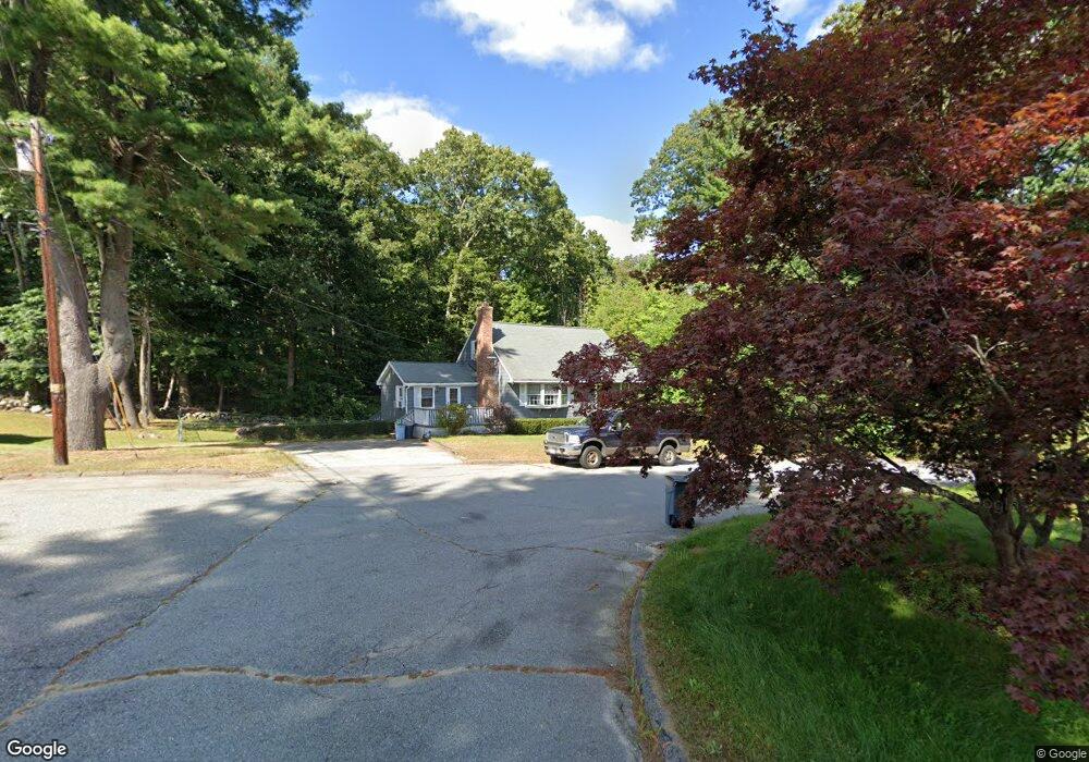
22 Emerson Ave Methuen, MA 01844
The West End NeighborhoodEstimated Value: $536,000 - $691,000
3
Beds
3
Baths
1,728
Sq Ft
$348/Sq Ft
Est. Value
About This Home
This home is located at 22 Emerson Ave, Methuen, MA 01844 and is currently estimated at $601,007, approximately $347 per square foot. 22 Emerson Ave is a home located in Essex County with nearby schools including Marsh Grammar School, Methuen High School, and The Birches Academy of Academics and Art.
Ownership History
Date
Name
Owned For
Owner Type
Purchase Details
Closed on
Sep 15, 1989
Sold by
Moore Alfred
Bought by
Sughrue James
Current Estimated Value
Home Financials for this Owner
Home Financials are based on the most recent Mortgage that was taken out on this home.
Original Mortgage
$116,150
Interest Rate
9.58%
Mortgage Type
Purchase Money Mortgage
Create a Home Valuation Report for This Property
The Home Valuation Report is an in-depth analysis detailing your home's value as well as a comparison with similar homes in the area
Home Values in the Area
Average Home Value in this Area
Purchase History
| Date | Buyer | Sale Price | Title Company |
|---|---|---|---|
| Sughrue James | $115,000 | -- | |
| Sughrue James | $115,000 | -- |
Source: Public Records
Mortgage History
| Date | Status | Borrower | Loan Amount |
|---|---|---|---|
| Open | Sughrue James | $100,000 | |
| Closed | Sughrue James | $116,150 |
Source: Public Records
Tax History
| Year | Tax Paid | Tax Assessment Tax Assessment Total Assessment is a certain percentage of the fair market value that is determined by local assessors to be the total taxable value of land and additions on the property. | Land | Improvement |
|---|---|---|---|---|
| 2025 | $5,304 | $501,300 | $212,500 | $288,800 |
| 2024 | $5,243 | $482,800 | $193,900 | $288,900 |
| 2023 | $4,894 | $418,300 | $172,300 | $246,000 |
| 2022 | $4,648 | $356,200 | $143,600 | $212,600 |
| 2021 | $4,428 | $335,700 | $136,400 | $199,300 |
| 2020 | $4,439 | $330,300 | $136,400 | $193,900 |
| 2019 | $4,294 | $302,600 | $122,100 | $180,500 |
| 2018 | $4,204 | $294,600 | $122,100 | $172,500 |
| 2017 | $4,073 | $278,000 | $122,100 | $155,900 |
| 2016 | $3,805 | $256,900 | $114,900 | $142,000 |
| 2015 | $3,650 | $250,000 | $114,900 | $135,100 |
Source: Public Records
Map
Nearby Homes
- 344B Hampshire Rd
- 58 Campus Rd
- 146 Hampshire Rd
- 25 Newbury Rd
- 16 Carmel Rd Unit M18 B12-16 L2
- 8 Carmel Rd
- 50 Arrowwood St
- 35 Canobieola Rd
- 65 Ormonde Rd
- 20 Pinehurst Ave
- 37 Lexington Ave
- 219 Pelham St
- 37 Summer Hill Rd
- 37 Brady Ave
- 534 Forest St
- 42 Perley St
- 23 Clough Dr
- 18 Stone Castle Dr Unit 76
- 50 Haigh Ave
- 280 & 290 Spring Rd
- 14 Emerson Ave
- 23 Emerson Ave
- 19 Emerson Ave
- 12 Emerson Ave
- 1 Emerson Terrace
- 2 Emerson Terrace
- 22 Frederick Ave
- 10 Emerson Ave
- 10 Emerson Ave Unit 10
- 15 Emerson Ave
- 27 Frederick Ave
- 48 Salem St
- 23 Frederick Ave
- 14 Frederick Ave
- 19 Frederick Ave
- 6 Emerson Ave
- 50 Salem St
- 15 Frederick Ave
- 49 Salem St
- 47 Salem St
Your Personal Tour Guide
Ask me questions while you tour the home.