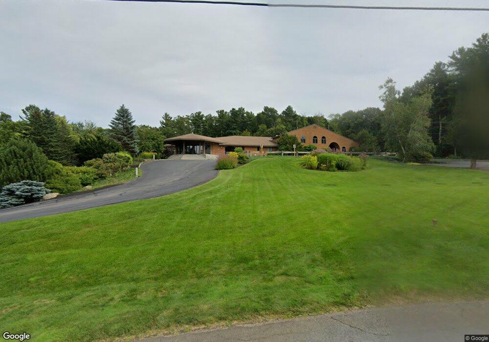
22 Garland Dr Hampstead, NH 03841
Estimated Value: $4,476,871
4
Beds
1
Bath
32,533
Sq Ft
$138/Sq Ft
Est. Value
About This Home
This home is located at 22 Garland Dr, Hampstead, NH 03841 and is currently estimated at $4,476,871, approximately $137 per square foot. 22 Garland Dr is a home located in Rockingham County with nearby schools including Hampstead Central School, Hampstead Middle School, and Pinkerton Academy.
Ownership History
Date
Name
Owned For
Owner Type
Purchase Details
Closed on
May 5, 2017
Sold by
Kieley Richard and Kieley Susan M
Bought by
Store Master Funding 1
Current Estimated Value
Create a Home Valuation Report for This Property
The Home Valuation Report is an in-depth analysis detailing your home's value as well as a comparison with similar homes in the area
Home Values in the Area
Average Home Value in this Area
Purchase History
| Date | Buyer | Sale Price | Title Company |
|---|---|---|---|
| Store Master Funding 1 | $2,150,000 | -- | |
| Store Master Funding 1 | $2,150,000 | -- |
Source: Public Records
Mortgage History
| Date | Status | Borrower | Loan Amount |
|---|---|---|---|
| Previous Owner | Store Master Funding 1 | $1,297,500 | |
| Previous Owner | Store Master Funding 1 | $1,038,000 | |
| Previous Owner | Store Master Funding 1 | $1,069,000 | |
| Previous Owner | Store Master Funding 1 | $67,032 |
Source: Public Records
Tax History Compared to Growth
Tax History
| Year | Tax Paid | Tax Assessment Tax Assessment Total Assessment is a certain percentage of the fair market value that is determined by local assessors to be the total taxable value of land and additions on the property. | Land | Improvement |
|---|---|---|---|---|
| 2024 | $56,208 | $3,031,700 | $831,000 | $2,200,700 |
| 2023 | $54,576 | $2,145,300 | $563,200 | $1,582,100 |
| 2022 | $50,801 | $2,145,300 | $563,200 | $1,582,100 |
| 2021 | $48,806 | $2,145,300 | $563,200 | $1,582,100 |
| 2020 | $13,883 | $2,145,300 | $563,200 | $1,582,100 |
| 2016 | $65,664 | $2,713,400 | $508,200 | $2,205,200 |
| 2015 | $60,862 | $2,713,400 | $508,200 | $2,205,200 |
| 2014 | $60,862 | $2,713,400 | $508,200 | $2,205,200 |
| 2006 | $46,905 | $2,588,600 | $353,200 | $2,235,400 |
Source: Public Records
Map
Nearby Homes
- 16 Edmund Meadow Ln
- 35 Kelly Brook Ln
- 14 Meredith Dr
- 42 Country Rd
- 41 Tewksbury Rd
- 93 Stage Rd
- 15 Cambridge Rd
- 3 Cameron Ct Unit 3
- 6 Russett Ln
- 12 Stage Rd
- 314 Main St
- 1 Remington Dr Unit 904C
- 333 Main St
- 13 Autumn Ln
- Lot 11 Crown Hill Rd
- 62 Veterans Way
- 132 Maple Ave
- 19 Crown Hill Rd
- 00 Woodridge Rd
- 33 Pillsbury Rd
- 27 Hazel Dr
- 5 Hazel Dr
- 471 State Route 111
- 472 State Route 111 Unit B1
- 472 State Route 111
- 472 State Route 111 Unit G
- 472 State Route 111 Unit G2
- 472 State Route 111 Unit G
- 472 State Route 111 Unit F
- 472 State Route 111 Unit E
- 472 New Hampshire 111 Unit B1
- 472 New Hampshire 111 Unit F
- 472 New Hampshire 111 Unit E
- 472 New Hampshire 111 Unit G
- 472 New Hampshire 111 Unit G2
- 472 New Hampshire 111 Unit C2,D2,E2,H2
- 472 New Hampshire 111
- 4 Hazel Dr
- 2 Village Green Rd O-088 Unit Bldg3
- 2 Village Green Rd O-088