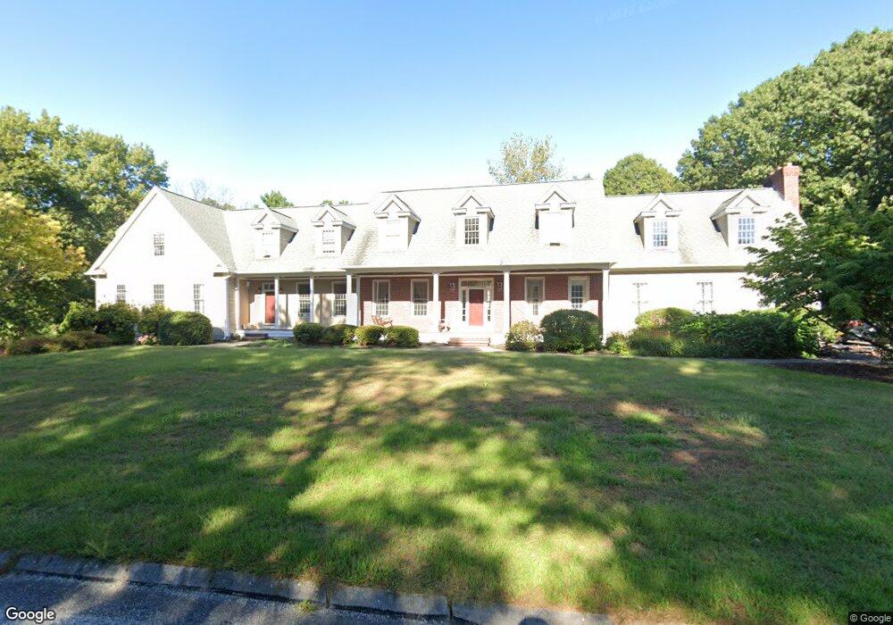
22 Lawrence Dr Franklin, MA 02038
Estimated Value: $1,235,000 - $1,345,000
2
Beds
3
Baths
1,880
Sq Ft
$679/Sq Ft
Est. Value
About This Home
This home is located at 22 Lawrence Dr, Franklin, MA 02038 and is currently estimated at $1,275,732, approximately $678 per square foot. 22 Lawrence Dr is a home located in Norfolk County with nearby schools including Gerald M. Parmenter Elementary School, Remington Middle School, and Franklin High School.
Ownership History
Date
Name
Owned For
Owner Type
Purchase Details
Closed on
Nov 20, 2017
Sold by
Destephano Joy F and Destephano Danner J
Bought by
22 Lawrence Drive Nt
Current Estimated Value
Purchase Details
Closed on
Aug 5, 2016
Sold by
Holcomb 3Rd John T and Holcomb Mary T
Bought by
Destephano Danner J and Destephano Joy F
Home Financials for this Owner
Home Financials are based on the most recent Mortgage that was taken out on this home.
Original Mortgage
$310,000
Interest Rate
3.56%
Mortgage Type
New Conventional
Purchase Details
Closed on
Mar 26, 2007
Sold by
Corriveau Jean P and Corriveau Lise M
Bought by
Holcomb John T and Holcomb Mary T
Purchase Details
Closed on
Jul 27, 2001
Sold by
Jones Timothy G
Bought by
Corriveau Jean P and Corriveau Lise M
Purchase Details
Closed on
Oct 30, 1996
Sold by
Gracewood Dev Corp
Bought by
Jones Timothy G and Jones Grace J
Create a Home Valuation Report for This Property
The Home Valuation Report is an in-depth analysis detailing your home's value as well as a comparison with similar homes in the area
Purchase History
| Date | Buyer | Sale Price | Title Company |
|---|---|---|---|
| 22 Lawrence Drive Nt | -- | -- | |
| Destephano Danner J | $792,500 | -- | |
| Holcomb John T | $820,000 | -- | |
| Jones Timothy G | $95,000 | -- | |
| 22 Lawrence Drive Nt | -- | -- | |
| Holcomb John T | $820,000 | -- | |
| Corriveau Jean P | $659,900 | -- | |
| Jones Timothy G | $95,000 | -- |
Source: Public Records
Mortgage History
| Date | Status | Borrower | Loan Amount |
|---|---|---|---|
| Previous Owner | Destephano Danner J | $310,000 | |
| Previous Owner | Jones Timothy G | $410,000 |
Source: Public Records
Tax History
| Year | Tax Paid | Tax Assessment Tax Assessment Total Assessment is a certain percentage of the fair market value that is determined by local assessors to be the total taxable value of land and additions on the property. | Land | Improvement |
|---|---|---|---|---|
| 2025 | $14,549 | $1,252,100 | $335,700 | $916,400 |
| 2024 | $14,352 | $1,217,300 | $335,700 | $881,600 |
| 2023 | $14,161 | $1,125,700 | $286,100 | $839,600 |
| 2022 | $13,558 | $965,000 | $225,300 | $739,700 |
| 2021 | $14,583 | $995,400 | $253,100 | $742,300 |
| 2020 | $13,758 | $948,200 | $242,700 | $705,500 |
| 2019 | $13,747 | $937,700 | $232,300 | $705,400 |
| 2018 | $12,539 | $855,900 | $224,000 | $631,900 |
| 2017 | $11,654 | $799,300 | $207,400 | $591,900 |
| 2016 | $11,723 | $808,500 | $222,200 | $586,300 |
| 2015 | $11,694 | $788,000 | $211,100 | $576,900 |
| 2014 | $11,012 | $762,100 | $185,200 | $576,900 |
Source: Public Records
Map
Nearby Homes
- 0 Fall Ln
- 139 King St Unit 306
- 82 Uncas Ave
- 82 Uncas Ave Unit 1
- 80 Uncas Ave
- 66 Uncas Ave
- 68 Uncas Ave
- 76 Uncas Ave
- 64 Uncas Ave
- 99 Summer St
- 62 Uncas Ave
- 1 Washington St
- 374-378 Union St
- 3 Washington St
- 90 E Central St Unit 103
- 90 E Central St Unit 106
- 90 E Central St Unit 304
- 90 E Central St Unit 202
- 90 E Central St Unit 105
- 90 E Central St Unit 301
- 22 Lawrence Dr
- 22 Lawrence Dr Unit 1
- 20 Lawrence Dr
- 24 Lawrence Dr
- Lot 23 Lawrence Dr
- Lot 21 Lawrence Dr
- 0 Dr
- 0 Lot#8 Lawrence Dr
- 0 Lot#4 Lawrence Dr
- Lot 24 Lawrence Dr
- Lot 20 Lawrence Dr
- 18 Lawrence Dr
- 21 Lawrence Dr
- 23 Lawrence Dr
- 26 Lawrence Dr
- 25 Lawrence Dr
- 25 Lawrence Dr
- 17 Lawrence Dr
- 15 Lawrence Dr Unit 15
- Lot 4 39 Lawrence Dr
Your Personal Tour Guide
Ask me questions while you tour the home.