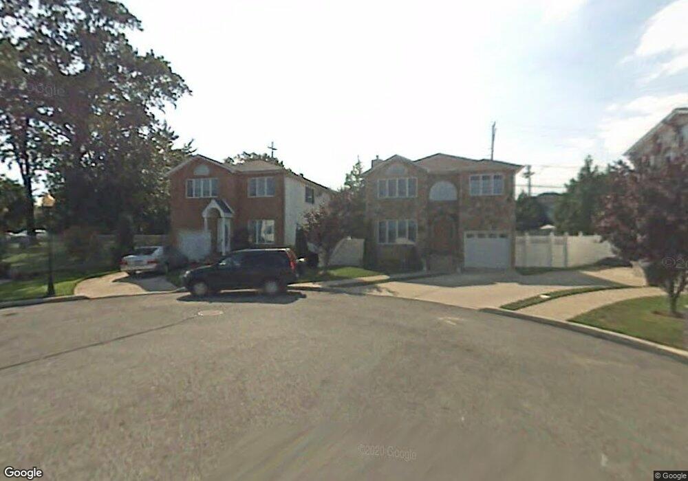
22 Lynbrook Ct Staten Island, NY 10309
Woodrow NeighborhoodEstimated Value: $1,063,120 - $1,232,000
--
Bed
--
Bath
2,600
Sq Ft
$441/Sq Ft
Est. Value
About This Home
This home is located at 22 Lynbrook Ct, Staten Island, NY 10309 and is currently estimated at $1,146,030, approximately $440 per square foot. 22 Lynbrook Ct is a home located in Richmond County with nearby schools including Kathleen Grimm School For Leadership, P.S. 56 - The Louis Desario School, and Is 34 Tottenville.
Ownership History
Date
Name
Owned For
Owner Type
Purchase Details
Closed on
Apr 2, 2002
Sold by
Sharrotts Development Corp
Bought by
Mirando Francine
Current Estimated Value
Home Financials for this Owner
Home Financials are based on the most recent Mortgage that was taken out on this home.
Original Mortgage
$130,000
Outstanding Balance
$55,197
Interest Rate
7.15%
Mortgage Type
Purchase Money Mortgage
Estimated Equity
$1,090,833
Create a Home Valuation Report for This Property
The Home Valuation Report is an in-depth analysis detailing your home's value as well as a comparison with similar homes in the area
Home Values in the Area
Average Home Value in this Area
Purchase History
| Date | Buyer | Sale Price | Title Company |
|---|---|---|---|
| Mirando Francine | $450,000 | -- |
Source: Public Records
Mortgage History
| Date | Status | Borrower | Loan Amount |
|---|---|---|---|
| Open | Mirando Francine | $130,000 |
Source: Public Records
Tax History Compared to Growth
Tax History
| Year | Tax Paid | Tax Assessment Tax Assessment Total Assessment is a certain percentage of the fair market value that is determined by local assessors to be the total taxable value of land and additions on the property. | Land | Improvement |
|---|---|---|---|---|
| 2025 | $10,685 | $66,840 | $11,534 | $55,306 |
| 2024 | $10,697 | $54,600 | $13,486 | $41,114 |
| 2023 | $10,307 | $52,152 | $11,486 | $40,666 |
| 2022 | $9,535 | $49,200 | $13,320 | $35,880 |
| 2021 | $10,258 | $51,420 | $13,320 | $38,100 |
| 2020 | $10,218 | $51,780 | $13,320 | $38,460 |
| 2019 | $9,510 | $53,100 | $13,320 | $39,780 |
| 2018 | $8,714 | $44,208 | $11,697 | $32,511 |
| 2017 | $8,712 | $44,208 | $12,729 | $31,479 |
| 2016 | $8,050 | $41,820 | $13,320 | $28,500 |
| 2015 | $7,189 | $41,393 | $10,955 | $30,438 |
| 2014 | $7,189 | $39,050 | $10,577 | $28,473 |
Source: Public Records
Map
Nearby Homes
- 62 Dexter Ave
- 669 Bloomingdale Rd
- 298 Kramer Ave
- 28 Brookside Loop
- 41 Brookside Loop
- 30 Harris Ln
- 16 Harris Ln
- 18 Harris Ln
- 24 Harris Ln
- 11 Jessica Ln
- 100 Marisa Cir
- 33 White Oak Ln
- 42 Spruce Ln
- 192 Mason Blvd
- 122 Clay Pit Rd
- 137 Shiel Ave
- 45 Pembrook Loop
- 59 Pembrook Loop
- 729 Correll Ave
- 91 Bombay St
- 25 Lynbrook Ct
- 20 Lynbrook Ct
- 23 Lynbrook Ct
- 21 Lynbrook Ct
- 19 Lynbrook Ct Unit 1st Floor
- 16 Lynbrook Ct
- 1552 Woodrow Rd
- 603 Bloomingdale Rd
- 620 Bloomingdale Rd
- 628 Bloomingdale Rd
- 630 Bloomingdale Rd
- 610 Bloomingdale Rd
- 601 Bloomingdale Rd
- 17 Lynbrook Ct
- 1554 Woodrow Rd
- 599 Bloomingdale Rd
- 1556 Woodrow Rd
- 14 Lynbrook Ct
- 597 Bloomingdale Rd
- 595 Bloomingdale Rd