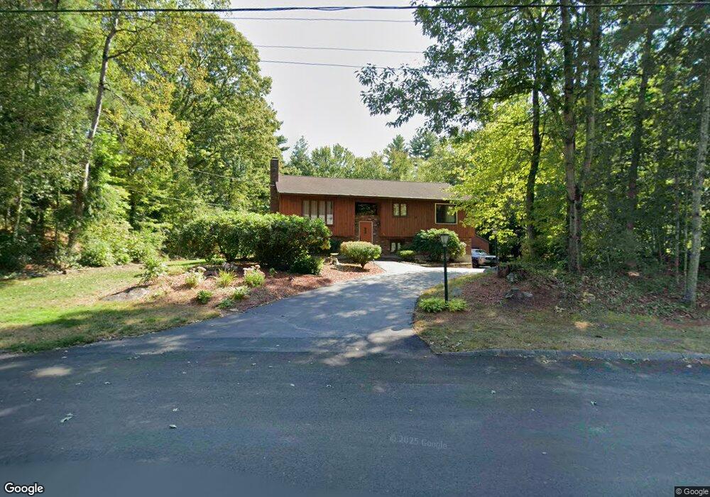
22 Michael Ave Nashua, NH 03062
West Hollis NeighborhoodEstimated Value: $539,019 - $603,000
3
Beds
2
Baths
1,912
Sq Ft
$301/Sq Ft
Est. Value
About This Home
This home is located at 22 Michael Ave, Nashua, NH 03062 and is currently estimated at $575,005, approximately $300 per square foot. 22 Michael Ave is a home located in Hillsborough County with nearby schools including Main Dunstable School, Elm Street Middle School, and Nashua High School South.
Ownership History
Date
Name
Owned For
Owner Type
Purchase Details
Closed on
Oct 31, 2005
Sold by
Graziose Thomas
Bought by
Salpas Jason G
Current Estimated Value
Home Financials for this Owner
Home Financials are based on the most recent Mortgage that was taken out on this home.
Original Mortgage
$244,000
Interest Rate
5.79%
Mortgage Type
Purchase Money Mortgage
Purchase Details
Closed on
Jun 25, 2004
Sold by
Turgeon Janet D
Bought by
Graziose Thomas
Home Financials for this Owner
Home Financials are based on the most recent Mortgage that was taken out on this home.
Original Mortgage
$260,910
Interest Rate
6.32%
Mortgage Type
Purchase Money Mortgage
Purchase Details
Closed on
Aug 24, 2001
Sold by
Manoukian Nora
Bought by
Turgeon Janet D
Home Financials for this Owner
Home Financials are based on the most recent Mortgage that was taken out on this home.
Original Mortgage
$182,400
Interest Rate
7.21%
Mortgage Type
Purchase Money Mortgage
Purchase Details
Closed on
Jul 17, 1998
Sold by
Snow Frank E and Snow Patricia H
Bought by
Manoukian Nora
Create a Home Valuation Report for This Property
The Home Valuation Report is an in-depth analysis detailing your home's value as well as a comparison with similar homes in the area
Home Values in the Area
Average Home Value in this Area
Purchase History
| Date | Buyer | Sale Price | Title Company |
|---|---|---|---|
| Salpas Jason G | $305,000 | -- | |
| Graziose Thomas | $289,900 | -- | |
| Turgeon Janet D | $228,000 | -- | |
| Manoukian Nora | $155,000 | -- |
Source: Public Records
Mortgage History
| Date | Status | Borrower | Loan Amount |
|---|---|---|---|
| Open | Manoukian Nora | $224,550 | |
| Closed | Manoukian Nora | $244,000 | |
| Previous Owner | Manoukian Nora | $260,910 | |
| Previous Owner | Manoukian Nora | $182,400 |
Source: Public Records
Tax History
| Year | Tax Paid | Tax Assessment Tax Assessment Total Assessment is a certain percentage of the fair market value that is determined by local assessors to be the total taxable value of land and additions on the property. | Land | Improvement |
|---|---|---|---|---|
| 2024 | $7,761 | $488,100 | $172,400 | $315,700 |
| 2023 | $7,370 | $404,300 | $137,900 | $266,400 |
| 2022 | $7,306 | $404,300 | $137,900 | $266,400 |
| 2021 | $6,611 | $284,700 | $96,500 | $188,200 |
| 2020 | $6,313 | $279,200 | $96,500 | $182,700 |
| 2019 | $6,075 | $279,200 | $96,500 | $182,700 |
| 2018 | $5,922 | $279,200 | $96,500 | $182,700 |
| 2017 | $6,360 | $246,600 | $78,400 | $168,200 |
| 2016 | $6,182 | $246,600 | $78,400 | $168,200 |
| 2015 | $6,049 | $246,600 | $78,400 | $168,200 |
| 2014 | $5,931 | $246,600 | $78,400 | $168,200 |
Source: Public Records
Map
Nearby Homes
- 17 Twilight Dr
- 19 Pioneer Dr
- 10 Houston Dr
- 33 Valencia Dr Unit U33
- 64 Mckenna Dr
- 25 Silverton Dr Unit U73
- 244 Harris Rd
- 5 Wilderness Dr
- 26 Old Coach Rd
- 4 Heather Ct Unit U34
- 30 Ledgewood Hills Dr Unit 104
- 23 Spring Cove Rd Unit U152
- 47 Dogwood Dr Unit U205
- 47 Dogwood Dr Unit U202
- 40 Spring Cove Rd Unit U117
- 12 Ledgewood Hills Dr Unit 105
- 154 Westwood Dr
- 4 Portchester Dr
- 4 Henry David Dr Unit 203
- 4 Henry David Dr Unit 202
- 24 Michael Ave
- 20 Michael Ave
- 21 Michael Ave
- 19 Michael Ave
- 26 Michael Ave
- 18 Michael Ave
- 23 Michael Ave
- 29 Twilight Dr
- 16 Michael Ave
- 25 Michael Ave
- 27 Twilight Dr
- 17 Michael Ave
- 14 Michael Ave
- 415 Main Dunstable Rd
- 26 Twilight Dr
- 15 Michael Ave
- 25 Twilight Dr
- 411 Main Dunstable Rd
- 24 Twilight Dr
- 11 Michael Ave
Your Personal Tour Guide
Ask me questions while you tour the home.