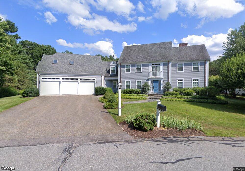
22 Pheasant Landing Rd Needham, MA 02492
Estimated Value: $1,844,000 - $2,598,000
5
Beds
4
Baths
2,715
Sq Ft
$850/Sq Ft
Est. Value
About This Home
This home is located at 22 Pheasant Landing Rd, Needham, MA 02492 and is currently estimated at $2,309,066, approximately $850 per square foot. 22 Pheasant Landing Rd is a home located in Norfolk County with nearby schools including Newman Elementary School, High Rock Middle School, and Pollard Middle School.
Ownership History
Date
Name
Owned For
Owner Type
Purchase Details
Closed on
Nov 10, 2016
Sold by
Lenehan Pamela F
Bought by
Pamela Flenehan 2013 R
Current Estimated Value
Purchase Details
Closed on
Oct 24, 1997
Sold by
Breitstein Nicky L and Breitstein Elizabeth C
Bought by
Lenehan Pamela F
Home Financials for this Owner
Home Financials are based on the most recent Mortgage that was taken out on this home.
Original Mortgage
$650,000
Interest Rate
7.48%
Mortgage Type
Purchase Money Mortgage
Purchase Details
Closed on
May 30, 1991
Sold by
Pheasant Landing Lp
Bought by
Breitstein Nicky L and Breitstein Eliz C
Home Financials for this Owner
Home Financials are based on the most recent Mortgage that was taken out on this home.
Original Mortgage
$250,000
Interest Rate
9.35%
Mortgage Type
Purchase Money Mortgage
Create a Home Valuation Report for This Property
The Home Valuation Report is an in-depth analysis detailing your home's value as well as a comparison with similar homes in the area
Home Values in the Area
Average Home Value in this Area
Purchase History
| Date | Buyer | Sale Price | Title Company |
|---|---|---|---|
| Pamela Flenehan 2013 R | -- | -- | |
| Lenehan Pamela F | $925,000 | -- | |
| Breitstein Nicky L | $575,000 | -- |
Source: Public Records
Mortgage History
| Date | Status | Borrower | Loan Amount |
|---|---|---|---|
| Previous Owner | Breitstein Nicky L | $650,000 | |
| Previous Owner | Breitstein Nicky L | $200,000 | |
| Previous Owner | Breitstein Nicky L | $250,000 |
Source: Public Records
Tax History Compared to Growth
Tax History
| Year | Tax Paid | Tax Assessment Tax Assessment Total Assessment is a certain percentage of the fair market value that is determined by local assessors to be the total taxable value of land and additions on the property. | Land | Improvement |
|---|---|---|---|---|
| 2025 | $21,377 | $2,016,700 | $887,800 | $1,128,900 |
| 2024 | $19,979 | $1,595,800 | $791,900 | $803,900 |
| 2023 | $20,091 | $1,540,700 | $791,900 | $748,800 |
| 2022 | $18,464 | $1,381,000 | $665,700 | $715,300 |
| 2021 | $17,994 | $1,381,000 | $665,700 | $715,300 |
| 2020 | $17,923 | $1,435,000 | $665,600 | $769,400 |
| 2019 | $17,707 | $1,429,100 | $665,600 | $763,500 |
| 2018 | $16,978 | $1,429,100 | $665,600 | $763,500 |
| 2017 | $17,261 | $1,451,700 | $700,600 | $751,100 |
| 2016 | $16,753 | $1,451,700 | $700,600 | $751,100 |
| 2015 | $16,390 | $1,451,700 | $700,600 | $751,100 |
| 2014 | $16,651 | $1,430,500 | $700,600 | $729,900 |
Source: Public Records
Map
Nearby Homes
- 78 Pheasant Landing Rd
- 60 Locust Ln
- 365 Charles River St
- 55 Ridge Hill Farm Rd
- 182 Winding River Rd
- 1780 Central Ave
- 60 Claybrook Rd
- 37 Carleton Dr
- 12 Winding River Cir
- 46 Charles River St
- 8 Warren Rd
- 52 Willow St
- 12 Haven St
- 1266 South St
- 29 Cottage St
- 29 Water St
- 12 Cranberry Ln
- 150 Dedham St
- 29 Tolman St
- 21 Eliot St
- 19 Pheasant Landing Rd
- 569 Charles River St
- 36 Pheasant Landing Rd
- 603 Charles River St
- 46 Pheasant Landing Rd
- 49 Pheasant Landing Rd
- 388-416 Charles River St
- 615 Charles River St
- 54 Pheasant Landing Rd
- 50 Pinehill Dr
- 61 Pheasant Landing Rd
- 590 Charles River St
- 68 Pheasant Landing Rd
- 526 Grove St
- 38 Pinehill Dr
- 73 Pheasant Landing Rd
- Lot 9 Grove St
- 47 Pinehill Dr
- 27 Belle Ln
- 534 Charles River St