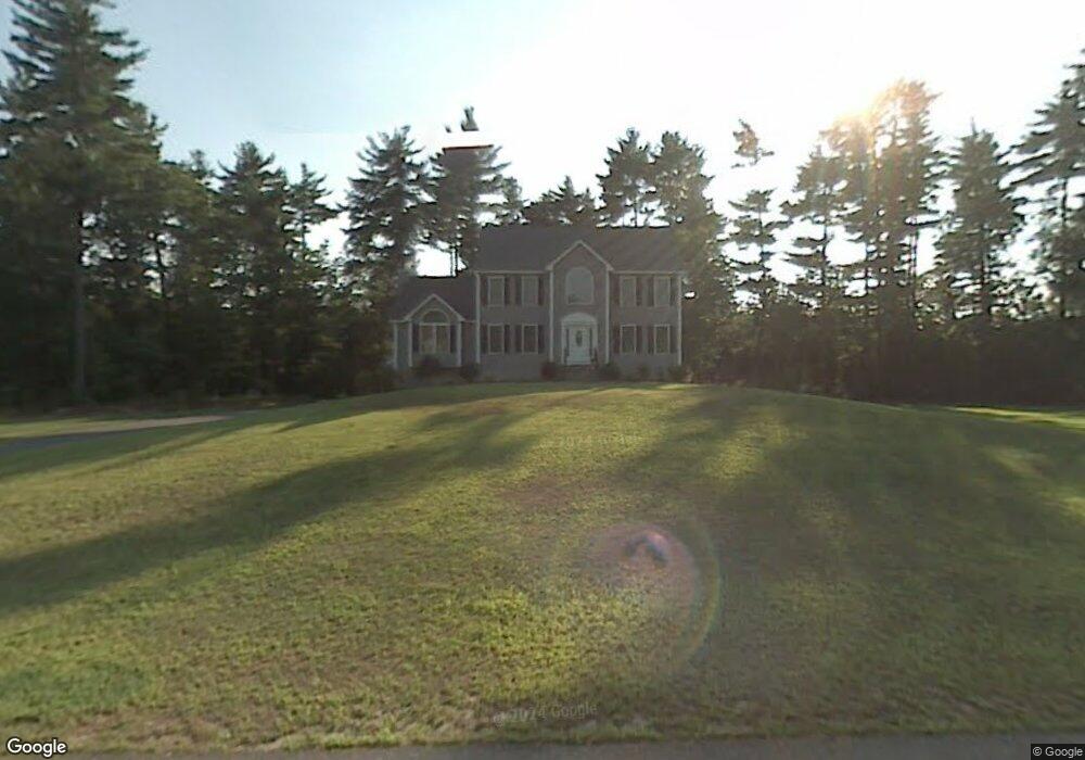
22 Quail Run Ln Pelham, NH 03076
Estimated Value: $713,000 - $889,000
3
Beds
3
Baths
2,572
Sq Ft
$302/Sq Ft
Est. Value
About This Home
This home is located at 22 Quail Run Ln, Pelham, NH 03076 and is currently estimated at $775,812, approximately $301 per square foot. 22 Quail Run Ln is a home with nearby schools including Pelham Elementary School, Pelham Memorial School, and Pelham High School.
Ownership History
Date
Name
Owned For
Owner Type
Purchase Details
Closed on
Aug 26, 2003
Sold by
Jrv Homes Inc
Bought by
Buck Patrick E and Buck Lisa A
Current Estimated Value
Home Financials for this Owner
Home Financials are based on the most recent Mortgage that was taken out on this home.
Original Mortgage
$289,900
Interest Rate
5.52%
Create a Home Valuation Report for This Property
The Home Valuation Report is an in-depth analysis detailing your home's value as well as a comparison with similar homes in the area
Home Values in the Area
Average Home Value in this Area
Purchase History
| Date | Buyer | Sale Price | Title Company |
|---|---|---|---|
| Buck Patrick E | $380,000 | -- |
Source: Public Records
Mortgage History
| Date | Status | Borrower | Loan Amount |
|---|---|---|---|
| Open | Buck Patrick E | $255,000 | |
| Closed | Buck Patrick E | $289,900 |
Source: Public Records
Tax History Compared to Growth
Tax History
| Year | Tax Paid | Tax Assessment Tax Assessment Total Assessment is a certain percentage of the fair market value that is determined by local assessors to be the total taxable value of land and additions on the property. | Land | Improvement |
|---|---|---|---|---|
| 2024 | $11,044 | $602,200 | $170,100 | $432,100 |
| 2023 | $10,954 | $602,200 | $170,100 | $432,100 |
| 2022 | $10,490 | $602,200 | $170,100 | $432,100 |
| 2021 | $9,611 | $602,200 | $170,100 | $432,100 |
| 2020 | $9,205 | $455,700 | $129,800 | $325,900 |
| 2019 | $8,841 | $455,700 | $129,800 | $325,900 |
| 2018 | $8,835 | $411,700 | $129,800 | $281,900 |
| 2017 | $8,831 | $411,700 | $129,800 | $281,900 |
| 2016 | $8,625 | $411,700 | $129,800 | $281,900 |
| 2015 | $8,462 | $363,800 | $123,600 | $240,200 |
| 2014 | $8,322 | $363,900 | $123,600 | $240,300 |
| 2013 | $8,322 | $363,900 | $123,600 | $240,300 |
Source: Public Records
Map
Nearby Homes
- 5 Stephanie Dr
- 436 Mammoth Rd
- 446 Mammoth Rd
- 63 Marsh Rd
- 508 Mammoth Rd
- 290 Mammoth Rd
- 10 Oakland Ridge Rd Unit 11
- 25 Misty Ln
- 4 Haystack Cir
- 1 Currier Rd
- 10 Dutton Rd
- 9 Cornstalk Ln
- 59 Thistlewood Dr Unit 47
- 73 Mammoth Rd Unit A&B
- 73 Mammoth Rd
- 73 A&B Mammoth Rd
- 50 Dutton Rd
- 1 Redwood Rd
- 67 2nd St
- 71 Deer Hill Cir