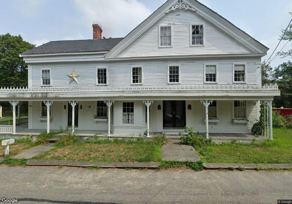
220 Holbrook Ave Wellfleet, MA 02667
Estimated Value: $868,000 - $1,346,202
5
Beds
2
Baths
2,568
Sq Ft
$444/Sq Ft
Est. Value
About This Home
This home is located at 220 Holbrook Ave, Wellfleet, MA 02667 and is currently estimated at $1,140,801, approximately $444 per square foot. 220 Holbrook Ave is a home located in Barnstable County with nearby schools including Wellfleet Elementary School, Nauset Regional Middle School, and Nauset Regional High School.
Ownership History
Date
Name
Owned For
Owner Type
Purchase Details
Closed on
Dec 6, 2016
Sold by
Nazarian Francis R and Nazarian Adele M
Bought by
Nazarian Adele M and Nazarian Francis R
Current Estimated Value
Purchase Details
Closed on
Dec 9, 1983
Bought by
Nazarian F Robert and Nazarian Adele M
Create a Home Valuation Report for This Property
The Home Valuation Report is an in-depth analysis detailing your home's value as well as a comparison with similar homes in the area
Home Values in the Area
Average Home Value in this Area
Purchase History
| Date | Buyer | Sale Price | Title Company |
|---|---|---|---|
| Nazarian Adele M | -- | -- | |
| Nazarian Adele M | -- | -- | |
| Nazarian F Robert | $51,000 | -- |
Source: Public Records
Tax History Compared to Growth
Tax History
| Year | Tax Paid | Tax Assessment Tax Assessment Total Assessment is a certain percentage of the fair market value that is determined by local assessors to be the total taxable value of land and additions on the property. | Land | Improvement |
|---|---|---|---|---|
| 2025 | $7,562 | $1,063,600 | $445,000 | $618,600 |
| 2024 | $7,053 | $1,032,700 | $423,800 | $608,900 |
| 2023 | $6,304 | $905,800 | $359,200 | $546,600 |
| 2022 | $5,539 | $711,900 | $315,100 | $396,800 |
| 2021 | $5,035 | $640,600 | $281,300 | $359,300 |
| 2020 | $4,930 | $636,100 | $286,200 | $349,900 |
| 2019 | $4,658 | $602,600 | $286,200 | $316,400 |
| 2018 | $4,314 | $600,900 | $286,200 | $314,700 |
| 2017 | $4,061 | $598,900 | $286,200 | $312,700 |
| 2016 | $3,792 | $555,200 | $244,300 | $310,900 |
| 2015 | $3,734 | $550,800 | $241,900 | $308,900 |
Source: Public Records
Map
Nearby Homes
- 20 Bank St
- 10 Bank St
- 35 Holbrook Ave
- 50 Higgins Ln
- 164 Kendrick Ave Unit B
- 164 Kendrick Ave Unit C
- 260 Kendrick Ave Unit 4
- 30 Harbor View Cir
- 135 Marven Way
- 256 Browns Neck Rd
- 40 Old Long Pond Rd
- 49 Oak Valley Rd
- 240 Gross Hill Rd
- 225 Coles Neck Rd
- 320 Coles Neck Rd
- 65 Belding Way
- 345 Cove Rd
- 100 E Hill Rd
- 45 Indian Neck Rd
- 30 Sam Hollow Rd
- 212 Holbrook Ave
- 0 Baker Ave
- 1545 Baker Ave
- 1556 Baker Ave
- 206 Holbrook Ave
- 215 Holbrook Ave
- 1546 Baker Ave
- 240 Holbrook Ave
- 200 Holbrook Ave
- 225 Holbrook Ave
- 1536 Baker Ave
- 190 Holbrook Ave
- 1527 Baker Ave
- 1523 Baker Ave
- 205 Holbrook Ave
- 250 Holbrook Ave
- 239 Holbrook Ave
- 1520 Baker Ave
- 180 Holbrook Ave
- 1525 Baker Ave