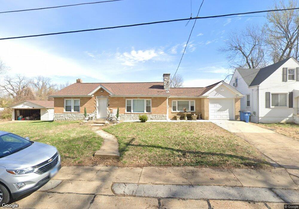
220 Runyon Ave Saint Louis, MO 63125
Lemay NeighborhoodEstimated Value: $146,000 - $207,000
2
Beds
2
Baths
1,392
Sq Ft
$129/Sq Ft
Est. Value
About This Home
This home is located at 220 Runyon Ave, Saint Louis, MO 63125 and is currently estimated at $179,561, approximately $128 per square foot. 220 Runyon Ave is a home located in St. Louis County with nearby schools including Hancock Place Elementary School, Hancock Place Middle School, and Hancock Place High School.
Ownership History
Date
Name
Owned For
Owner Type
Purchase Details
Closed on
Oct 30, 2020
Sold by
Sobeck Deborah A and Nellie Vonder Haar Trust
Bought by
Sobeck Victoria M
Current Estimated Value
Home Financials for this Owner
Home Financials are based on the most recent Mortgage that was taken out on this home.
Original Mortgage
$117,000
Outstanding Balance
$104,113
Interest Rate
2.8%
Mortgage Type
New Conventional
Estimated Equity
$75,448
Purchase Details
Closed on
Nov 23, 2019
Sold by
Sobeck Deborah and The Nellie M Vonderhaar Trust
Bought by
Dgdt Llc
Purchase Details
Closed on
Oct 3, 2005
Sold by
Vonderhaar Nellie M
Bought by
Nellie Vonderhaar Trust
Create a Home Valuation Report for This Property
The Home Valuation Report is an in-depth analysis detailing your home's value as well as a comparison with similar homes in the area
Home Values in the Area
Average Home Value in this Area
Purchase History
| Date | Buyer | Sale Price | Title Company |
|---|---|---|---|
| Sobeck Victoria M | $125,000 | Investors Title Co Clayton | |
| Dgdt Llc | $61,000 | None Available | |
| Nellie Vonderhaar Trust | -- | -- |
Source: Public Records
Mortgage History
| Date | Status | Borrower | Loan Amount |
|---|---|---|---|
| Open | Sobeck Victoria M | $117,000 |
Source: Public Records
Tax History
| Year | Tax Paid | Tax Assessment Tax Assessment Total Assessment is a certain percentage of the fair market value that is determined by local assessors to be the total taxable value of land and additions on the property. | Land | Improvement |
|---|---|---|---|---|
| 2025 | $2,351 | $36,080 | $13,090 | $22,990 |
| 2024 | $2,351 | $30,150 | $5,240 | $24,910 |
| 2023 | $2,234 | $30,150 | $5,240 | $24,910 |
| 2022 | $2,476 | $28,440 | $6,040 | $22,400 |
| 2021 | $2,266 | $28,440 | $6,040 | $22,400 |
| 2020 | $2,051 | $24,570 | $5,870 | $18,700 |
| 2019 | $2,046 | $24,570 | $5,870 | $18,700 |
| 2018 | $1,983 | $20,770 | $4,540 | $16,230 |
| 2017 | $1,949 | $20,770 | $4,540 | $16,230 |
| 2016 | $1,681 | $17,230 | $2,070 | $15,160 |
Source: Public Records
Map
Nearby Homes
- 3720 Comstock Dr
- 424 Tiffany Dr
- 7824 Decatur Dr
- 3917 Crosby Dr
- 227 Hernan Dr
- 607 Majesty Ct
- 7856 Leona St
- 5321 Tesson Ct
- 4120 Kettler Rd
- 4100 Whippoorwill Dr
- 8626 Shoss Ave
- 704 Dallas Dr
- 4140 Tesson St
- 8277 Morganford Rd
- 4116 Santen Dr
- 4338 Seibert Ave
- 707 Pardella Ave
- 251 Wachtel Ave
- 252 Wachtel Ave
- 235 Military Rd
Your Personal Tour Guide
Ask me questions while you tour the home.