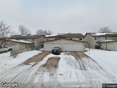
220 South St W South St. Paul, MN 55075
Estimated Value: $281,000 - $293,000
3
Beds
2
Baths
912
Sq Ft
$315/Sq Ft
Est. Value
About This Home
This home is located at 220 South St W, South St. Paul, MN 55075 and is currently estimated at $287,020, approximately $314 per square foot. 220 South St W is a home located in Dakota County with nearby schools including Kaposia Education Center Elementary, South St. Paul Secondary, and Discovery Charter School.
Ownership History
Date
Name
Owned For
Owner Type
Purchase Details
Closed on
Aug 16, 2019
Sold by
Kemp Mari L and Kemp Haywood
Bought by
Storrs Joshua Patrick
Current Estimated Value
Home Financials for this Owner
Home Financials are based on the most recent Mortgage that was taken out on this home.
Original Mortgage
$181,000
Interest Rate
3.7%
Mortgage Type
New Conventional
Purchase Details
Closed on
Aug 25, 2004
Sold by
Evanoff Christine M and Burg Christine Ann
Bought by
Kemp Mari L and Kemp Haywood
Create a Home Valuation Report for This Property
The Home Valuation Report is an in-depth analysis detailing your home's value as well as a comparison with similar homes in the area
Home Values in the Area
Average Home Value in this Area
Purchase History
| Date | Buyer | Sale Price | Title Company |
|---|---|---|---|
| Storrs Joshua Patrick | $220,000 | Trademark Title Services Inc | |
| Kemp Mari L | $157,500 | -- |
Source: Public Records
Mortgage History
| Date | Status | Borrower | Loan Amount |
|---|---|---|---|
| Open | Storrs Joshua P | $183,400 | |
| Closed | Storrs Joshua Patrick | $181,000 | |
| Previous Owner | Kemp Mari L | $172,000 |
Source: Public Records
Tax History Compared to Growth
Tax History
| Year | Tax Paid | Tax Assessment Tax Assessment Total Assessment is a certain percentage of the fair market value that is determined by local assessors to be the total taxable value of land and additions on the property. | Land | Improvement |
|---|---|---|---|---|
| 2023 | $3,694 | $258,700 | $45,100 | $213,600 |
| 2022 | $3,238 | $265,100 | $45,100 | $220,000 |
| 2021 | $3,338 | $226,300 | $39,200 | $187,100 |
| 2020 | $2,500 | $213,300 | $37,300 | $176,000 |
| 2019 | $3,155 | $197,400 | $35,600 | $161,800 |
| 2018 | $3,019 | $172,300 | $32,300 | $140,000 |
| 2017 | $2,610 | $149,400 | $30,800 | $118,600 |
| 2016 | $2,391 | $132,200 | $28,000 | $104,200 |
| 2015 | $2,308 | $98,356 | $19,213 | $79,143 |
| 2014 | -- | $90,726 | $18,779 | $71,947 |
| 2013 | -- | $81,461 | $16,008 | $65,453 |
Source: Public Records
Map
Nearby Homes
- 1442 7th Ave S
- 1440 8th Ave S
- 1239 7th Ave S
- 146 Dale St W
- 6050 Cahill Ave
- 1114 6th Ave S
- 1107 9th Ave S
- 1550 Lincoln Park Dr
- 239 Buron Ln
- 5845 Blackberry Trail
- 5887 Blackberry Bridge Path
- 3833 64th St E
- 159 9th St S
- 1663 Concord St S
- 928 8th Ave S
- 831 2nd Ave S
- 824 3rd Ave S
- 840 7th Ave S
- 813 4th Ave S
- 6400 Crosby Ave