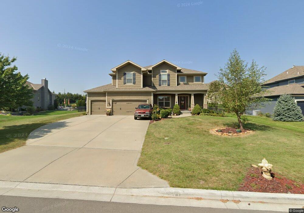
220 SW Ansel Adams Dr Lees Summit, MO 64081
Estimated Value: $629,000 - $748,000
5
Beds
4
Baths
2,834
Sq Ft
$238/Sq Ft
Est. Value
About This Home
This home is located at 220 SW Ansel Adams Dr, Lees Summit, MO 64081 and is currently estimated at $673,207, approximately $237 per square foot. 220 SW Ansel Adams Dr is a home located in Jackson County with nearby schools including Cedar Creek Elementary School, Pleasant Lea Middle School, and Lee's Summit Senior High School.
Ownership History
Date
Name
Owned For
Owner Type
Purchase Details
Closed on
May 3, 2021
Sold by
Gustafson Donald Ray and Gustafson Brenda Gail
Bought by
Gustafson Donald Ray and Gustafson Brenda Gail
Current Estimated Value
Home Financials for this Owner
Home Financials are based on the most recent Mortgage that was taken out on this home.
Original Mortgage
$276,000
Interest Rate
3.1%
Mortgage Type
New Conventional
Purchase Details
Closed on
Mar 28, 2011
Sold by
Summit Custom Homes Llc
Bought by
Gustason Donald Ray and Gustason Brenda Gail
Purchase Details
Closed on
Oct 5, 2010
Sold by
Pfeifer King Building Corporation
Bought by
Summit Custom Homes Llc
Home Financials for this Owner
Home Financials are based on the most recent Mortgage that was taken out on this home.
Original Mortgage
$268,677
Interest Rate
4.36%
Mortgage Type
Construction
Create a Home Valuation Report for This Property
The Home Valuation Report is an in-depth analysis detailing your home's value as well as a comparison with similar homes in the area
Home Values in the Area
Average Home Value in this Area
Purchase History
We collect this data history from publicly available records. To have your information removed, we recommend requesting removal directly through your county’s website.
| Date | Buyer | Sale Price | Title Company |
|---|---|---|---|
| Gustafson Donald Ray | -- | Silk Abstract Company | |
| Gustason Donald Ray | -- | Kansas City Title | |
| Summit Custom Homes Llc | -- | Chicago |
Source: Public Records
Mortgage History
We collect this data history from publicly available records. To have your information removed, we recommend requesting removal directly through your county’s website.
| Date | Status | Borrower | Loan Amount |
|---|---|---|---|
| Previous Owner | Gustafson Donald Ray | $276,000 | |
| Previous Owner | Summit Custom Homes Llc | $268,677 |
Source: Public Records
Tax History
| Year | Tax Paid | Tax Assessment Tax Assessment Total Assessment is a certain percentage of the fair market value that is determined by local assessors to be the total taxable value of land and additions on the property. | Land | Improvement |
|---|---|---|---|---|
| 2025 | $6,943 | $102,017 | $17,925 | $84,092 |
| 2024 | $6,893 | $96,159 | $14,231 | $81,928 |
| 2023 | $6,893 | $96,159 | $17,298 | $78,861 |
| 2022 | $6,227 | $77,140 | $12,474 | $64,666 |
| 2021 | $6,356 | $77,140 | $12,474 | $64,666 |
| 2020 | $6,113 | $73,462 | $12,474 | $60,988 |
| 2019 | $5,946 | $73,462 | $12,474 | $60,988 |
| 2018 | $6,024 | $69,067 | $10,774 | $58,293 |
| 2017 | $6,024 | $69,067 | $10,774 | $58,293 |
| 2016 | $5,933 | $67,336 | $12,350 | $54,986 |
| 2014 | $5,977 | $66,501 | $12,341 | $54,160 |
Source: Public Records
Map
Nearby Homes
- 212 SW Ansel Adams Dr
- 194 SW Roosevelt Ridge
- 166 SW Roosevelt Ridge
- 2905 SW Muir Dr
- 3008 SW Saddlewood Dr
- 451 SW Longview Blvd
- 205 NW Lovins
- 441 SW Longview Blvd
- 445 SW Longview Blvd
- 447 SW Longview Blvd
- 449 SW Longview Blvd
- 325 NW Earle Ln
- 316 NW Earle Ln
- 308 NW Earle Ln
- 3104 NW Berkebile Ln
- 300 NW Earle Ln
- 317 NW Lovins
- 316 NW Lovins
- 320 NW Lovins
- 321 NW Lovins
- 216 Ansel Adams
- 208 SW Ansel Adams Dr
- 213 SW Mackenzie Dr
- 209 SW Mackenzie
- 221 SW Roosevelt Ridge
- 225 SW Roosevelt Ridge
- 3033 SW Lewis Place
- 3016 SW Lewis Dr
- 205 SW Mackenzie
- 217 SW Roosevelt Ridge
- 3029 SW Lewis Place
- 200 SW Ansel Adams Dr
- 198 Ansel Adams
- 224 SW Ansel Adams Dr
- 201 SW Ansel Adams Dr
- 200 SW Mackenzie Dr
- 201 SW Mackenzie
- 3012 SW Lewis Dr
- 226 SW Roosevelt Ridge
- 3025 SW Lewis Place
Your Personal Tour Guide
Ask me questions while you tour the home.