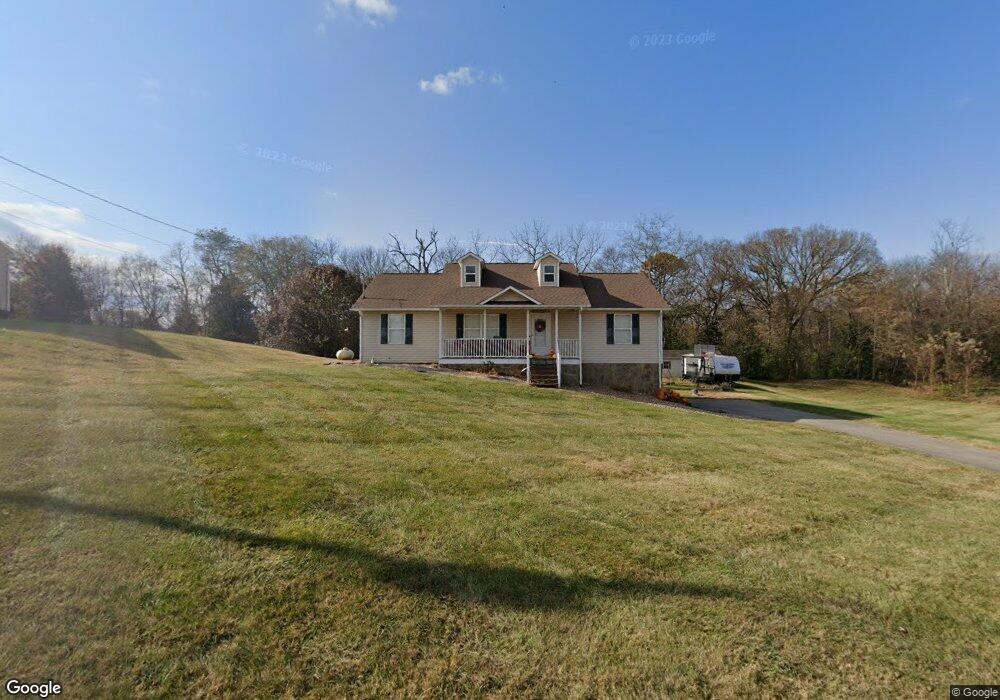
220 Wayland Dr Greeneville, TN 37743
Estimated Value: $306,000 - $349,000
3
Beds
2
Baths
1,500
Sq Ft
$216/Sq Ft
Est. Value
About This Home
This home is located at 220 Wayland Dr, Greeneville, TN 37743 and is currently estimated at $323,772, approximately $215 per square foot. 220 Wayland Dr is a home located in Greene County with nearby schools including Camp Creek Elementary School, South Greene Middle School, and South Greene High School.
Ownership History
Date
Name
Owned For
Owner Type
Purchase Details
Closed on
Nov 30, 2011
Sold by
Davis William A
Bought by
Huff Steven M and Huff Tara N
Current Estimated Value
Home Financials for this Owner
Home Financials are based on the most recent Mortgage that was taken out on this home.
Original Mortgage
$131,377
Outstanding Balance
$90,086
Interest Rate
4.06%
Mortgage Type
Commercial
Estimated Equity
$233,686
Create a Home Valuation Report for This Property
The Home Valuation Report is an in-depth analysis detailing your home's value as well as a comparison with similar homes in the area
Home Values in the Area
Average Home Value in this Area
Purchase History
| Date | Buyer | Sale Price | Title Company |
|---|---|---|---|
| Huff Steven M | $128,750 | -- |
Source: Public Records
Mortgage History
| Date | Status | Borrower | Loan Amount |
|---|---|---|---|
| Open | Huff Steven M | $131,377 |
Source: Public Records
Tax History Compared to Growth
Tax History
| Year | Tax Paid | Tax Assessment Tax Assessment Total Assessment is a certain percentage of the fair market value that is determined by local assessors to be the total taxable value of land and additions on the property. | Land | Improvement |
|---|---|---|---|---|
| 2024 | $1,003 | $60,775 | $8,025 | $52,750 |
| 2023 | $1,003 | $60,775 | $0 | $0 |
| 2022 | $67,800 | $33,675 | $4,325 | $29,350 |
| 2021 | $678 | $33,675 | $4,325 | $29,350 |
| 2020 | $678 | $33,675 | $4,325 | $29,350 |
| 2019 | $678 | $33,675 | $4,325 | $29,350 |
| 2018 | $678 | $33,675 | $4,325 | $29,350 |
| 2017 | $694 | $35,150 | $4,325 | $30,825 |
| 2016 | $658 | $35,150 | $4,325 | $30,825 |
| 2015 | $658 | $35,150 | $4,325 | $30,825 |
| 2014 | $658 | $35,150 | $4,325 | $30,825 |
Source: Public Records
Map
Nearby Homes
- 320 Wayland Dr
- 2166 Asheville Hwy
- 2160 Whirlwind Rd
- 126 Woodland Cir
- 2568 Asheville Hwy
- 1124 Hixon Ave
- 74 Cutshall Ave
- 208 Majestic Cir
- 1650 Asheville Hwy
- 40 Decatur St
- 150 Decatur St
- 255 Birdwell Cir
- 225 Red Tail Ridge
- 270 Red Tail Ridge Unit Lot 10
- 245 Red Tail Ridge Unit Lot 6
- 126 Harrison Dr
- 104 Royce St
- 110 Royce St
- 1405 Lick Hollow Rd
- 1204 Alice St
- 230 Wayland Dr
- 00 Wayland Dr
- 265 Wayland Dr
- 195 Wayland Dr
- 250 Wayland Dr
- 160 Wayland Dr
- 165 Wayland Dr
- 285 Wayland Dr
- 290 Wayland Dr
- 145 Wayland Dr
- 140 Wayland Dr
- 210 Crossover Dr
- 310 Wayland Dr
- 190 Crossover Dr
- 100 Wayland Dr
- 170 Crossover Dr
- 335 Wayland Dr
- 95 Wayland Dr
- 340 Wayland Dr
- 80 Wayland Dr