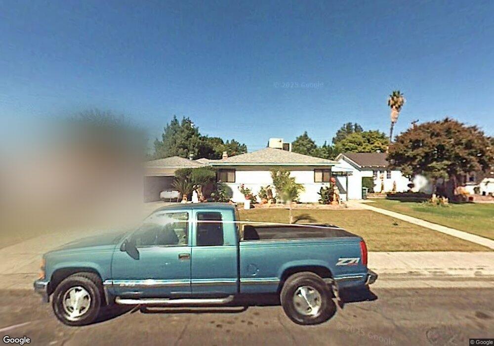
2200 Mark Ct Bakersfield, CA 93304
Benton Park NeighborhoodEstimated Value: $283,000 - $317,000
3
Beds
2
Baths
1,092
Sq Ft
$279/Sq Ft
Est. Value
About This Home
This home is located at 2200 Mark Ct, Bakersfield, CA 93304 and is currently estimated at $304,845, approximately $279 per square foot. 2200 Mark Ct is a home located in Kern County with nearby schools including Frank West Elementary School, Curran Middle School, and South High School.
Ownership History
Date
Name
Owned For
Owner Type
Purchase Details
Closed on
Oct 13, 2021
Sold by
Lozano Connie J
Bought by
Lozano Connie J and Garcia Terri K
Current Estimated Value
Purchase Details
Closed on
Aug 2, 2004
Sold by
Pilchard Ronald C and Pilchard Judy M
Bought by
Lozano Connie J
Home Financials for this Owner
Home Financials are based on the most recent Mortgage that was taken out on this home.
Original Mortgage
$126,000
Outstanding Balance
$62,274
Interest Rate
5.95%
Mortgage Type
Purchase Money Mortgage
Estimated Equity
$242,571
Purchase Details
Closed on
Jan 24, 1997
Sold by
Jamison Larry C and Jamison Nancy S
Bought by
Pilchard Ronald C and Pilchard Judy M
Home Financials for this Owner
Home Financials are based on the most recent Mortgage that was taken out on this home.
Original Mortgage
$85,914
Interest Rate
7.66%
Mortgage Type
FHA
Create a Home Valuation Report for This Property
The Home Valuation Report is an in-depth analysis detailing your home's value as well as a comparison with similar homes in the area
Home Values in the Area
Average Home Value in this Area
Purchase History
| Date | Buyer | Sale Price | Title Company |
|---|---|---|---|
| Lozano Connie J | -- | None Available | |
| Lozano Connie J | $165,000 | Stewart Title | |
| Pilchard Ronald C | $86,000 | First American Title Ins Co |
Source: Public Records
Mortgage History
| Date | Status | Borrower | Loan Amount |
|---|---|---|---|
| Open | Lozano Connie J | $126,000 | |
| Previous Owner | Pilchard Ronald C | $85,914 |
Source: Public Records
Tax History Compared to Growth
Tax History
| Year | Tax Paid | Tax Assessment Tax Assessment Total Assessment is a certain percentage of the fair market value that is determined by local assessors to be the total taxable value of land and additions on the property. | Land | Improvement |
|---|---|---|---|---|
| 2025 | $3,278 | $229,975 | $41,806 | $188,169 |
| 2024 | $3,208 | $225,467 | $40,987 | $184,480 |
| 2023 | $3,208 | $221,047 | $40,184 | $180,863 |
| 2022 | $3,135 | $216,714 | $39,397 | $177,317 |
| 2021 | $3,018 | $212,466 | $38,625 | $173,841 |
| 2020 | $2,891 | $203,000 | $51,000 | $152,000 |
| 2019 | $2,567 | $177,000 | $44,000 | $133,000 |
| 2018 | $2,308 | $157,000 | $39,000 | $118,000 |
| 2017 | $2,282 | $153,000 | $38,000 | $115,000 |
| 2016 | $2,151 | $155,000 | $39,000 | $116,000 |
| 2015 | $1,778 | $121,000 | $30,000 | $91,000 |
| 2014 | $1,746 | $121,000 | $30,000 | $91,000 |
Source: Public Records
Map
Nearby Homes
- 2216 Bradley Ave
- 1920 Hodges Ave
- 1800 Hughes Ln
- 1920 Doolittle Ave
- 1317 Edna St
- 1814 June Ave
- 1925 La France Dr
- 1811 Radiance Dr
- 1212 S F St
- 1206 S Oleander Ave
- 2510 Wilson Rd
- 1900 La France Dr
- 2207 Ellen Way
- 1901 Rose Marie Dr
- 1512 Southgate Dr
- 1917 S J St
- 2812 Echo Ave
- 2912 Lum Ave
- 1405 S Chester Ave
- 1221 El Rancho Dr