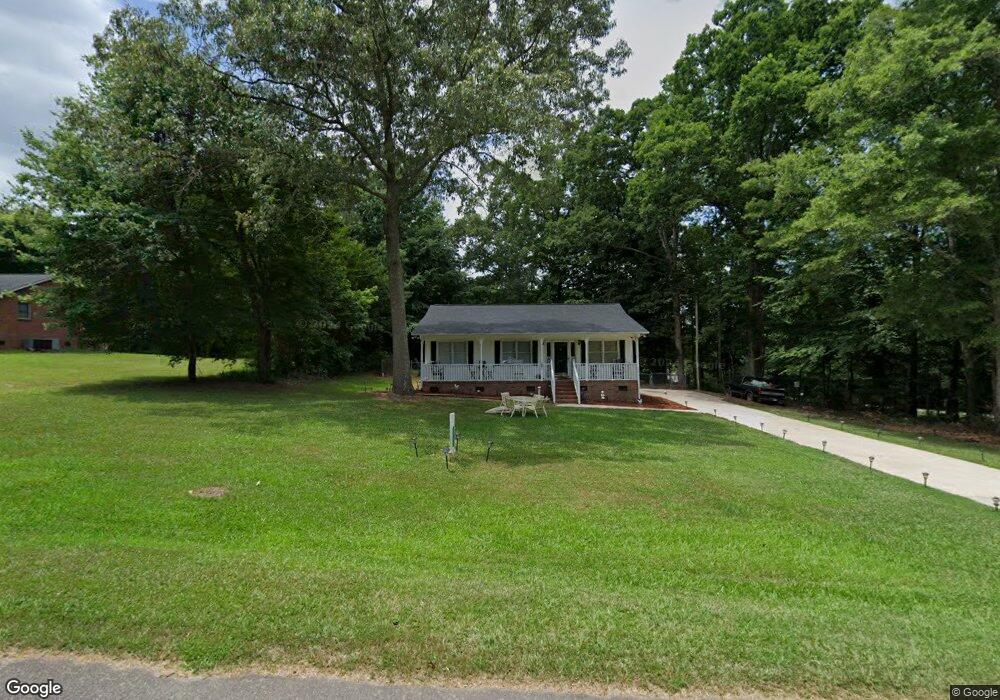
2200 Mount Laurel Rd Lancaster, SC 29720
Estimated Value: $197,259 - $242,000
3
Beds
2
Baths
1,110
Sq Ft
$198/Sq Ft
Est. Value
About This Home
This home is located at 2200 Mount Laurel Rd, Lancaster, SC 29720 and is currently estimated at $219,565, approximately $197 per square foot. 2200 Mount Laurel Rd is a home located in Lancaster County with nearby schools including Brooklyn Springs Elementary School, South Middle School, and Lancaster High School.
Ownership History
Date
Name
Owned For
Owner Type
Purchase Details
Closed on
Oct 18, 2010
Sold by
Kirkley Dustin C
Bought by
Brown Mitchell L and Brown Shirley H
Current Estimated Value
Home Financials for this Owner
Home Financials are based on the most recent Mortgage that was taken out on this home.
Original Mortgage
$98,671
Outstanding Balance
$65,146
Interest Rate
4.36%
Mortgage Type
FHA
Estimated Equity
$154,419
Purchase Details
Closed on
Mar 31, 2003
Sold by
Hud
Bought by
Parker Dixon B
Purchase Details
Closed on
Oct 22, 2002
Sold by
Kersey Michael Wayne
Bought by
Hud
Create a Home Valuation Report for This Property
The Home Valuation Report is an in-depth analysis detailing your home's value as well as a comparison with similar homes in the area
Home Values in the Area
Average Home Value in this Area
Purchase History
| Date | Buyer | Sale Price | Title Company |
|---|---|---|---|
| Brown Mitchell L | $100,000 | -- | |
| Parker Dixon B | $80,000 | -- | |
| Hud | $2,500 | -- |
Source: Public Records
Mortgage History
| Date | Status | Borrower | Loan Amount |
|---|---|---|---|
| Open | Brown Mitchell L | $98,671 |
Source: Public Records
Tax History Compared to Growth
Tax History
| Year | Tax Paid | Tax Assessment Tax Assessment Total Assessment is a certain percentage of the fair market value that is determined by local assessors to be the total taxable value of land and additions on the property. | Land | Improvement |
|---|---|---|---|---|
| 2024 | $278 | $3,812 | $520 | $3,292 |
| 2023 | $582 | $3,812 | $520 | $3,292 |
| 2022 | $580 | $3,812 | $520 | $3,292 |
| 2021 | $568 | $3,812 | $520 | $3,292 |
| 2020 | $540 | $3,516 | $520 | $2,996 |
| 2019 | $1,190 | $3,516 | $520 | $2,996 |
| 2018 | $1,145 | $3,516 | $520 | $2,996 |
| 2017 | $527 | $0 | $0 | $0 |
| 2016 | $514 | $0 | $0 | $0 |
| 2015 | $423 | $0 | $0 | $0 |
| 2014 | $423 | $0 | $0 | $0 |
| 2013 | $423 | $0 | $0 | $0 |
Source: Public Records
Map
Nearby Homes
- 165 Bailey Rd
- 992 S Potter Rd
- 2538 Old Camden Hwy
- 230 E Doc Garris Rd
- 967 Hilldale Dr
- 3051 Bucks Dr
- 04 Old Camden Hwy
- 03 Old Camden Hwy
- 02 Old Camden Hwy
- 01 Old Camden Hwy
- 00 Old Camden Hwy
- 11.53 acres Old Camden Hwy
- 5144 Foxmeade Ct
- 4046 W Fairmeadow Dr
- 2697 State Road S-29-369
- 521 State Road S-29-757
- 2569 Tully Ct
- 2795 Cane Mill Rd
- 2565 Oxford Cir
- 2592 Tully Ct Unit 78
- 2210 Mountain Laurel Rd
- 492 Community Ln
- 522 Community Ln
- 2236 Mountain Laurel Rd
- 2243 Mount Laurel Rd
- 2254 Mount Laurel Rd
- 2104 Mount Laurel Rd
- 529 Oakhaven Dr
- 2253 Mount Laurel Rd
- 539 Oakhaven Dr
- 545 Community Ln
- 2262 Mountain Laurel Rd
- 2262 Mountain Laurel Rd
- 549 Oakhaven Dr
- 2093 Mountain Laurel Rd
- 556 Community Ln
- 512 Oakhaven Dr
- 559 Community Ln
- 528 Oakhaven Dr
- 559 Oakhaven Dr