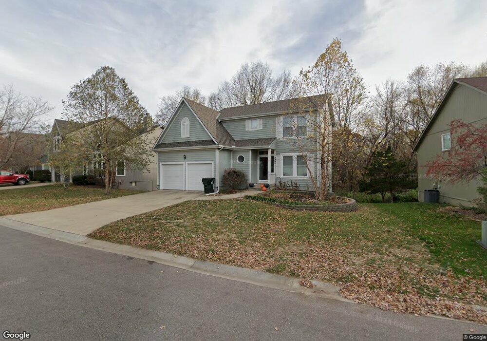
22001 W 48th St Shawnee, KS 66226
Estimated Value: $384,000 - $417,000
3
Beds
3
Baths
1,709
Sq Ft
$234/Sq Ft
Est. Value
About This Home
This home is located at 22001 W 48th St, Shawnee, KS 66226 and is currently estimated at $399,614, approximately $233 per square foot. 22001 W 48th St is a home located in Johnson County with nearby schools including Riverview Elementary School, Mill Creek Middle School, and Mill Valley High School.
Ownership History
Date
Name
Owned For
Owner Type
Purchase Details
Closed on
Apr 25, 2007
Sold by
Everhart Chad J and Everhart Lisa A
Bought by
Showalter Kirk C and Showalter Quin
Current Estimated Value
Create a Home Valuation Report for This Property
The Home Valuation Report is an in-depth analysis detailing your home's value as well as a comparison with similar homes in the area
Home Values in the Area
Average Home Value in this Area
Purchase History
| Date | Buyer | Sale Price | Title Company |
|---|---|---|---|
| Showalter Kirk C | -- | Accommodation |
Source: Public Records
Tax History Compared to Growth
Tax History
| Year | Tax Paid | Tax Assessment Tax Assessment Total Assessment is a certain percentage of the fair market value that is determined by local assessors to be the total taxable value of land and additions on the property. | Land | Improvement |
|---|---|---|---|---|
| 2024 | $4,617 | $39,859 | $7,757 | $32,102 |
| 2023 | $4,706 | $40,055 | $7,757 | $32,298 |
| 2022 | $4,361 | $36,363 | $7,388 | $28,975 |
| 2021 | $4,143 | $33,154 | $6,717 | $26,437 |
| 2020 | $3,607 | $28,578 | $5,847 | $22,731 |
| 2019 | $3,660 | $28,578 | $5,319 | $23,259 |
| 2018 | $3,574 | $27,658 | $5,319 | $22,339 |
| 2017 | $3,443 | $25,990 | $4,439 | $21,551 |
| 2016 | $3,340 | $24,898 | $4,439 | $20,459 |
| 2015 | $3,513 | $25,795 | $4,439 | $21,356 |
| 2013 | -- | $22,851 | $4,439 | $18,412 |
Source: Public Records
Map
Nearby Homes
- 22014 W 47th Terrace
- 22014 W 51st St
- 5005 Hilltop Dr
- 4713 Lone Elm
- 5116 Payne St
- 21525 W 51st St
- 21408 W 50th St
- 4638 Aminda St
- 22115 W 51st Terrace
- 22625 W 49th St
- 21222 W 48th St
- 22611 W 46th Terrace
- 4754 Lakecrest Dr
- 5206 Round Prairie St
- 22714 W 49th St
- 21804 W 52nd Terrace
- 9307 Aminda St
- 9303 Aminda St
- 9313 Aminda St
- 9305 Aminda St
- 21907 W 48th St
- 22005 W 48th St
- 21903 W 48th St
- 4750 Payne St
- 4751 Brockway St
- 22013 W 48th St
- 4747 Brockway St
- 4749 Payne St
- 4746 Payne St
- 22012 W 48th St
- 22017 W 48th St
- 4743 Brockway St
- 4745 Payne St
- 4742 Payne St
- 22016 W 48th St
- 0 Brockway St Unit 2039130
- 4810 Noreston St
- 21814 W 49th St
- 4806 Noreston St
- 4746 Brockway St