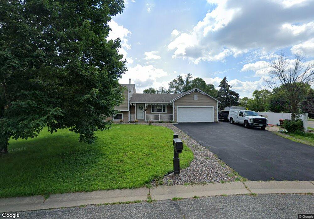
2204 Mcafee Cir Saint Paul, MN 55109
Sherwood Glen NeighborhoodEstimated Value: $361,249 - $396,000
3
Beds
2
Baths
1,140
Sq Ft
$330/Sq Ft
Est. Value
About This Home
This home is located at 2204 Mcafee Cir, Saint Paul, MN 55109 and is currently estimated at $376,312, approximately $330 per square foot. 2204 Mcafee Cir is a home located in Ramsey County with nearby schools including Weaver Elementary School, John Glenn Middle School, and St Jerome Elementary School.
Ownership History
Date
Name
Owned For
Owner Type
Purchase Details
Closed on
Jan 22, 2025
Sold by
Phan Nancy and Phan Han
Bought by
Phan Trust
Current Estimated Value
Purchase Details
Closed on
Jul 24, 2003
Sold by
Lawrence Timothy E and Lawrence Karen K
Bought by
Pham Han and Pham Nancy
Create a Home Valuation Report for This Property
The Home Valuation Report is an in-depth analysis detailing your home's value as well as a comparison with similar homes in the area
Home Values in the Area
Average Home Value in this Area
Purchase History
| Date | Buyer | Sale Price | Title Company |
|---|---|---|---|
| Phan Trust | $500 | None Listed On Document | |
| Phan Trust | $500 | None Listed On Document | |
| Pham Han | $225,000 | -- |
Source: Public Records
Tax History Compared to Growth
Tax History
| Year | Tax Paid | Tax Assessment Tax Assessment Total Assessment is a certain percentage of the fair market value that is determined by local assessors to be the total taxable value of land and additions on the property. | Land | Improvement |
|---|---|---|---|---|
| 2025 | $4,918 | $356,000 | $57,000 | $299,000 |
| 2023 | $4,918 | $349,700 | $57,000 | $292,700 |
| 2022 | $4,128 | $314,900 | $57,100 | $257,800 |
| 2021 | $3,854 | $284,600 | $57,100 | $227,500 |
| 2020 | $4,050 | $273,000 | $57,100 | $215,900 |
| 2019 | $3,392 | $267,600 | $57,100 | $210,500 |
| 2018 | $3,462 | $232,100 | $57,100 | $175,000 |
| 2017 | $3,710 | $230,300 | $57,100 | $173,200 |
| 2016 | $3,902 | $0 | $0 | $0 |
| 2015 | $3,682 | $221,000 | $52,300 | $168,700 |
| 2014 | $3,214 | $0 | $0 | $0 |
Source: Public Records
Map
Nearby Homes
- 1247 Lealand Rd E
- 1467 County Road B E
- 1496 Laurie Rd E
- 1509 Sandhurst Ave E
- 2420 Hazelwood St
- 1201 Frost Ave
- 1940 Barclay St
- 1666 Laurie Rd E
- 1984 Prosperity Rd
- 1869 Birmingham St
- 1018 Sextant Ave
- 1854 Barclay St
- 1751 Clarence St
- 1937 Flandrau St
- 1779 Frank St
- 955 Brooks Ct
- 1740 English St
- 1849 Kennard St
- 1730 Atlantic St
- 1875 E Shore Dr Unit 302
- 1343 County Road B E
- 1343 County Road B E
- 2210 Mcafee Cir
- 2187 Mcafee Cir N
- 2188 Mcafee Cir
- 2216 Mcafee Cir
- 2207 Mcafee Cir
- 1344 County Road B E
- 2182 Mcafee Cir
- 2213 Mcafee Cir
- 2222 Mcafee Cir
- 2197 Mcafee Cir
- xxxx Mcafee Cir
- 2219 Mcafee Cir
- 2215 Ide Ct
- 2215 Ide Ct Unit 622
- 2176 Mcafee Cir
- 2211 Ide Ct
- 2181 Mcafee Cir
- 2228 Mcafee Cir