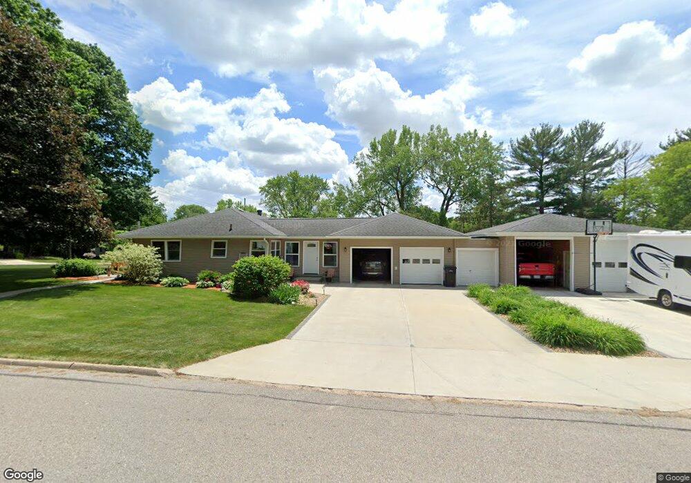
2205 Rownd St Cedar Falls, IA 50613
Estimated Value: $242,636 - $266,000
3
Beds
2
Baths
1,176
Sq Ft
$218/Sq Ft
Est. Value
About This Home
This home is located at 2205 Rownd St, Cedar Falls, IA 50613 and is currently estimated at $255,909, approximately $217 per square foot. 2205 Rownd St is a home located in Black Hawk County with nearby schools including Cedar Heights Elementary School, Peet Junior High School, and Cedar Falls High School.
Ownership History
Date
Name
Owned For
Owner Type
Purchase Details
Closed on
Sep 25, 2020
Sold by
Christensen Joan and Christensen Lynn W
Bought by
Ccj Properties Llc
Current Estimated Value
Create a Home Valuation Report for This Property
The Home Valuation Report is an in-depth analysis detailing your home's value as well as a comparison with similar homes in the area
Home Values in the Area
Average Home Value in this Area
Purchase History
| Date | Buyer | Sale Price | Title Company |
|---|---|---|---|
| Ccj Properties Llc | $100,000 | None Listed On Document |
Source: Public Records
Tax History Compared to Growth
Tax History
| Year | Tax Paid | Tax Assessment Tax Assessment Total Assessment is a certain percentage of the fair market value that is determined by local assessors to be the total taxable value of land and additions on the property. | Land | Improvement |
|---|---|---|---|---|
| 2025 | $3,144 | $250,070 | $36,330 | $213,740 |
| 2024 | $3,144 | $227,780 | $36,330 | $191,450 |
| 2023 | $3,074 | $227,780 | $36,330 | $191,450 |
| 2022 | $3,108 | $178,750 | $36,330 | $142,420 |
| 2021 | $2,896 | $178,750 | $36,330 | $142,420 |
| 2020 | $2,832 | $167,370 | $31,140 | $136,230 |
| 2019 | $2,832 | $167,370 | $31,140 | $136,230 |
| 2018 | $2,870 | $167,370 | $31,140 | $136,230 |
| 2017 | $2,938 | $167,370 | $31,140 | $136,230 |
| 2016 | $2,744 | $167,370 | $31,140 | $136,230 |
| 2015 | $2,744 | $167,370 | $31,140 | $136,230 |
| 2014 | $2,666 | $161,180 | $31,140 | $130,040 |
Source: Public Records
Map
Nearby Homes
- 2309 California St
- 1830 Madison St
- 1916 Ashland Ave
- 1927 Ashland Ave
- 2513 Ashland Ave
- 2601 Victory Dr
- 1316 Sunnyside Dr
- 2522 Sunset Blvd
- 1513 Cherry Ln
- 1221 Parker St
- 1304 Grand Blvd
- 2804 Neola St
- 1117 Melrose Dr
- 2727 Cedar Heights Dr
- 3123 Neola St
- 3023 Cottonwood Ln
- 1802 Waterloo Rd
- 206 Loma St
- 2912 Tucson Dr
- 2627 Orchard Dr Unit 6
- 2217 Rownd St
- 2001 Sunnyside Dr
- 2117 Rownd St
- 2006 Sunnyside Dr
- 2103 Sunnyside Dr
- 2109 Rownd St
- 2305 Rownd St
- 2218 Rownd St
- 2000 Sunnyside Dr
- 2118 Rownd St
- 2306 Rownd St
- 2105 Rownd St
- 1925 Sunnyside Dr
- 1926 Sunnyside Dr
- 1917 Sunnyside Dr
- 2002 Hawthorne Dr
- 1920 Sunnyside Dr
- 2110 Rownd St
- 2101 Rownd St
- 2213 Hickory Ln