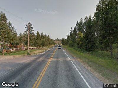
22065 Mt Highway 35 Bigfork, MT 59911
Estimated Value: $1,130,698 - $2,032,000
4
Beds
3
Baths
1,930
Sq Ft
$751/Sq Ft
Est. Value
About This Home
This home is located at 22065 Mt Highway 35, Bigfork, MT 59911 and is currently estimated at $1,449,566, approximately $751 per square foot. 22065 Mt Highway 35 is a home located in Lake County with nearby schools including Bigfork Elementary School, Bigfork Junior High School, and Bigfork High School.
Ownership History
Date
Name
Owned For
Owner Type
Purchase Details
Closed on
Jul 8, 2021
Sold by
Crosby Welton Laurel and Crosby Wala Welton
Bought by
Miller Lisa and Miller Phillip
Current Estimated Value
Home Financials for this Owner
Home Financials are based on the most recent Mortgage that was taken out on this home.
Original Mortgage
$748,000
Outstanding Balance
$696,098
Interest Rate
2.9%
Mortgage Type
New Conventional
Estimated Equity
$885,815
Purchase Details
Closed on
Oct 11, 2010
Sold by
Crosby Alla
Bought by
Crosby Welton Laurel
Create a Home Valuation Report for This Property
The Home Valuation Report is an in-depth analysis detailing your home's value as well as a comparison with similar homes in the area
Home Values in the Area
Average Home Value in this Area
Purchase History
| Date | Buyer | Sale Price | Title Company |
|---|---|---|---|
| Miller Lisa | -- | Fidelity National Title | |
| Crosby Welton Laurel | -- | None Available |
Source: Public Records
Mortgage History
| Date | Status | Borrower | Loan Amount |
|---|---|---|---|
| Open | Miller Lisa | $748,000 | |
| Previous Owner | Crosby Welton Laurel | $230,000 |
Source: Public Records
Tax History Compared to Growth
Tax History
| Year | Tax Paid | Tax Assessment Tax Assessment Total Assessment is a certain percentage of the fair market value that is determined by local assessors to be the total taxable value of land and additions on the property. | Land | Improvement |
|---|---|---|---|---|
| 2024 | $4,393 | $749,800 | $0 | $0 |
| 2023 | $3,196 | $563,571 | $0 | $0 |
| 2022 | $3,147 | $430,548 | $0 | $0 |
| 2021 | $2,893 | $380,908 | $0 | $0 |
| 2020 | $2,558 | $314,338 | $0 | $0 |
| 2019 | $2,506 | $314,338 | $0 | $0 |
| 2018 | $2,666 | $327,700 | $0 | $0 |
| 2017 | $2,607 | $327,700 | $0 | $0 |
| 2016 | $2,442 | $318,400 | $0 | $0 |
| 2015 | $2,277 | $318,400 | $0 | $0 |
| 2014 | $1,829 | $182,888 | $0 | $0 |
Source: Public Records
Map
Nearby Homes
- 32187 Tiffany Shore Ln
- 17909 Wolf Creek Ln
- 17431 Fishing Rock Ln
- 17299 Cliffhanger Ln
- 32187 Beargrass Ln
- Nhn Sunset Heights Dr
- 21770 Mt Highway 35
- 21990 Montana Highway 35
- 32054 Birch Tree Dr
- 15286 Woods Bay Point Rd
- 14668 Shore Acres Dr
- 24699 Mt Highway 35
- 33336 Whitecap Ln Unit RV 17, Boat Slip 5
- 33191 Lakeshore Dr
- Nhn Lakeview Ct
- 32646 Delaro Ranch Rd
- 32691 Pine Meadow Dr
- 13993 Pine St
- 33581 Cherry Ln
- 13962 Pine St
