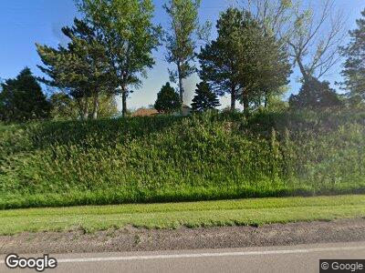
2207 210th St Bronson, IA 51007
Estimated Value: $479,000 - $533,075
4
Beds
5
Baths
2,263
Sq Ft
$223/Sq Ft
Est. Value
About This Home
This home is located at 2207 210th St, Bronson, IA 51007 and is currently estimated at $505,025, approximately $223 per square foot. 2207 210th St is a home located in Woodbury County with nearby schools including Bronson Elementary School and Lawton Junior/Senior High School.
Ownership History
Date
Name
Owned For
Owner Type
Purchase Details
Closed on
Feb 13, 2018
Sold by
Cole Henry L and Cole Esther E
Bought by
Henrich Jeremy G and Henrich Katie M
Current Estimated Value
Home Financials for this Owner
Home Financials are based on the most recent Mortgage that was taken out on this home.
Original Mortgage
$212,000
Outstanding Balance
$184,648
Interest Rate
4.15%
Mortgage Type
New Conventional
Estimated Equity
$334,781
Create a Home Valuation Report for This Property
The Home Valuation Report is an in-depth analysis detailing your home's value as well as a comparison with similar homes in the area
Home Values in the Area
Average Home Value in this Area
Purchase History
| Date | Buyer | Sale Price | Title Company |
|---|---|---|---|
| Henrich Jeremy G | $311,500 | -- |
Source: Public Records
Mortgage History
| Date | Status | Borrower | Loan Amount |
|---|---|---|---|
| Open | Henrich Jeremy G | $212,000 |
Source: Public Records
Tax History Compared to Growth
Tax History
| Year | Tax Paid | Tax Assessment Tax Assessment Total Assessment is a certain percentage of the fair market value that is determined by local assessors to be the total taxable value of land and additions on the property. | Land | Improvement |
|---|---|---|---|---|
| 2024 | $4,590 | $459,730 | $58,000 | $401,730 |
| 2023 | $4,654 | $459,730 | $58,000 | $401,730 |
| 2022 | $5,194 | $373,270 | $58,000 | $315,270 |
| 2021 | $5,194 | $373,270 | $58,000 | $315,270 |
| 2020 | $4,728 | $329,940 | $62,060 | $267,880 |
| 2019 | $4,496 | $329,940 | $62,060 | $267,880 |
| 2018 | $4,422 | $299,630 | $42,800 | $256,830 |
| 2017 | $4,422 | $299,630 | $42,800 | $256,830 |
| 2016 | $4,352 | $287,400 | $0 | $0 |
| 2015 | $4,170 | $268,600 | $40,000 | $228,600 |
| 2014 | $4,166 | $268,600 | $40,000 | $228,600 |
Source: Public Records
Map
Nearby Homes
- 231 Maple St
- 97 W 2nd St
- TBD Old Highway 141
- 1713 Old Highway 141
- 103 W Creek Dr
- 326 E Maple St
- TBD 230th St
- 2135 Hancock Ave
- 6811 Prairie View Dr
- 6805 Prairie View Ct
- 6811 Brookside Dr
- 6700 Windsong Ct
- 6751 Prairie View Ct
- 6701 Windsong Ct
- 3300 Glen Ellen Rd
- 6719 Timberline Cir
- 6713 Windsong Ct
- 6765 Cantebury Ct
- 6755 Cantebury Ct
- 6540 Palm Valley Dr
